MyTopo
New Fork Lakes Wyoming US Topo Map
Couldn't load pickup availability
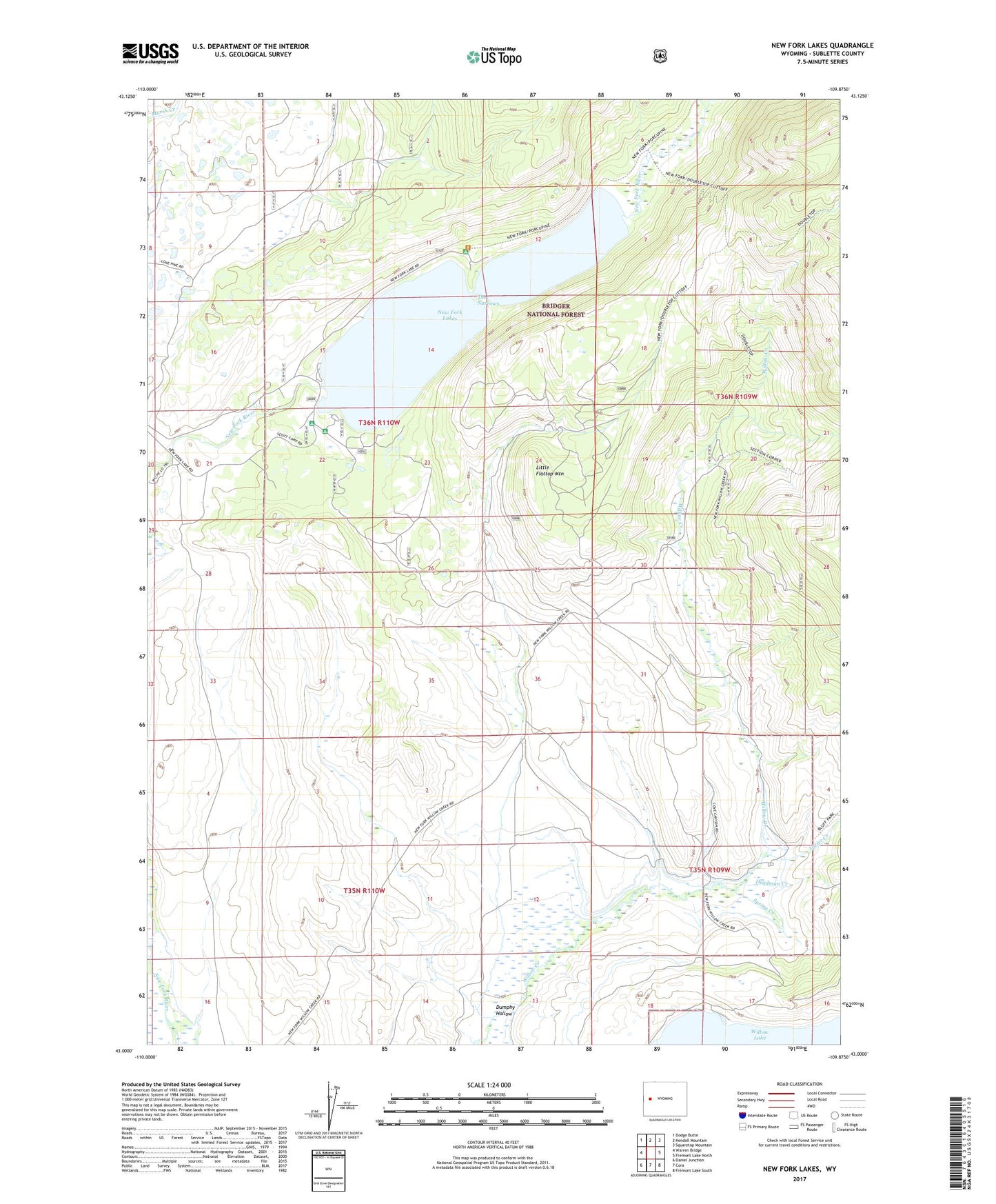
2021 topographic map quadrangle New Fork Lakes in the state of Wyoming. Scale: 1:24000. Based on the newly updated USGS 7.5' US Topo map series, this map is in the following counties: Sublette. The map contains contour data, water features, and other items you are used to seeing on USGS maps, but also has updated roads and other features. This is the next generation of topographic maps. Printed on high-quality waterproof paper with UV fade-resistant inks.
Quads adjacent to this one:
West: Warren Bridge
Northwest: Dodge Butte
North: Kendall Mountain
Northeast: Squaretop Mountain
East: Fremont Lake North
Southeast: Fremont Lake South
South: Cora
Southwest: Daniel Junction
Contains the following named places: Deadman Creek, Dodge Ditch, Dumphy Hollow, Graham Ditch, Josephine Ditch, Little Flattop Mountain, Lizzie Lozier Ditch, Lizzie Lozier North Ditch, Lowline Trail, Lozier Creek, Lozier Ranch, New Fork Canyon Trail, New Fork Lake, New Fork Lake Dam, New Fork Lakes, New Fork Lakes Campground, New Fork Scout Camp, New York Campground, Spring Creek, The Narrows, The Narrows Campground, Willow Creek Guard Station, Z Bar U Ranch