MyTopo
Daniel Junction Wyoming US Topo Map
Couldn't load pickup availability
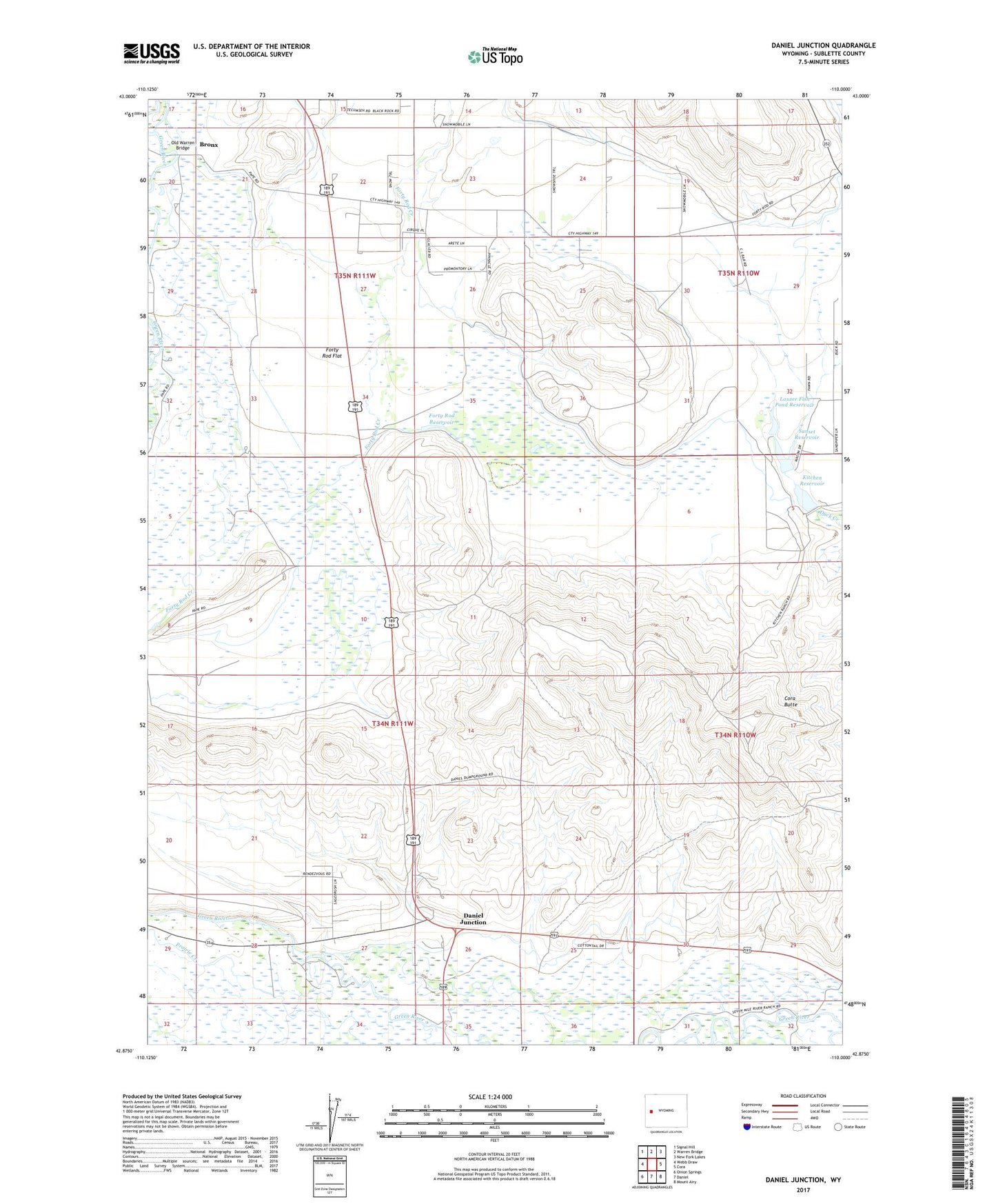
2021 topographic map quadrangle Daniel Junction in the state of Wyoming. Scale: 1:24000. Based on the newly updated USGS 7.5' US Topo map series, this map is in the following counties: Sublette. The map contains contour data, water features, and other items you are used to seeing on USGS maps, but also has updated roads and other features. This is the next generation of topographic maps. Printed on high-quality waterproof paper with UV fade-resistant inks.
Quads adjacent to this one:
West: Webb Draw
Northwest: Signal Hill
North: Warren Bridge
Northeast: New Fork Lakes
East: Cora
Southeast: Mount Airy
South: Daniel
Southwest: Onion Springs
This map covers the same area as the classic USGS quad with code o42110h1.
Contains the following named places: Alexander Pit, Angus Reservoir, Apex Ditch, Apex Pit, Ashley Wolf Ditch, Bronx, Cora Butte, Daniel Junction, Dickinson Number 1 Ditch, Extension Dickinson Ditch, Forty Rod Flat, Forty Rod North Mine, Forty Rod Pit, Forty Rod Reservoir, Kitchen Dam, Kitchen Reservoir, Lauzer Fish Pond Reservoir, North Pape Pit, Old Warren Bridge, Pape Pit, Sunset Dam, Sunset Reservoir, Thompson and Kirby Ditch, Van Ditch, Wye Pit