MyTopo
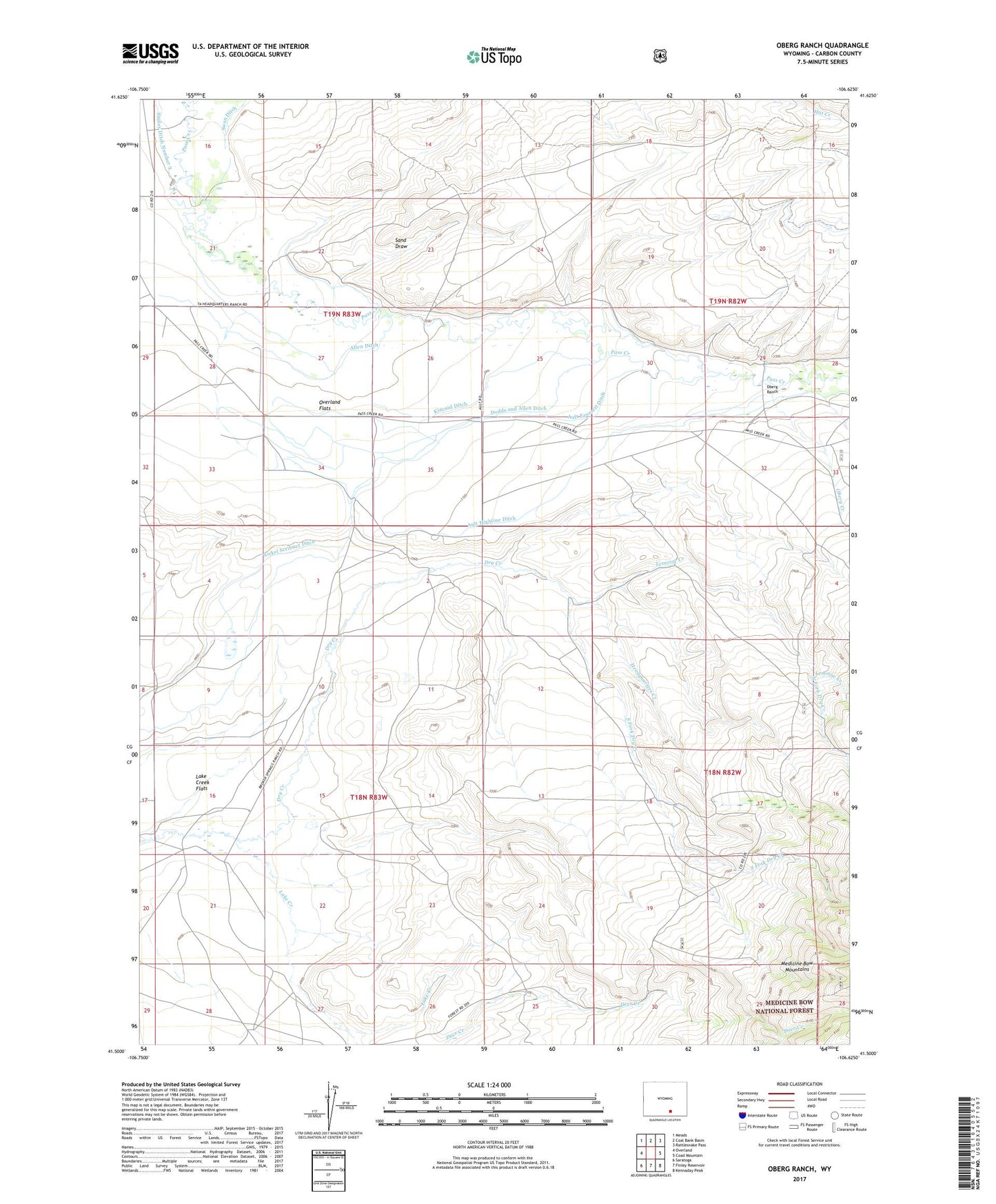
Oberg Ranch Wyoming US Topo Map
Couldn't load pickup availability
Also explore the Oberg Ranch Forest Service Topo of this same quad for updated USFS data
2021 topographic map quadrangle Oberg Ranch in the state of Wyoming. Scale: 1:24000. Based on the newly updated USGS 7.5' US Topo map series, this map is in the following counties: Carbon. The map contains contour data, water features, and other items you are used to seeing on USGS maps, but also has updated roads and other features. This is the next generation of topographic maps. Printed on high-quality waterproof paper with UV fade-resistant inks.
Quads adjacent to this one:
West: Overland
Northwest: Meads
North: Coal Bank Basin
Northeast: Rattlesnake Pass
East: Coad Mountain
Southeast: Kennaday Peak
South: Finley Reservoir
Southwest: Saratoga
This map covers the same area as the classic USGS quad with code o41106e6.
Contains the following named places: Allen Ditch, Ault Faussett Ditch, Ault Highline Ditch, Dodds and Allen Ditch, Dry Creek, Headquarters Creek, Kincaid Ditch, Lake Creek Flats, Lemoine Creek, Moore Ranch, Nickel Scribner Ditch, North Fork Dry Creek, Oberg Creek, Oberg Ranch, Old Pennock Place, Overland Flats, Sand Draw, Shelton Allen Ditch, South Fork Dry Creek, South Fork Lake Creek, Standard Pass Creek School, Swan Ditch