MyTopo
Finley Reservoir Wyoming US Topo Map
Couldn't load pickup availability
Also explore the Finley Reservoir Forest Service Topo of this same quad for updated USFS data
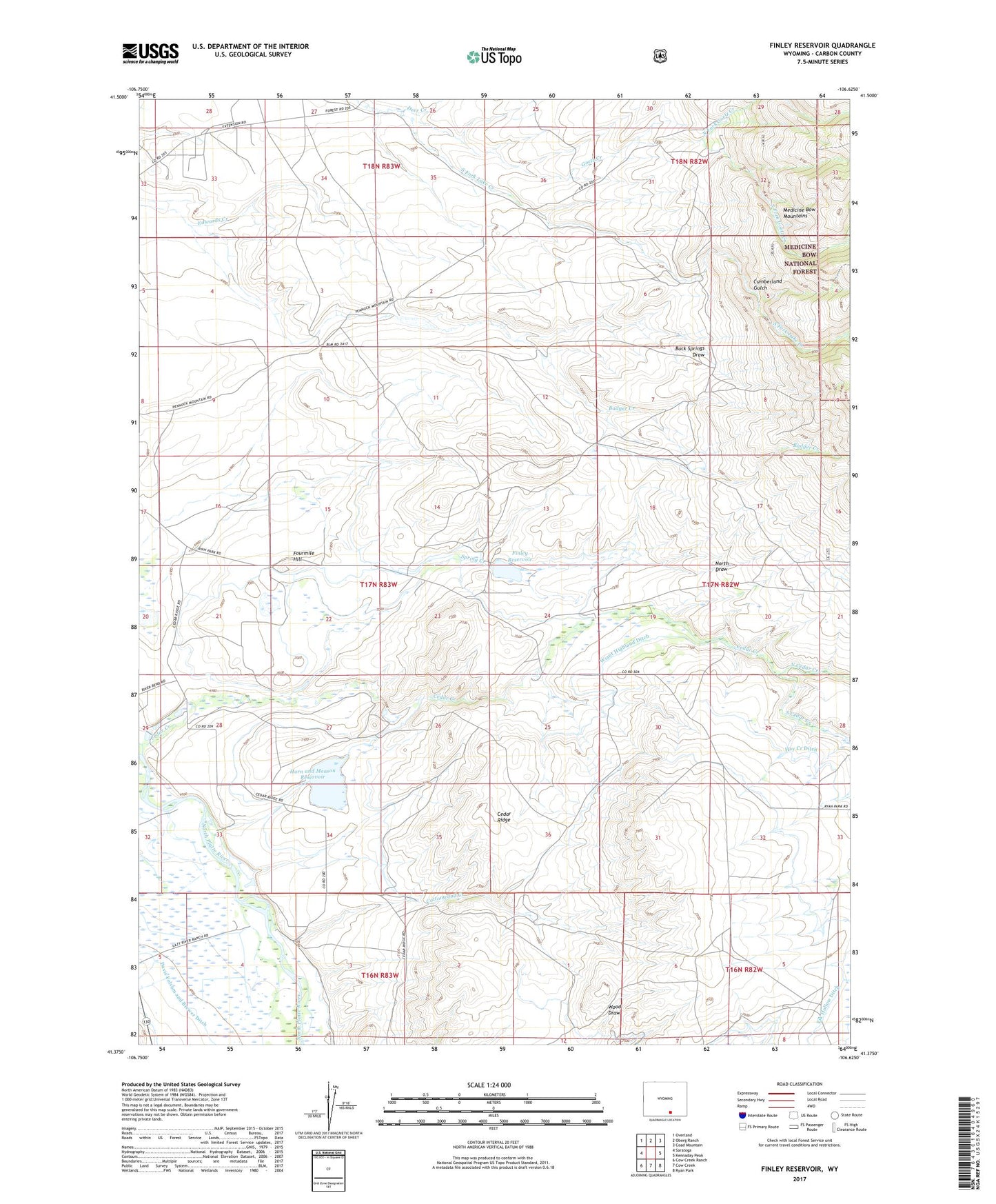
2021 topographic map quadrangle Finley Reservoir in the state of Wyoming. Scale: 1:24000. Based on the newly updated USGS 7.5' US Topo map series, this map is in the following counties: Carbon. The map contains contour data, water features, and other items you are used to seeing on USGS maps, but also has updated roads and other features. This is the next generation of topographic maps. Printed on high-quality waterproof paper with UV fade-resistant inks.
Quads adjacent to this one:
West: Saratoga
Northwest: Overland
North: Oberg Ranch
Northeast: Coad Mountain
East: Kennaday Peak
Southeast: Ryan Park
South: Cow Creek
Southwest: Cow Creek Ranch
This map covers the same area as the classic USGS quad with code o41106d6.
Contains the following named places: Badger Creek, Cedar Ridge, Chastain Ranch, Cottonwood Creek, Cumberland Gulch, Davis Folsom and Brewer Ditch, Deer Creek, Edwards Creek, Finley Dam, Finley Ranch, Finley Reservoir, Fourmile Hill, Goetz Creek, Hay Creek Ditch, Horn and Meason Dam, Horn and Meason Reservoir, Lazy River M Ranch, North Cedar Creek, North Draw, North Fork Goetz Creek, North Fork Goetze Creek, South Cedar Creek, South Fork Goetz Creek, Spring Creek, Taylor Ranch, Wiant Ditch, Wiant Highland Ditch, Wiant Ranch