MyTopo
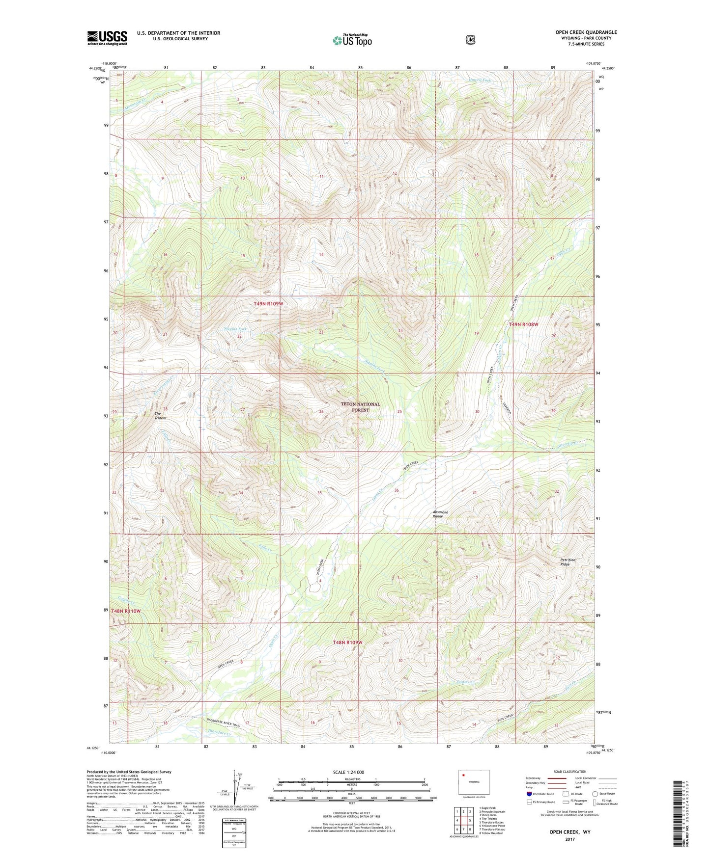
Open Creek Wyoming US Topo Map
Couldn't load pickup availability
Also explore the Open Creek Forest Service Topo of this same quad for updated USFS data
2021 topographic map quadrangle Open Creek in the state of Wyoming. Scale: 1:24000. Based on the newly updated USGS 7.5' US Topo map series, this map is in the following counties: Park. The map contains contour data, water features, and other items you are used to seeing on USGS maps, but also has updated roads and other features. This is the next generation of topographic maps. Printed on high-quality waterproof paper with UV fade-resistant inks.
Quads adjacent to this one:
West: The Trident
Northwest: Eagle Peak
North: Pinnacle Mountain
Northeast: Sheep Mesa
East: Thorofare Buttes
Southeast: Yellow Mountain
South: Thorofare Plateau
Southwest: Yellowstone Point
This map covers the same area as the classic USGS quad with code o44109b8.
Contains the following named places: Coyote Creek, Falls Creek, Open Creek, Open Creek Trail, Siggins Fork, Silvertip Creek