MyTopo
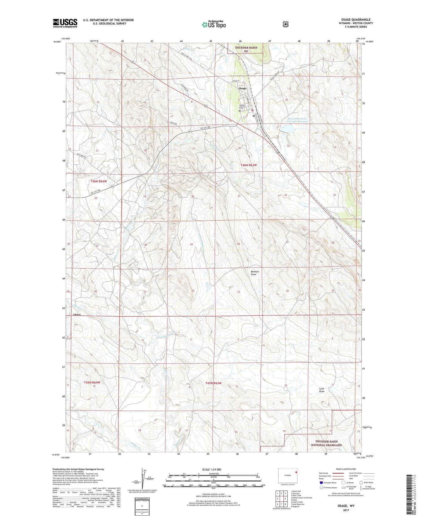
Osage Wyoming US Topo Map
Couldn't load pickup availability
Also explore the Osage Forest Service Topo of this same quad for updated USFS data
2021 topographic map quadrangle Osage in the state of Wyoming. Scale: 1:24000. Based on the newly updated USGS 7.5' US Topo map series, this map is in the following counties: Weston. The map contains contour data, water features, and other items you are used to seeing on USGS maps, but also has updated roads and other features. This is the next generation of topographic maps. Printed on high-quality waterproof paper with UV fade-resistant inks.
Quads adjacent to this one:
West: Sheep Canyon Creek East
Northwest: Upton East
North: Clay Spur
Northeast: Skull Creek
East: Pedro
Southeast: Osage SE
South: Klodt Reservoir
Southwest: Lassen Creek
This map covers the same area as the classic USGS quad with code o43104h4.
Contains the following named places: Benhart Draw, Black Hills Power and Light Dam, Black Hills Power and Light Reservoir, East Fork Beaver Creek, Garhart Cemetery, Kitty Moats School, Osage, Osage Census Designated Place, Osage Oil Field, Osage Post Office, Osage Volunteer Fire Department and Ambulance, Poison Creek, Spoon Creek