MyTopo
Clay Spur Wyoming US Topo Map
Couldn't load pickup availability
Also explore the Clay Spur Forest Service Topo of this same quad for updated USFS data
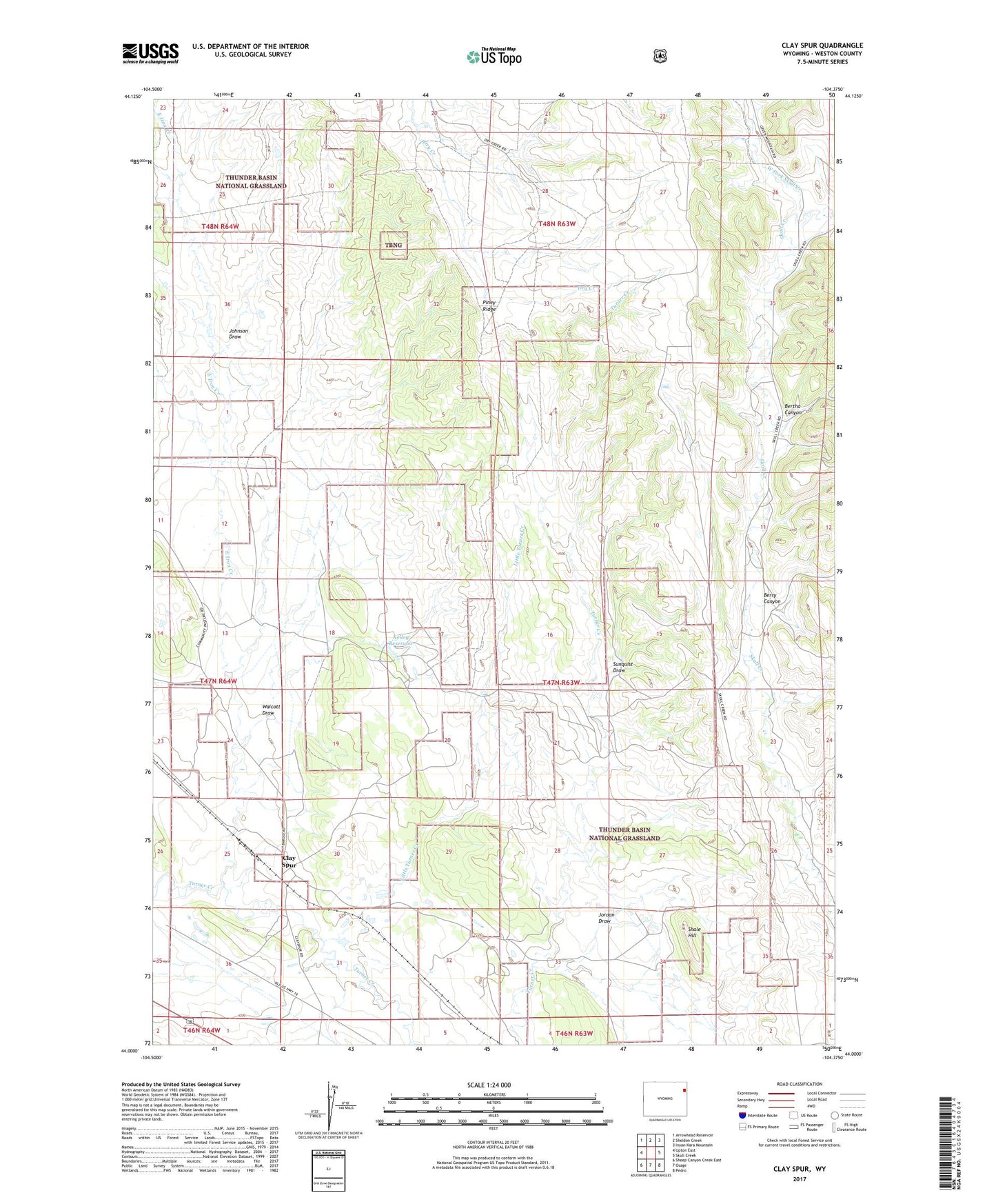
2021 topographic map quadrangle Clay Spur in the state of Wyoming. Scale: 1:24000. Based on the newly updated USGS 7.5' US Topo map series, this map is in the following counties: Weston. The map contains contour data, water features, and other items you are used to seeing on USGS maps, but also has updated roads and other features. This is the next generation of topographic maps. Printed on high-quality waterproof paper with UV fade-resistant inks.
Quads adjacent to this one:
West: Upton East
Northwest: Arrowhead Reservoir
North: Sheldon Creek
Northeast: Inyan Kara Mountain
East: Skull Creek
Southeast: Pedro
South: Osage
Southwest: Sheep Canyon Creek East
This map covers the same area as the classic USGS quad with code o44104a4.
Contains the following named places: Berry Canyon, Bertha Canyon, Clay Spur, Douglas Place, Douglas-Sweet School, East Iron Creek, Farley Number One Mine, Farley Number Three Mine, Farley Number Two Mine, Johnson Draw, Jordan Draw, Kellog Reservoir, Little Turner Creek, Osage Clay Spur Quarries Mine, Osage Mine, Piney Ridge, Shale Hill, Sunquist Draw, Sweet Ranch, Tavegia Pit Mine, Walcott Draw, West Fork Skull Creek, ZIP Code: 82723