MyTopo
Packsaddle Canyon Wyoming US Topo Map
Couldn't load pickup availability
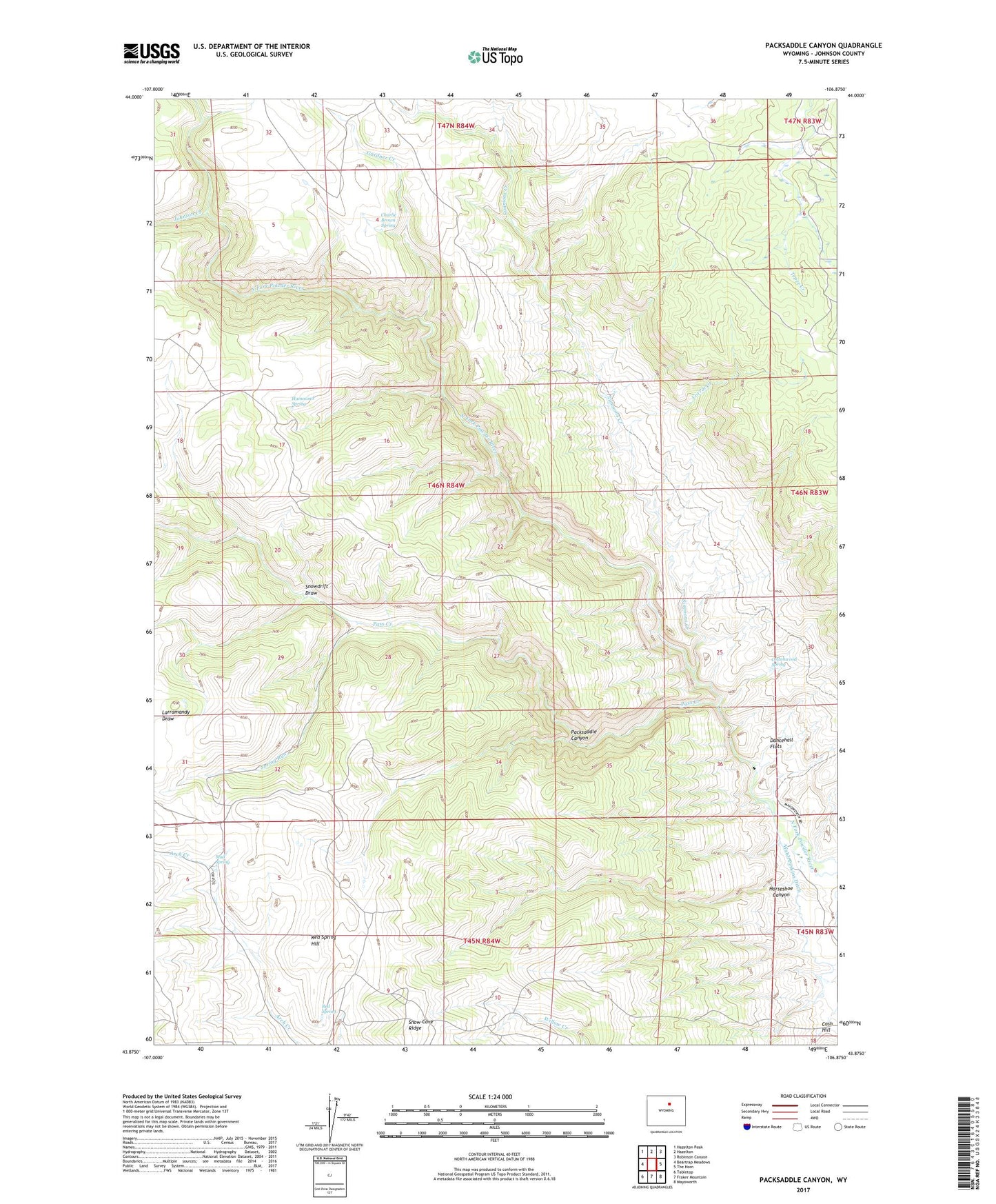
2021 topographic map quadrangle Packsaddle Canyon in the state of Wyoming. Scale: 1:24000. Based on the newly updated USGS 7.5' US Topo map series, this map is in the following counties: Johnson. The map contains contour data, water features, and other items you are used to seeing on USGS maps, but also has updated roads and other features. This is the next generation of topographic maps. Printed on high-quality waterproof paper with UV fade-resistant inks.
Quads adjacent to this one:
West: Beartrap Meadows
Northwest: Hazelton Peak
North: Hazelton
Northeast: Robinson Canyon
East: The Horn
Southeast: Mayoworth
South: Fraker Mountain
Southwest: Tabletop
Contains the following named places: Armstrong Cabin, Brack Cabin, Cash Trail, Charlie Brown Spring, Corral Creek, Cottonwood Spring, Dancehall Flats, Emerald Park Mine, Everson Cabin, Gardner Creek, Gibbs Cabin, Gordons Camp, Gordons Cowcamp, Hammond Spring, Hat Ranch, Horseshoe Canyon, Johnson Creek, Lindar Cabin, Mud Spring, Packsaddle Canyon, Pass Creek, Red Spring, Red Spring Hill, Red Spring Reservoirs, Simmons Creek, Smith Cabin, Smith Cabins, Snowdrift Draw, Spring Run, Webb Perkins Ditch