MyTopo
Fraker Mountain Wyoming US Topo Map
Couldn't load pickup availability
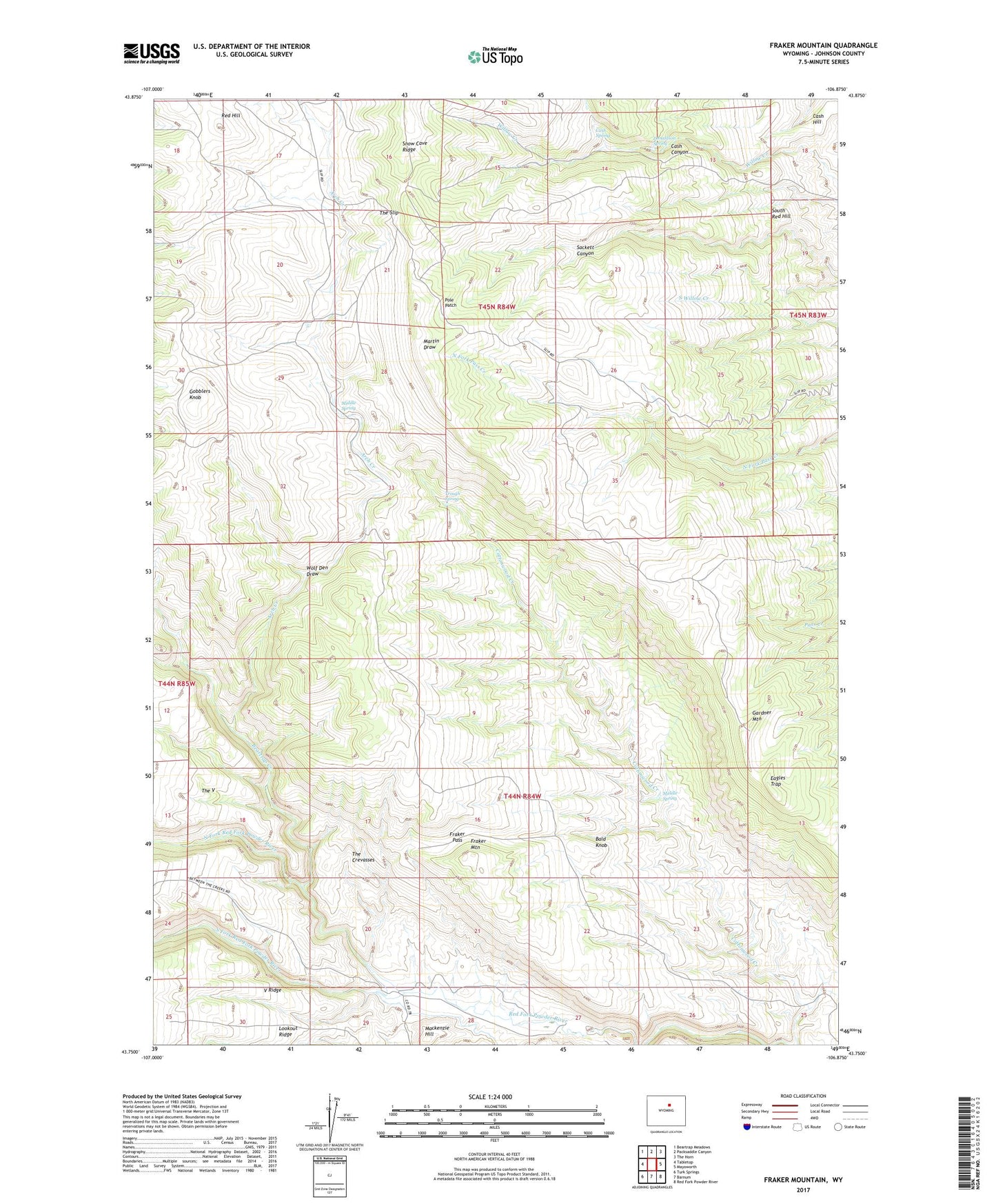
2021 topographic map quadrangle Fraker Mountain in the state of Wyoming. Scale: 1:24000. Based on the newly updated USGS 7.5' US Topo map series, this map is in the following counties: Johnson. The map contains contour data, water features, and other items you are used to seeing on USGS maps, but also has updated roads and other features. This is the next generation of topographic maps. Printed on high-quality waterproof paper with UV fade-resistant inks.
Quads adjacent to this one:
West: Tabletop
Northwest: Beartrap Meadows
North: Packsaddle Canyon
Northeast: The Horn
East: Mayoworth
Southeast: Red Fork Powder River
South: Barnum
Southwest: Turk Springs
This map covers the same area as the classic USGS quad with code o43106g8.
Contains the following named places: Arch Creek, Arndt Ranch, Bald Knob, Beartrap Creek, Brock Cowcamp, Cash Canyon, Cash Hill, Cash Spring, Donaldson Spring, Eagles Trap, Fraker Mountain, Fraker Pass, Gardner Mountain, Gobblers Knob, Lookout Ridge, Mackenzie Hill, Middle Spring, Norris Graves Ranch, North Fork Red Fork Powder River, Perry Cabin, Pole Patch, Red Hill, Snow Cave Ridge, South Fork Red Fork Powder River, South Red Hill, The Arch, The Crevasses, The Slip, The V, Trough Spring, V Ridge, Wolf Den Draw