MyTopo
Mayoworth Wyoming US Topo Map
Couldn't load pickup availability
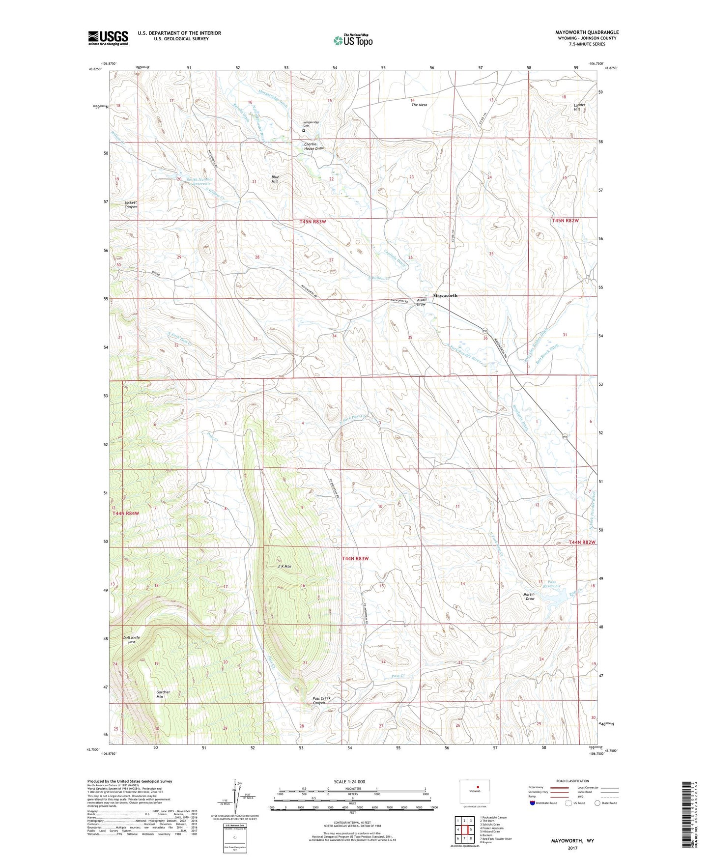
2021 topographic map quadrangle Mayoworth in the state of Wyoming. Scale: 1:24000. Based on the newly updated USGS 7.5' US Topo map series, this map is in the following counties: Johnson. The map contains contour data, water features, and other items you are used to seeing on USGS maps, but also has updated roads and other features. This is the next generation of topographic maps. Printed on high-quality waterproof paper with UV fade-resistant inks.
Quads adjacent to this one:
West: Fraker Mountain
Northwest: Packsaddle Canyon
North: The Horn
Northeast: Schlicht Draw
East: Hibbard Draw
Southeast: Kaycee
South: Red Fork Powder River
Southwest: Barnum
This map covers the same area as the classic USGS quad with code o43106g7.
Contains the following named places: Alkali Draw, Barrett Ditch, Blue Hill, Capitola Ditch, Charlie House Draw, Chubb and Lloyd Ranch, Condit Ranch, Dull Knife Pass, E K Mountain, Gorden Pit, Gordon Ranch, Kaycee Bentonite Corporation Number Ninety-six Mine, Lander Hill, Martin Draw, Mayoworth, Mayoworth Number Ten Mine, Morgareidge Cemetery, Morgareidge Ditch, North Fork Pass Creek, Pass Creek Canyon, Pass Creek Number 2 Reservoir, Pass Dam, Pass Reservoir, Pass Reservoir Area Mine, Red Fork Powder River Area Number One Mine, Red Fork Powder River Area Number Two Mine, Roseberry Ditch, Sackett Canyon, Slate Ridge Number Five Mine, Slate Ridge Numbers One-eleven Mines, Smith Number 2 Dam, Smith Number 2 Reservoir, Smith Ranch, South Willow Creek, Strickler Rinker Ditch, The Mesa, Willow Creek