
MyTopo
Peru Wyoming US Topo Map
Couldn't load pickup availability
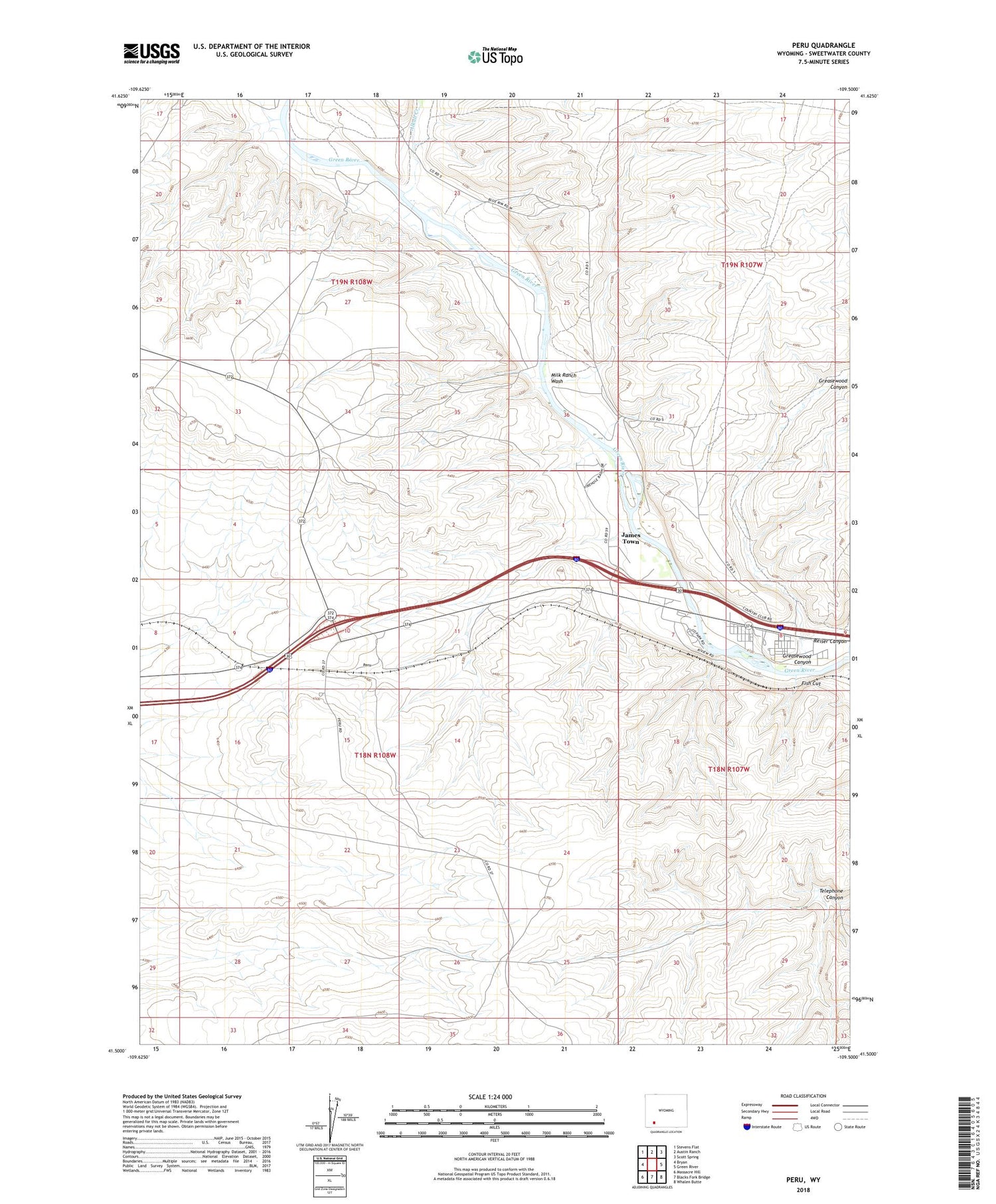
2021 topographic map quadrangle Peru in the state of Wyoming. Scale: 1:24000. Based on the newly updated USGS 7.5' US Topo map series, this map is in the following counties: Sweetwater. The map contains contour data, water features, and other items you are used to seeing on USGS maps, but also has updated roads and other features. This is the next generation of topographic maps. Printed on high-quality waterproof paper with UV fade-resistant inks.
Quads adjacent to this one:
West: Bryan
Northwest: Stevens Flat
North: Austin Ranch
Northeast: Scott Spring
East: Green River
Southeast: Whalen Butte
South: Blacks Fork Bridge
Southwest: Massacre Hill
Contains the following named places: Alkali Creek, Diamond Alkali Company-Butler Well Number One Mine, Fish Cut, Gaensslen Ranch, Greasewood Canyon, Green River Pit, James Town, James Town Census Designated Place, Milk Ranch Wash, Peru, Reiser Canyon, Riovista, Riview, Shaul Ranch


