MyTopo
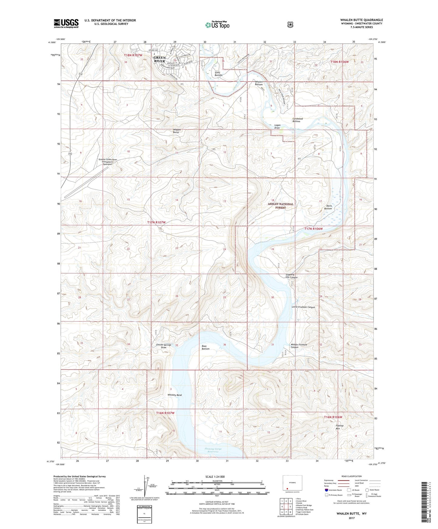
Whalen Butte Wyoming US Topo Map
Couldn't load pickup availability
Also explore the Whalen Butte Forest Service Topo of this same quad for updated USFS data
2021 topographic map quadrangle Whalen Butte in the state of Wyoming. Scale: 1:24000. Based on the newly updated USGS 7.5' US Topo map series, this map is in the following counties: Sweetwater. The map contains contour data, water features, and other items you are used to seeing on USGS maps, but also has updated roads and other features. This is the next generation of topographic maps. Printed on high-quality waterproof paper with UV fade-resistant inks.
Quads adjacent to this one:
West: Blacks Fork Bridge
Northwest: Peru
North: Green River
Northeast: Kanda
East: Wilkins Peak
Southeast: Firehole Basin
South: Sage Creek Basin
Southwest: Halfway Hollow East
This map covers the same area as the classic USGS quad with code o41109d4.
Contains the following named places: Boat Bottom, Chicken Springs Draw, Cordwood Bottom, Davis Bottom, Greater Green River Intergalactic Spaceport, Laney Wash, Little Firehole Canyon, Logan Draw, Middle Firehole Canyon, Scott Bottom, Slippery Jim Canyon, Whalen Bottom, Whalen Butte, Whiskey Bend