MyTopo
Green River Wyoming US Topo Map
Couldn't load pickup availability
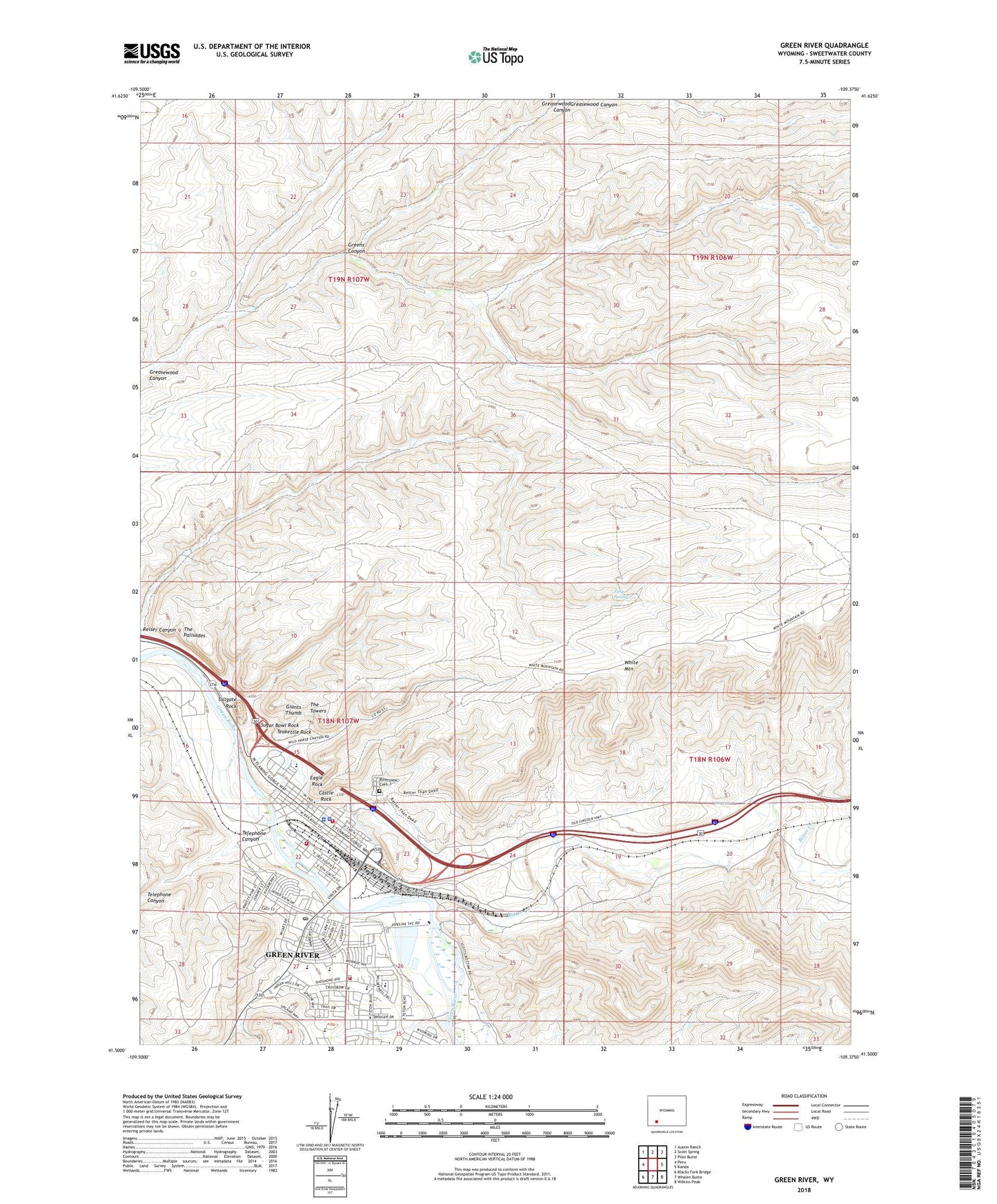
2021 topographic map quadrangle Green River in the state of Wyoming. Scale: 1:24000. Based on the newly updated USGS 7.5' US Topo map series, this map is in the following counties: Sweetwater. The map contains contour data, water features, and other items you are used to seeing on USGS maps, but also has updated roads and other features. This is the next generation of topographic maps. Printed on high-quality waterproof paper with UV fade-resistant inks.
Quads adjacent to this one:
West: Peru
Northwest: Austin Ranch
North: Scott Spring
Northeast: Pilot Butte
East: Kanda
Southeast: Wilkins Peak
South: Whalen Butte
Southwest: Blacks Fork Bridge
This map covers the same area as the classic USGS quad with code o41109e4.
Contains the following named places: Acme Pit, Bitter Creek, Castle Rock, Castle Rock Ambulance Services, Castle Rock Convalescent Center, City of Green River, Eagle Rock, First Spring, Flaming Gorge Shopping Center, Giants Thumb, Granger Volunteer Fire Department, Green River, Green River Area Mine, Green River Fire Department, Green River Police Department, Green River Post Office, Greens Canyon, Hutton Heights Shopping Center, Island Park, KUGR-AM (Green River), Lincoln High School, Old Stage Station, Riverview Cemetery, Roosevelt School, Sugar Bowl Rock, Sweetwater County Sheriff's Office, Teakettle Rock, Telephone Canyon, The Palisades, The Towers, Tollgate Rock, Washington School