MyTopo
Pierce Reservoir Wyoming US Topo Map
Couldn't load pickup availability
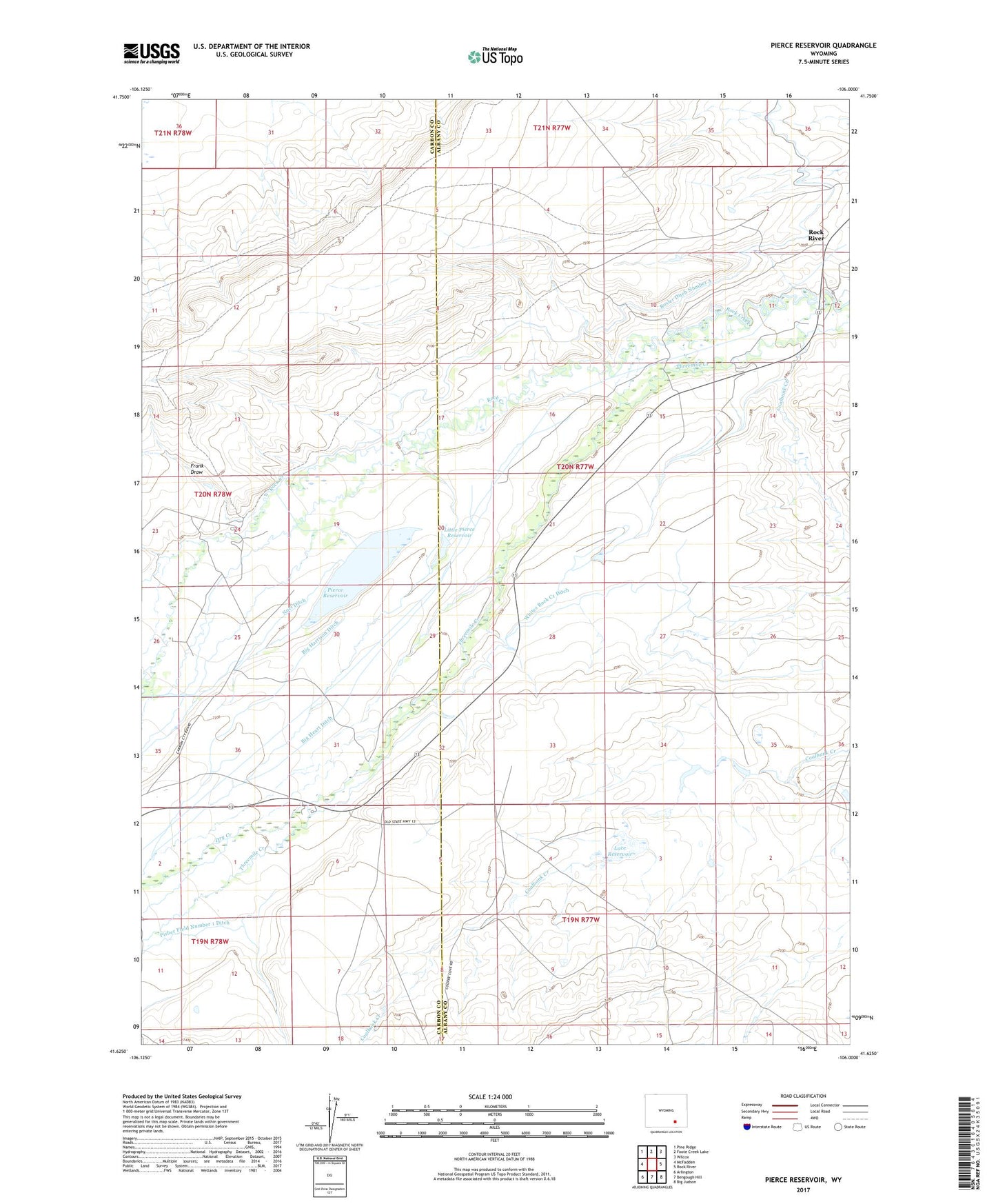
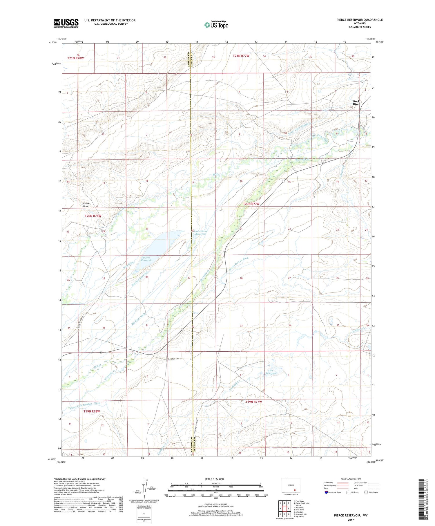
2021 topographic map quadrangle Pierce Reservoir in the state of Wyoming. Scale: 1:24000. Based on the newly updated USGS 7.5' US Topo map series, this map is in the following counties: Albany, Carbon. The map contains contour data, water features, and other items you are used to seeing on USGS maps, but also has updated roads and other features. This is the next generation of topographic maps. Printed on high-quality waterproof paper with UV fade-resistant inks.
Quads adjacent to this one:
West: McFadden
Northwest: Pine Ridge
North: Foote Creek Lake
Northeast: Wilcox
East: Rock River
Southeast: Big Judson
South: Bengough Hill
Southwest: Arlington
Contains the following named places: Banzhof Ranch, Big Harrison Ditch, Big Heart Ditch, Bosler Ditch Number 3, Coalbank Creek, Diamond Dome Gas Field, Diamond Ranch, Dobson Ranch, Double K Ranch, Dry Creek, Fisher Field Number 1 Ditch, Frank Draw, Jankovsky Ranch, John White Enlargement Ditch, King Mine, Lace Dam, Lace Reservoir, Little Pierce Dam, Little Pierce Reservoir, Monarch Mine, Noel Ditch, Pierce Dam, Pierce Reservoir, Rock Creek Valley Volunteer Fire Department, Threemile Creek, Valley Station, Watkins Creek, Whiskey Number 1 Dam, Whiskey Number 1 Reservoir, Whites Dam, Whites Reservoir, Whites Rock Creek Ditch, ZIP Code: 82083