MyTopo
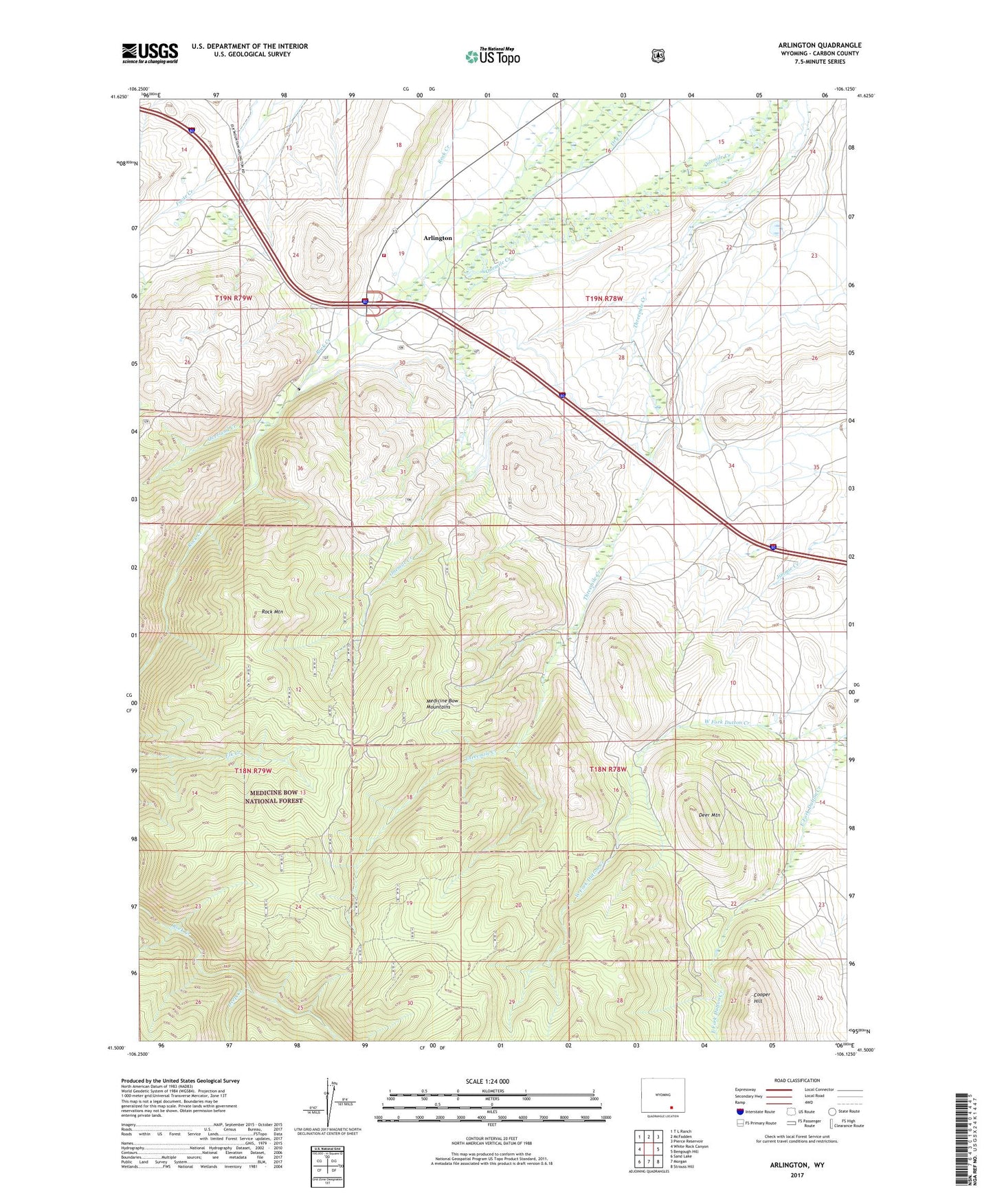
Arlington Wyoming US Topo Map
Couldn't load pickup availability
Also explore the Arlington Forest Service Topo of this same quad for updated USFS data
2021 topographic map quadrangle Arlington in the state of Wyoming. Scale: 1:24000. Based on the newly updated USGS 7.5' US Topo map series, this map is in the following counties: Carbon. The map contains contour data, water features, and other items you are used to seeing on USGS maps, but also has updated roads and other features. This is the next generation of topographic maps. Printed on high-quality waterproof paper with UV fade-resistant inks.
Quads adjacent to this one:
West: White Rock Canyon
Northwest: T L Ranch
North: McFadden
Northeast: Pierce Reservoir
East: Bengough Hill
Southeast: Strouss Hill
South: Morgan
Southwest: Sand Lake
This map covers the same area as the classic USGS quad with code o41106e2.
Contains the following named places: Arlington, Arlington Census Designated Place, Brokaw Ranch, Canon Ditch, Copper King Mine, Cottontail Mine, Deep Creek, Deer Mountain, Old Fisher Ranch, Overland Creek, Rafter Six Ranch, Rock Creek Mine, Rock Creek Picnic Ground, Rock Mountain, Waterloo Prospects, West Fork Dutton Creek, White Ranch, Woodedge