MyTopo
Poker Butte Wyoming US Topo Map
Couldn't load pickup availability
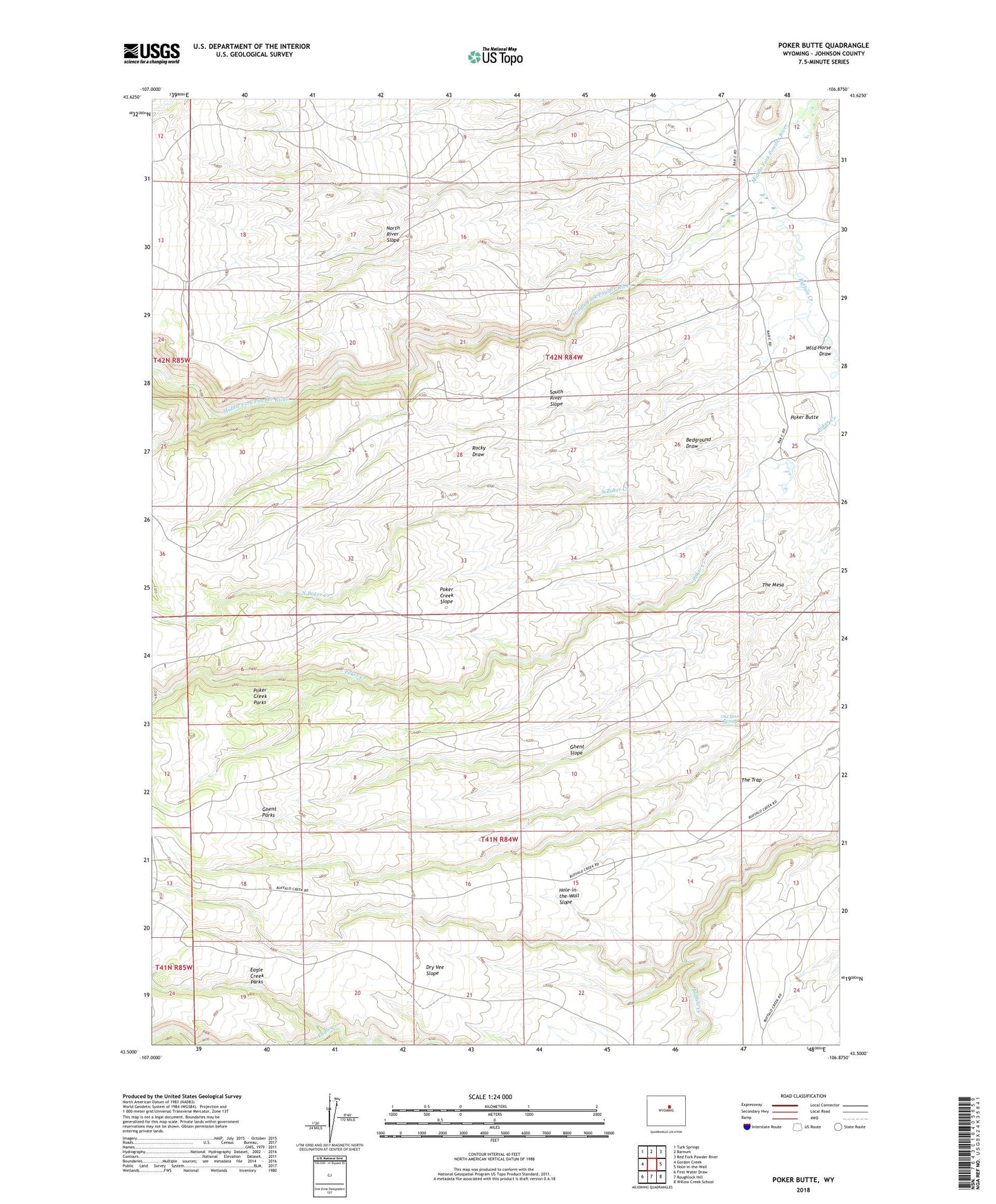
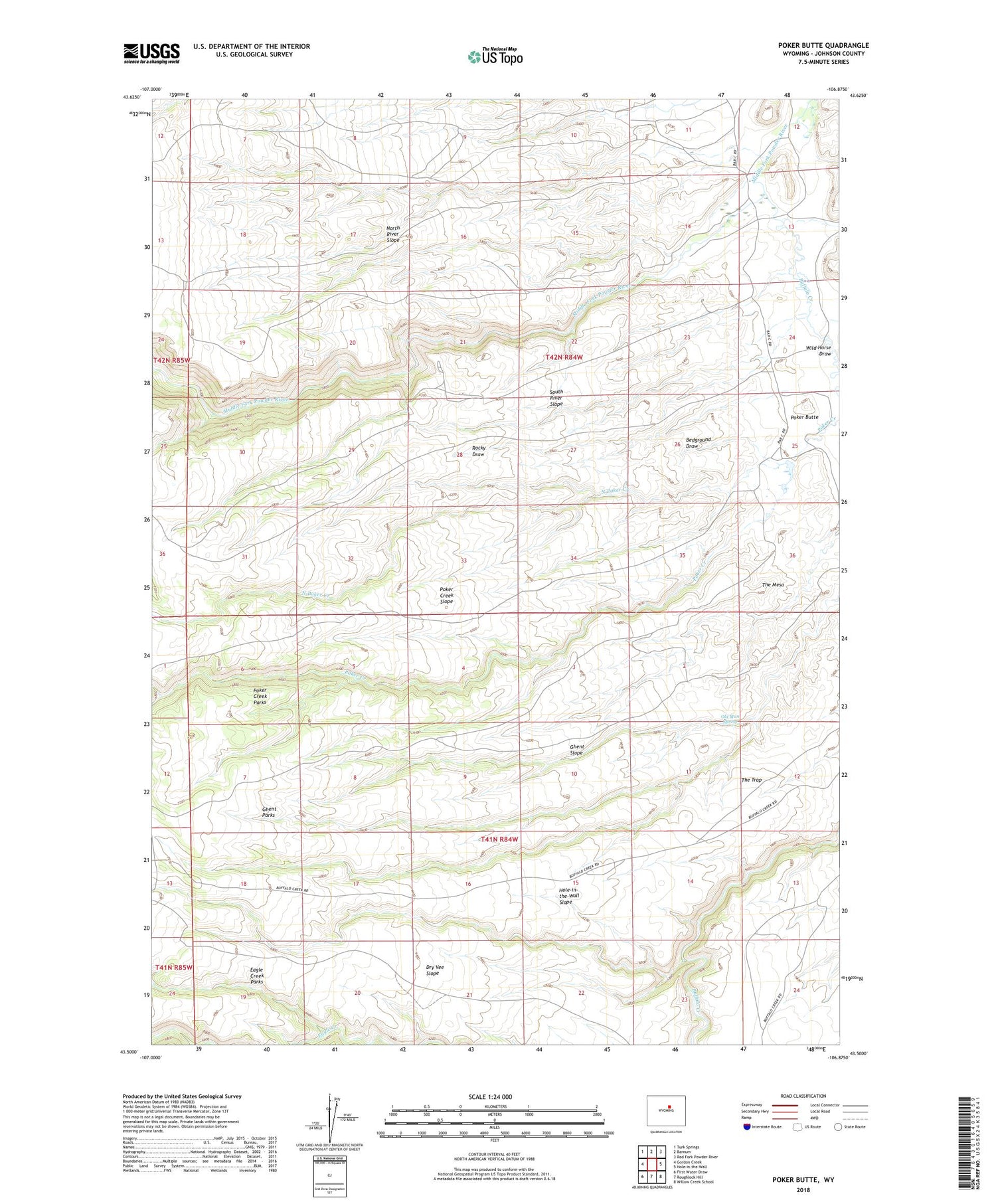
2021 topographic map quadrangle Poker Butte in the state of Wyoming. Scale: 1:24000. Based on the newly updated USGS 7.5' US Topo map series, this map is in the following counties: Johnson. The map contains contour data, water features, and other items you are used to seeing on USGS maps, but also has updated roads and other features. This is the next generation of topographic maps. Printed on high-quality waterproof paper with UV fade-resistant inks.
Quads adjacent to this one:
West: Gordon Creek
Northwest: Turk Springs
North: Barnum
Northeast: Red Fork Powder River
East: Hole-in-the-Wall
Southeast: Willow Creek School
South: Roughlock Hill
Southwest: First Water Draw
Contains the following named places: Bar C Ranch, Bedground Draw, Buffalo Creek, Dry Vee Cabin, Dry Vee Slope, Dry Vee Windmill, Eagle Creek Parks, Ghent Parks, Ghent Slope, Hole-in-the-Wall Slope, Hole-in-the-Wall Windmill, Johnson Ranch, Lea Ditch, North River Slope, Old Man Spring, Poker Creek Parks, Poker Creek Slope, South River Slope, Spangler Cabin, Spring Creek, The Mesa, The Trap, Wild Horse Draw