MyTopo
Hole-in-the-Wall Wyoming US Topo Map
Couldn't load pickup availability
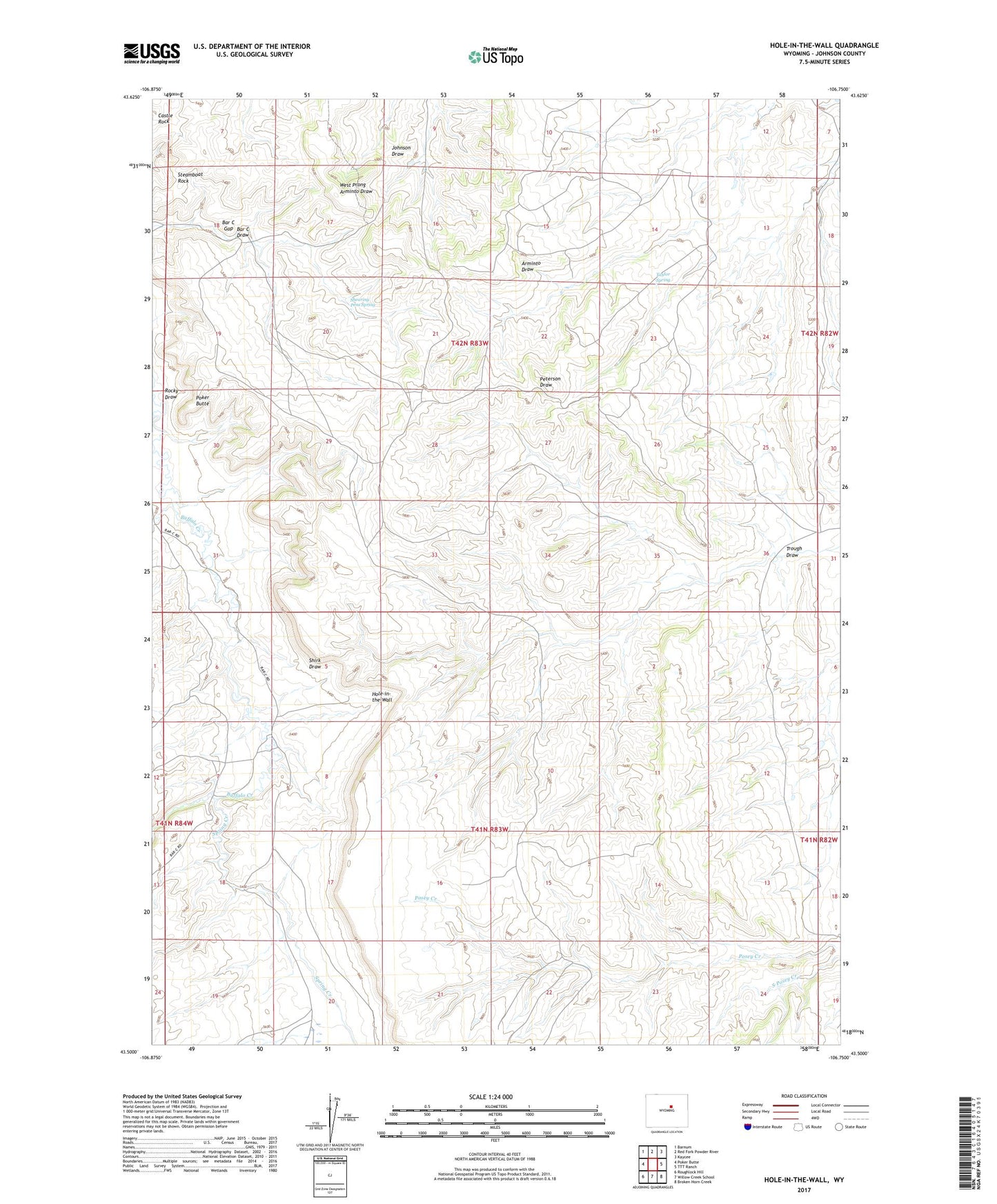
2021 topographic map quadrangle Hole-in-the-Wall in the state of Wyoming. Scale: 1:24000. Based on the newly updated USGS 7.5' US Topo map series, this map is in the following counties: Johnson. The map contains contour data, water features, and other items you are used to seeing on USGS maps, but also has updated roads and other features. This is the next generation of topographic maps. Printed on high-quality waterproof paper with UV fade-resistant inks.
Quads adjacent to this one:
West: Poker Butte
Northwest: Barnum
North: Red Fork Powder River
Northeast: Kaycee
East: TTT Ranch
Southeast: Broken Horn Creek
South: Willow Creek School
Southwest: Roughlock Hill
This map covers the same area as the classic USGS quad with code o43106e7.
Contains the following named places: Albert Number 2 Dam, Albert Number 2 Reservoir, Bar C Draw, Bar C Gap, Buffalo Creek, Castle Rock, Elmer Rinker Homestead, Ghent Homestead, Hole-in-the-Wall, Keith Reservoir, Murphy Creek Area Mine, North Poker Creek, Peterson Draw Mine, Poker Butte, Poker Creek, Poker Creek Ranch, Rocky Draw, Shearing Pens Spring, Shirk Draw, Spring Creek, Spring Creek Mine, Steamboat Rock, Taylor Spring, Trough Draw