MyTopo
Pole Creek Ranch Wyoming US Topo Map
Couldn't load pickup availability
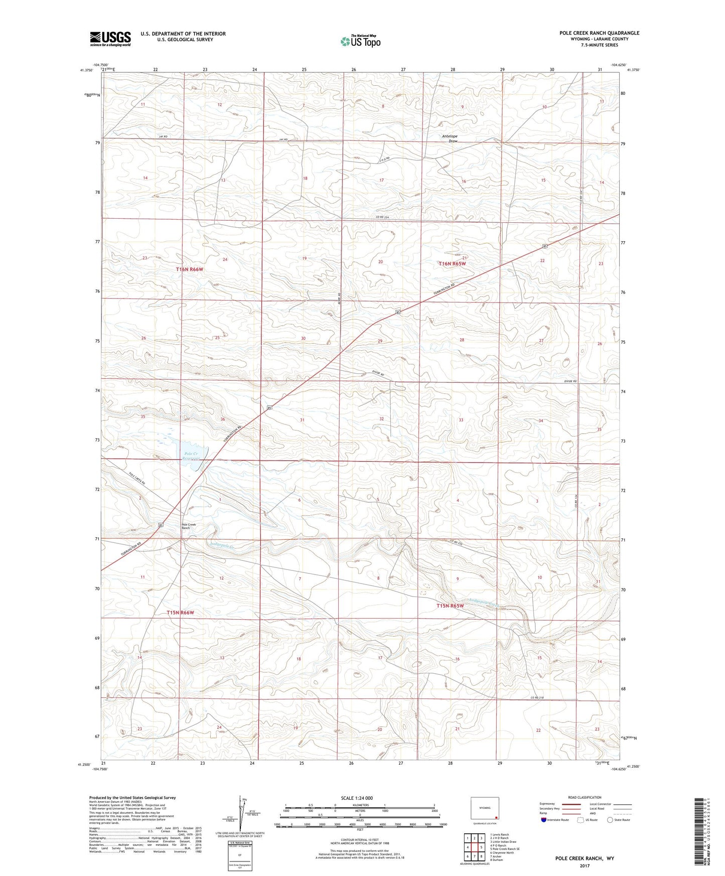
2021 topographic map quadrangle Pole Creek Ranch in the state of Wyoming. Scale: 1:24000. Based on the newly updated USGS 7.5' US Topo map series, this map is in the following counties: Laramie. The map contains contour data, water features, and other items you are used to seeing on USGS maps, but also has updated roads and other features. This is the next generation of topographic maps. Printed on high-quality waterproof paper with UV fade-resistant inks.
Quads adjacent to this one:
West: P O Ranch
Northwest: Lewis Ranch
North: J H D Ranch
Northeast: Little Indian Draw
East: Pole Creek Ranch SE
Southeast: Durham
South: Archer
Southwest: Cheyenne North
This map covers the same area as the classic USGS quad with code o41104c6.
Contains the following named places: Berry Camp, Cheyenne East Division, Eagle Camp, Hillside Camp, Laramie County, Middle Camp, Ninemile Draw, One Mile Dam, One Mile Reservoir, Peogh Camp, Pole Creek Farm, Pole Creek Ranch, Pole Creek Reservoir, Rabbit Camp