MyTopo
Provence Ranch Wyoming US Topo Map
Couldn't load pickup availability
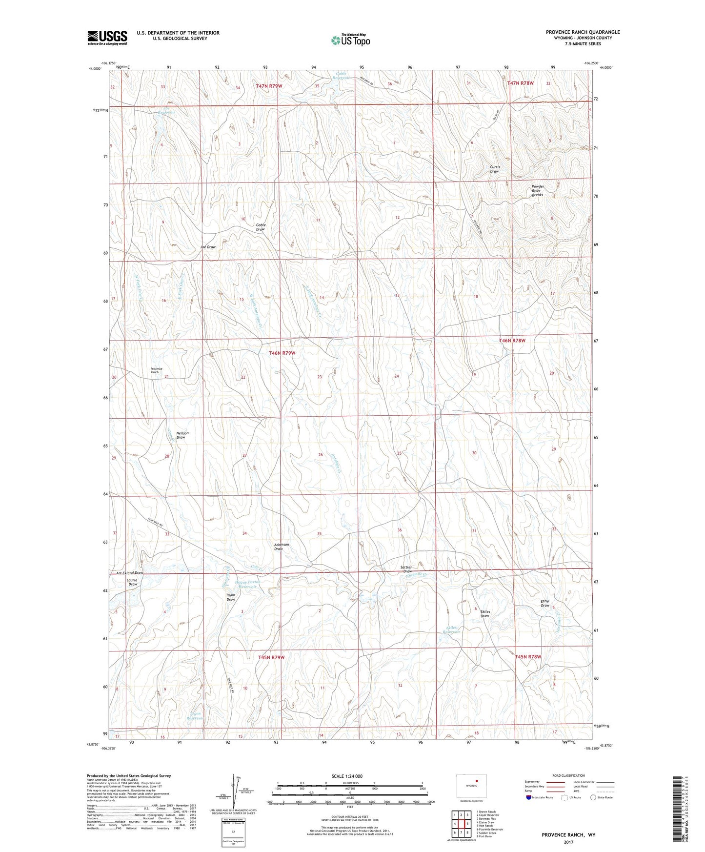
2021 topographic map quadrangle Provence Ranch in the state of Wyoming. Scale: 1:24000. Based on the newly updated USGS 7.5' US Topo map series, this map is in the following counties: Johnson. The map contains contour data, water features, and other items you are used to seeing on USGS maps, but also has updated roads and other features. This is the next generation of topographic maps. Printed on high-quality waterproof paper with UV fade-resistant inks.
Quads adjacent to this one:
West: Elaine Draw
Northwest: Brown Ranch
North: Coyer Reservoir
Northeast: Bowman Flat
East: Hoe Ranch
Southeast: Fort Reno
South: Soldier Creek
Southwest: Fourmile Reservoir
Contains the following named places: Adamson Draw, Antelope Creek, Art Ekland Draw, Cow Creek, East Fork Antelope Creek, East Fork Cow Creek, Ehtyl Number 2 Reservoir, Ethyl Draw, Ethyl Number 1 Dam, Ethyl Number 1 Reservoir, Ethyl Number 2 Dam, Goble Reservoir, Hague Paxton Dam, Hague Paxton Reservoir, Joe Dam, Joe Reservoir, Laurie Draw, Margaret Dam, Margaret Reservoir, Neilson Draw, Powder River Breaks, Provence Ranch, Sattler Draw, Skiles Draw, Skiles Reservoir, Sunset Claim Group Mine, Tryon Draw, Tryon Reservoir, West Fork Antelope Creek, West Fork Cow Creek