MyTopo
Fourmile Reservoir Wyoming US Topo Map
Couldn't load pickup availability
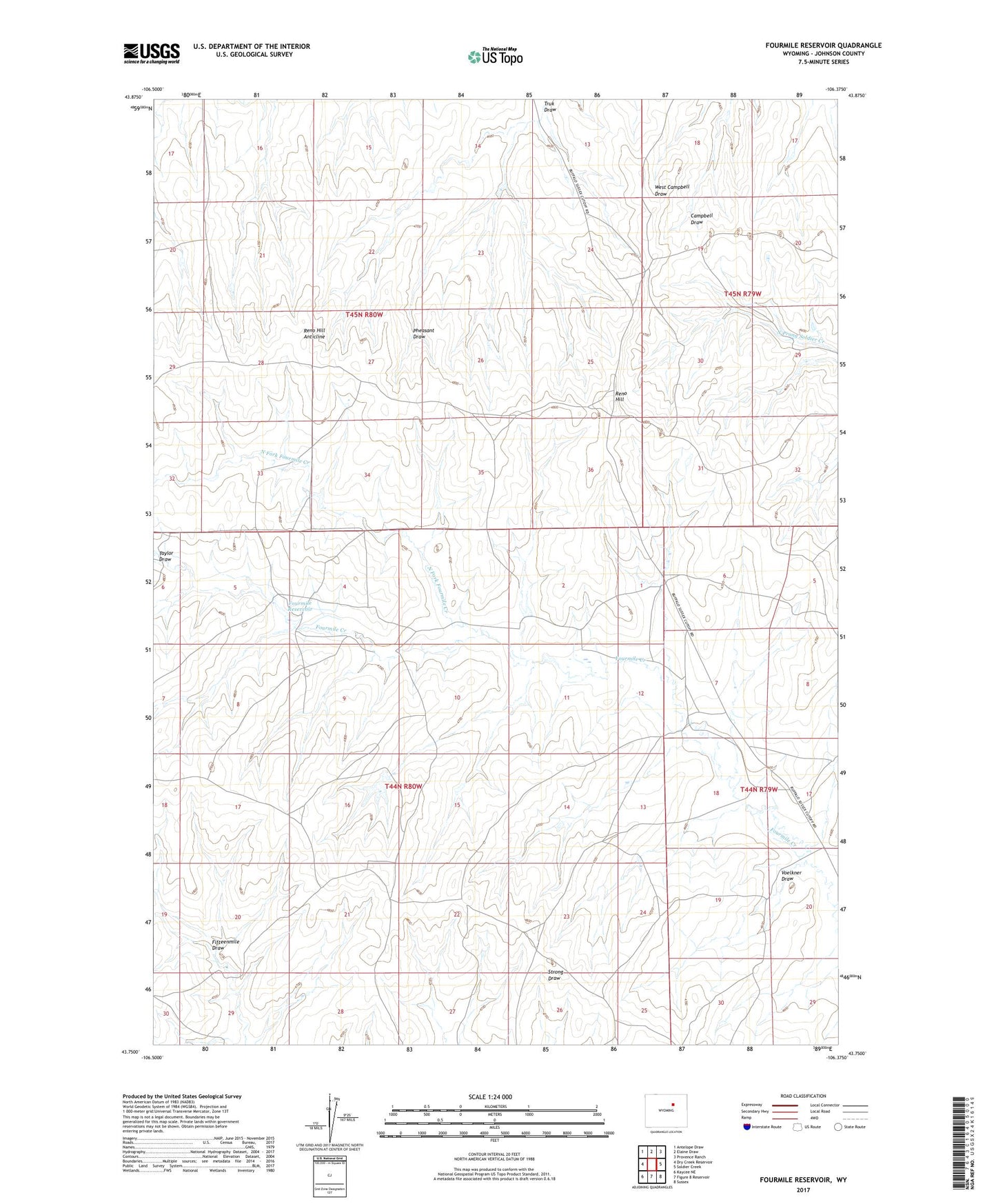
2021 topographic map quadrangle Fourmile Reservoir in the state of Wyoming. Scale: 1:24000. Based on the newly updated USGS 7.5' US Topo map series, this map is in the following counties: Johnson. The map contains contour data, water features, and other items you are used to seeing on USGS maps, but also has updated roads and other features. This is the next generation of topographic maps. Printed on high-quality waterproof paper with UV fade-resistant inks.
Quads adjacent to this one:
West: Dry Creek Reservoir
Northwest: Antelope Draw
North: Elaine Draw
Northeast: Provence Ranch
East: Soldier Creek
Southeast: Sussex
South: Figure 8 Reservoir
Southwest: Kaycee NE
This map covers the same area as the classic USGS quad with code o43106g4.
Contains the following named places: Campbell Number One Mine, Four Mile Dam, Fourmile Reservoir, North Fork Fourmile Creek, Reno Hill, Reno Hill Anticline, Taylor Draw, Truk Draw, Voelkner Draw