MyTopo
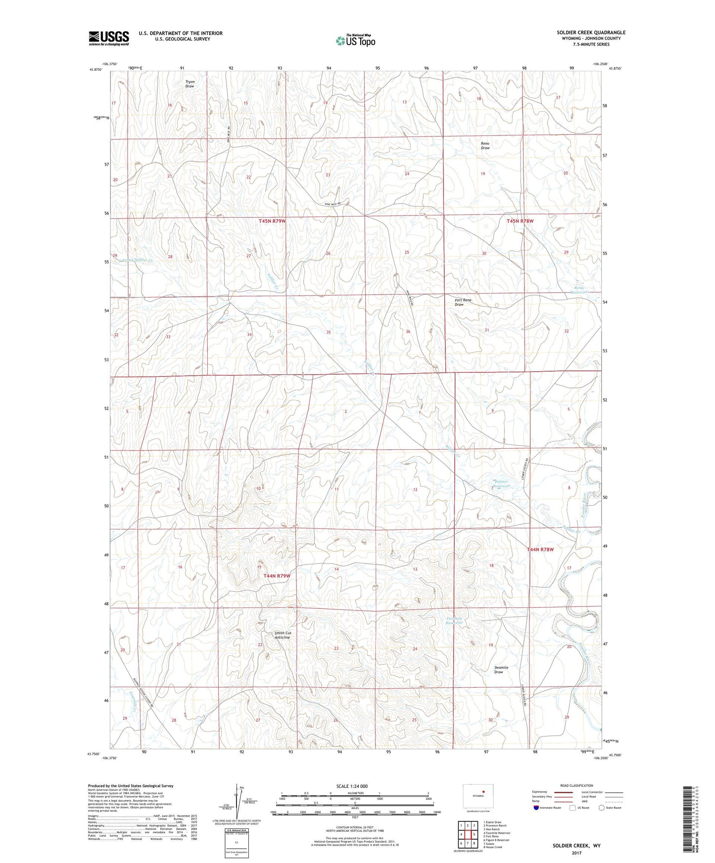
Soldier Creek Wyoming US Topo Map
Couldn't load pickup availability
2021 topographic map quadrangle Soldier Creek in the state of Wyoming. Scale: 1:24000. Based on the newly updated USGS 7.5' US Topo map series, this map is in the following counties: Johnson. The map contains contour data, water features, and other items you are used to seeing on USGS maps, but also has updated roads and other features. This is the next generation of topographic maps. Printed on high-quality waterproof paper with UV fade-resistant inks.
Quads adjacent to this one:
West: Fourmile Reservoir
Northwest: Elaine Draw
North: Provence Ranch
Northeast: Hoe Ranch
East: Fort Reno
Southeast: House Creek
South: Sussex
Southwest: Figure 8 Reservoir
This map covers the same area as the classic USGS quad with code o43106g3.
Contains the following named places: North Prong Soldier Creek, Palmer Dam, Palmer Reservoir, Reno Dam, Reno Reservoir, Skiles-Reno Pit, Smith Cut Anticline, Twomile Draw, Twomile Reservoir