MyTopo
Beaver Basin Colorado US Topo Map
Couldn't load pickup availability
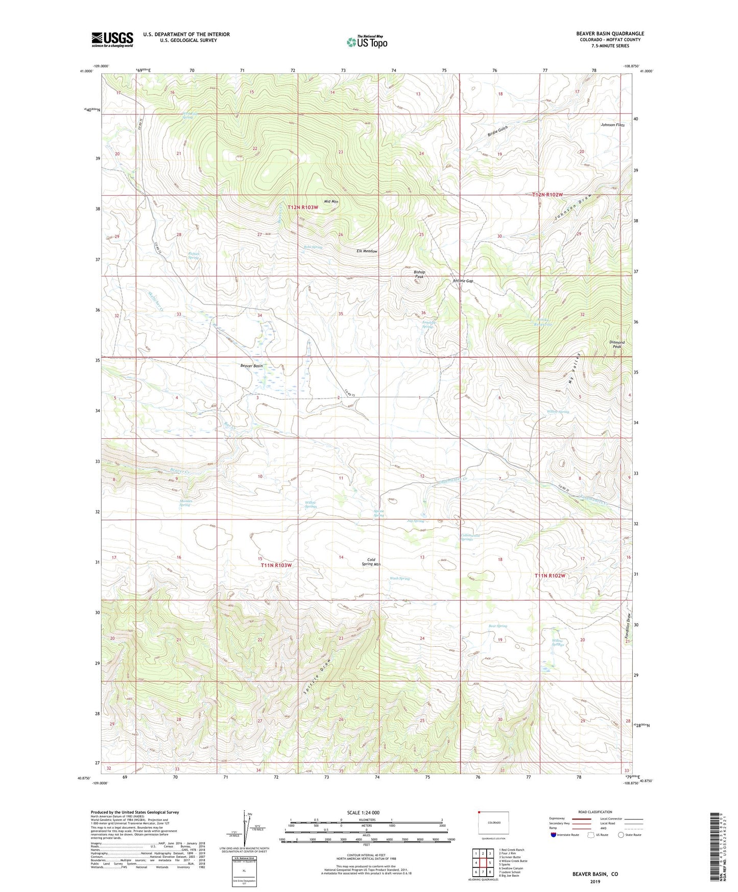
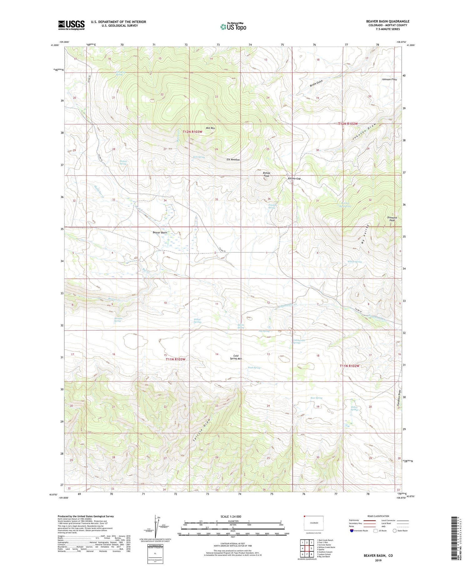
2022 topographic map quadrangle Beaver Basin in the state of Colorado. Scale: 1:24000. Based on the newly updated USGS 7.5' US Topo map series, this map is in the following counties: Moffat. The map contains contour data, water features, and other items you are used to seeing on USGS maps, but also has updated roads and other features. This is the next generation of topographic maps. Printed on high-quality waterproof paper with UV fade-resistant inks.
Quads adjacent to this one:
West: Willow Creek Butte
Northwest: Red Creek Ranch
North: Four J Rim
Northeast: Scrivner Butte
East: Sparks
Southeast: Big Joe Basin
South: Lodore School
Southwest: Swallow Canyon
This map covers the same area as the classic USGS quad with code o40108h8.
Contains the following named places: Antelope Spring, Antone Gap, Bar Creek, Bear Spring, Beaver Basin, Bishop Peak, Bobs Spring, Buckley Cow Camp, Cottonwood Springs, Diamond Peak, Elk Meadow, Jug Spring, Mansfield Cabin, Middle Mountain, Morales Spring, My Valley, NS Creek, Richies Spring, Rocky Reservoir, Skeltcher Creek, Spitzie Spring, The Pines, Wash Spring, West End Spring, Willow Spring, Willow Springs