MyTopo
Shell Wyoming US Topo Map
Couldn't load pickup availability
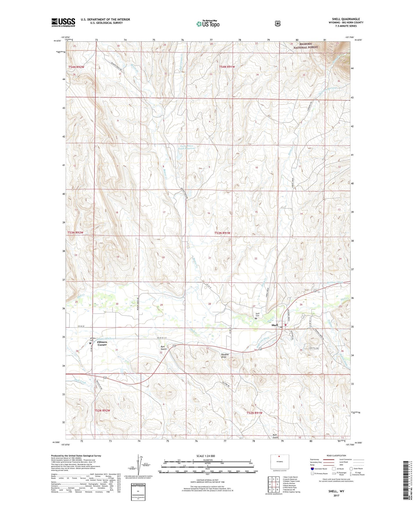
2021 topographic map quadrangle Shell in the state of Wyoming. Scale: 1:24000. Based on the newly updated USGS 7.5' US Topo map series, this map is in the following counties: Big Horn. The map contains contour data, water features, and other items you are used to seeing on USGS maps, but also has updated roads and other features. This is the next generation of topographic maps. Printed on high-quality waterproof paper with UV fade-resistant inks.
Quads adjacent to this one:
West: Devils Kitchen
Northwest: Bear Creek Ranch
North: Leavitt Reservoir
Northeast: Hidden Tepee Creek
East: Black Mountain
Southeast: White Sulphur Spring
South: Manderson NE
Southwest: Wild Horse Flats
Contains the following named places: Beaver Creek, Big Hill Group Mine, Douglas Draw, Dry Fork Horse Creek, Elkhorn Ranch, Ewen Dam, Ewen Pence Gulch Dam, Ewen Pence Gulch Reservoir, Ewen Reservoir, Flitners Corner, High Line Ditch, Horse Creek, Porter Gulch Area Mine, Red Canyon Creek, Red Gulch, Reeves Corner, Shell, Shell Cemetery, Shell Census Designated Place, Shell Post Office, Shell Valley Volunteer Fire Department, Trapper Creek, Whaley Cemetery, ZIP Code: 82426