MyTopo
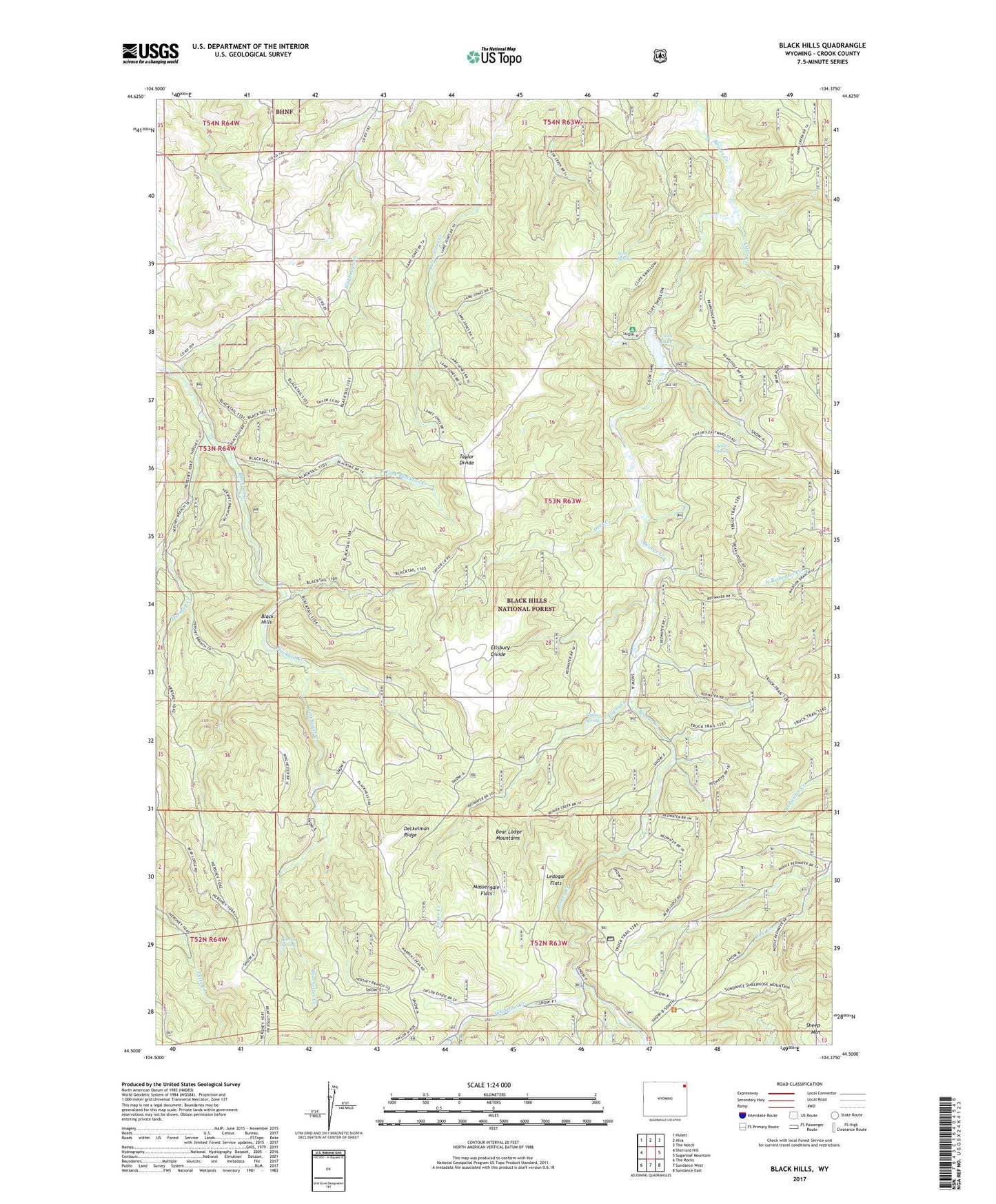
Black Hills Wyoming US Topo Map
Couldn't load pickup availability
Also explore the Black Hills Forest Service Topo of this same quad for updated USFS data
2021 topographic map quadrangle Black Hills in the state of Wyoming. Scale: 1:24000. Based on the newly updated USGS 7.5' US Topo map series, this map is in the following counties: Crook. The map contains contour data, water features, and other items you are used to seeing on USGS maps, but also has updated roads and other features. This is the next generation of topographic maps. Printed on high-quality waterproof paper with UV fade-resistant inks.
Quads adjacent to this one:
West: Sherrard Hill
Northwest: Hulett
North: Alva
Northeast: The Notch
East: Sugarloaf Mountain
Southeast: Sundance East
South: Sundance West
Southwest: The Rocks
This map covers the same area as the classic USGS quad with code o44104e4.
Contains the following named places: Black Hills, Cook Lake, Cook Lake Dam, Corral Spring, Deckelman Ridge, Deer Creek, East Fork Blacktail Creek, Ellsbury Divide, Hershey Creek, Ledogar Flats, Little Creek, Massengale Flats, Scott Spring, Selliez Spring, Sheep Mountain, Taylor Divide, Togus Creek, Togus Spring, Whitelaw Creek, Winchester Creek