MyTopo
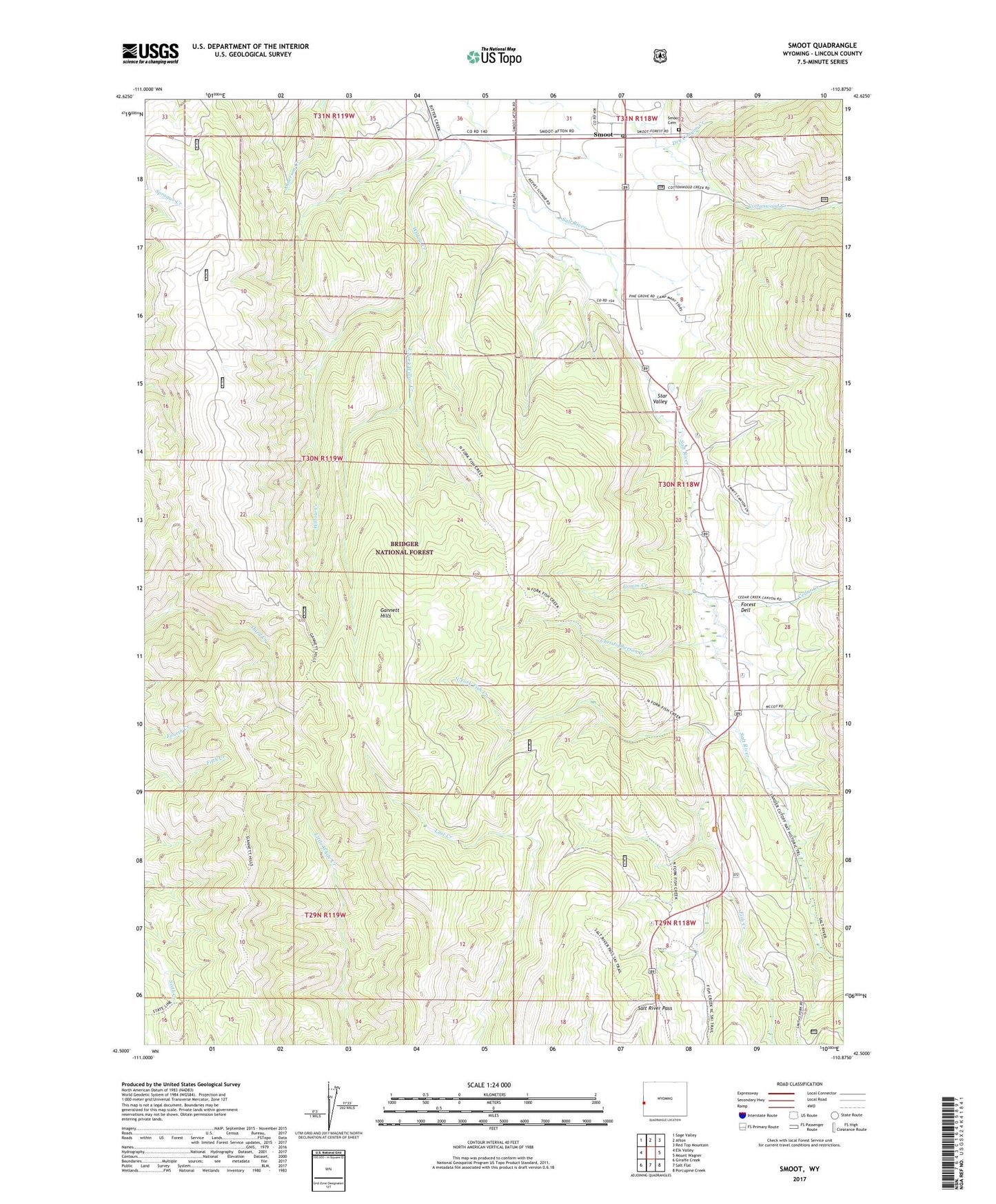
Smoot Wyoming US Topo Map
Couldn't load pickup availability
2021 topographic map quadrangle Smoot in the state of Wyoming. Scale: 1:24000. Based on the newly updated USGS 7.5' US Topo map series, this map is in the following counties: Lincoln. The map contains contour data, water features, and other items you are used to seeing on USGS maps, but also has updated roads and other features. This is the next generation of topographic maps. Printed on high-quality waterproof paper with UV fade-resistant inks.
Quads adjacent to this one:
West: Elk Valley
Northwest: Sage Valley
North: Afton
Northeast: Red Top Mountain
East: Mount Wagner
Southeast: Porcupine Creek
South: Salt Flat
Southwest: Giraffe Creek
Contains the following named places: Cedar Creek, Christopherson Creek, Dry Canyon Creek, East Fork Willow Creek, Fish Creek, Forest Dell, Gomm Creek, Johnson Ditch, KOA Campground, North Fork Fish Creek, Salt River Pass, Salt River Pass Recreation Site, Smoot, Smoot Cemetery, Smoot Census Designated Place, Smoot Post Office, Spring Creek, Willow Creek