MyTopo
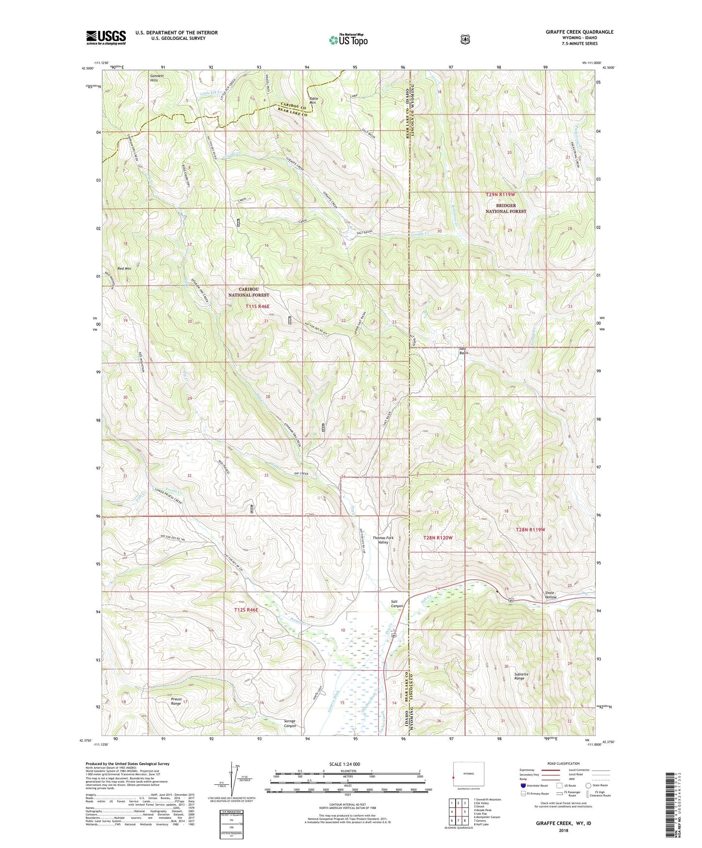
Giraffe Creek Wyoming US Topo Map
Couldn't load pickup availability
Also explore the Giraffe Creek Forest Service Topo of this same quad for updated USFS data
2021 topographic map quadrangle Giraffe Creek in the states of Idaho, Wyoming. Scale: 1:24000. Based on the newly updated USGS 7.5' US Topo map series, this map is in the following counties: Lincoln, Bear Lake, Caribou. The map contains contour data, water features, and other items you are used to seeing on USGS maps, but also has updated roads and other features. This is the next generation of topographic maps. Printed on high-quality waterproof paper with UV fade-resistant inks.
Quads adjacent to this one:
West: Meade Peak
Northwest: Snowdrift Mountain
North: Elk Valley
Northeast: Smoot
East: Salt Flat
Southeast: Huff Lake
South: Geneva
Southwest: Montpelier Canyon
This map covers the same area as the classic USGS quad with code o42111d1.
Contains the following named places: Dip Creek, Dry Creek, Fish Creek, Preuss Creek, Robinson Creek, Salt Basin, Salt Canyon, Salt Creek, Shale Hollow, Surnge Canyon, Table Mountain