MyTopo
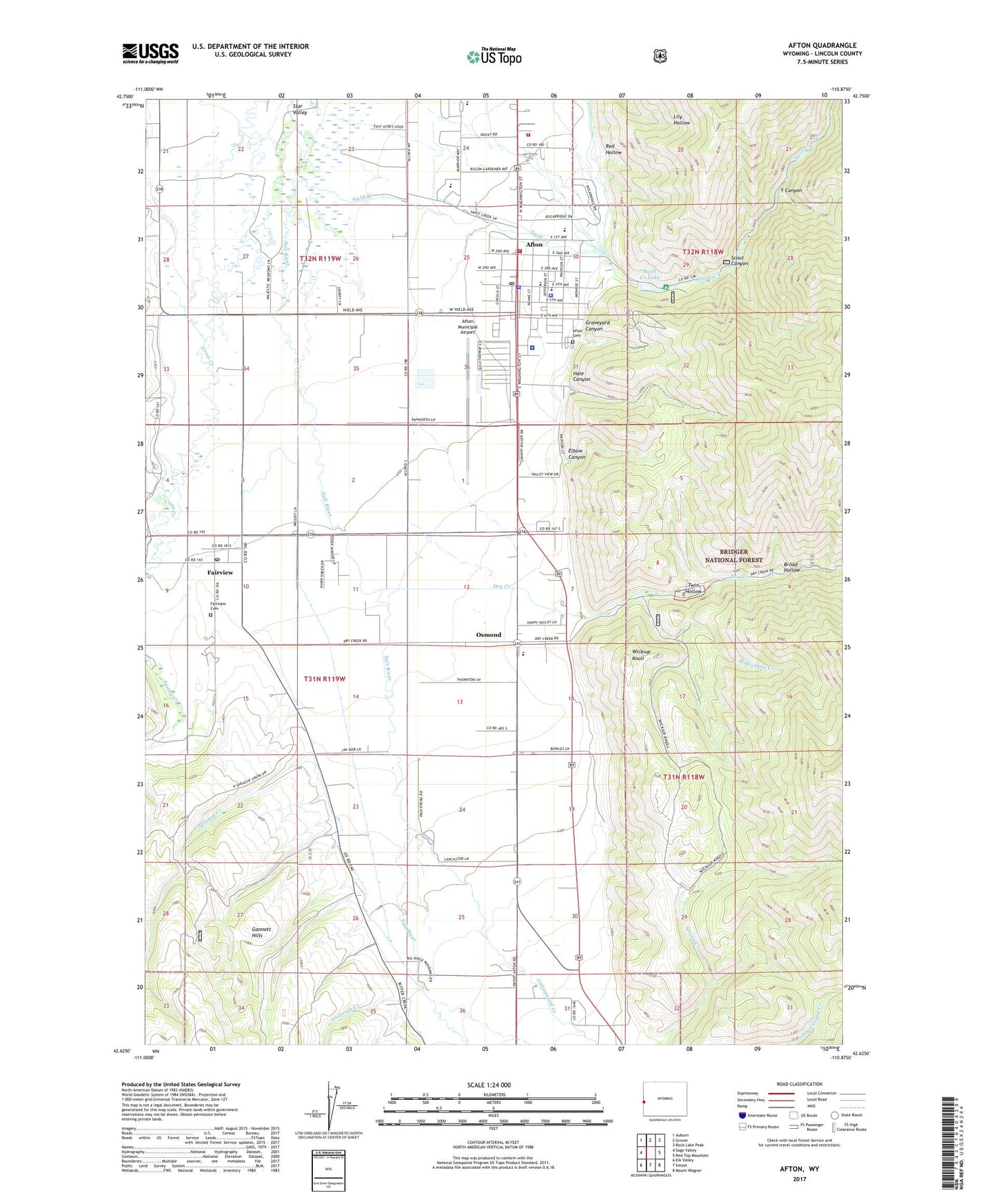
Afton Wyoming US Topo Map
Couldn't load pickup availability
Also explore the Afton Forest Service Topo of this same quad for updated USFS data
2021 topographic map quadrangle Afton in the state of Wyoming. Scale: 1:24000. Based on the newly updated USGS 7.5' US Topo map series, this map is in the following counties: Lincoln. The map contains contour data, water features, and other items you are used to seeing on USGS maps, but also has updated roads and other features. This is the next generation of topographic maps. Printed on high-quality waterproof paper with UV fade-resistant inks.
Quads adjacent to this one:
West: Sage Valley
Northwest: Auburn
North: Grover
Northeast: Rock Lake Peak
East: Red Top Mountain
Southeast: Mount Wagner
South: Smoot
Southwest: Elk Valley
This map covers the same area as the classic USGS quad with code o42110f8.
Contains the following named places: Afton, Afton Cemetery, Afton Electric Dam, Afton Elementary School, Afton Municipal Airport, Afton Post Office, Afton Rest Area, Afton Volunteer Fire Department, Anderson Creek, Bridger - Teton National Forest Greys River Ranger District Fire Engine Crew, Broad Hollow, Child Creek, Cottonwood Creek, Crow Creek, Dry Creek, Elbow Canyon, Fairview, Fairview Canal, Fairview Cemetery, Fairview Census Designated Place, Fairview Post Office, Graveyard Canyon, Greys River District Ranger Office, Hale Canyon, Harmony Creek, KRSV-AM (Afton), Landmark Star Tower, Lincoln County Fair Grounds, Mikes Hole Creek, Osmond, Osmond Census Designated Place, Osmond School, Red Hollow, Richardson Creek, Scout Canyon, Sprague Creek, Star Valley Elementary School, Star Valley High School, Star Valley Junior High School, Star Valley Latter Day Saints Hospital, Star Valley Medical Center, Star Valley Medical Center Emergency Medical Services, Swift Creek, Swift Creek Area Mine, Swift Creek Campground, Swift Creek Lake, Town of Afton, Twin Hollow, Wickiup Knoll, Y Canyon, ZIP Code: 83119