MyTopo
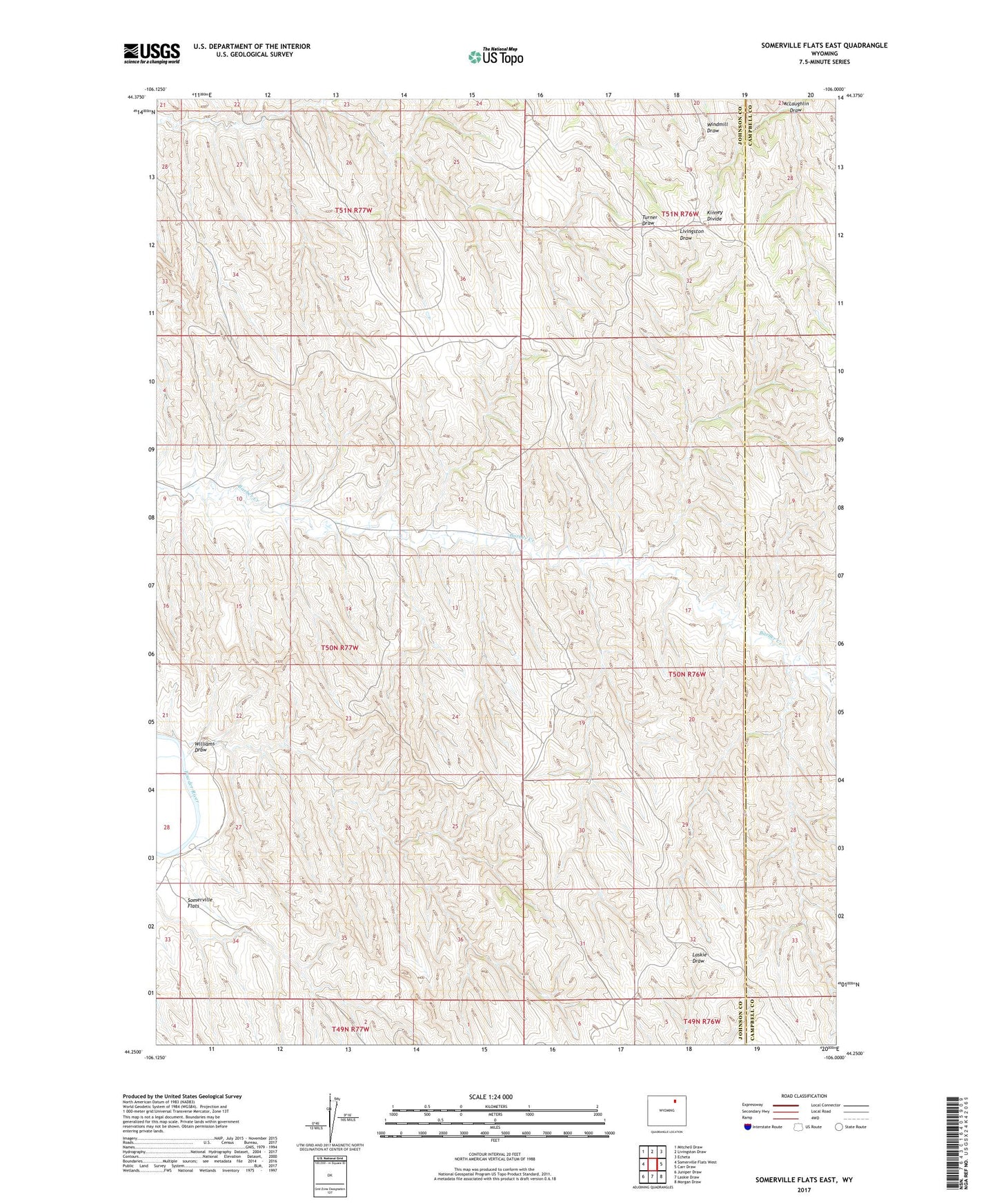
Somerville Flats East Wyoming US Topo Map
Couldn't load pickup availability
2021 topographic map quadrangle Somerville Flats East in the state of Wyoming. Scale: 1:24000. Based on the newly updated USGS 7.5' US Topo map series, this map is in the following counties: Johnson, Campbell. The map contains contour data, water features, and other items you are used to seeing on USGS maps, but also has updated roads and other features. This is the next generation of topographic maps. Printed on high-quality waterproof paper with UV fade-resistant inks.
Quads adjacent to this one:
West: Somerville Flats West
Northwest: Mitchell Draw
North: Livingston Draw
Northeast: Echeta
East: Carr Draw
Southeast: Morgan Draw
South: Laskie Draw
Southwest: Juniper Draw
This map covers the same area as the classic USGS quad with code o44106c1.
Contains the following named places: Barber Creek West Oil Field, Kinney Divide, Lula Dam, Lula Reservoir, Somerville Flats, Williams Draw