MyTopo
Marsh Draw Wyoming US Topo Map
Couldn't load pickup availability
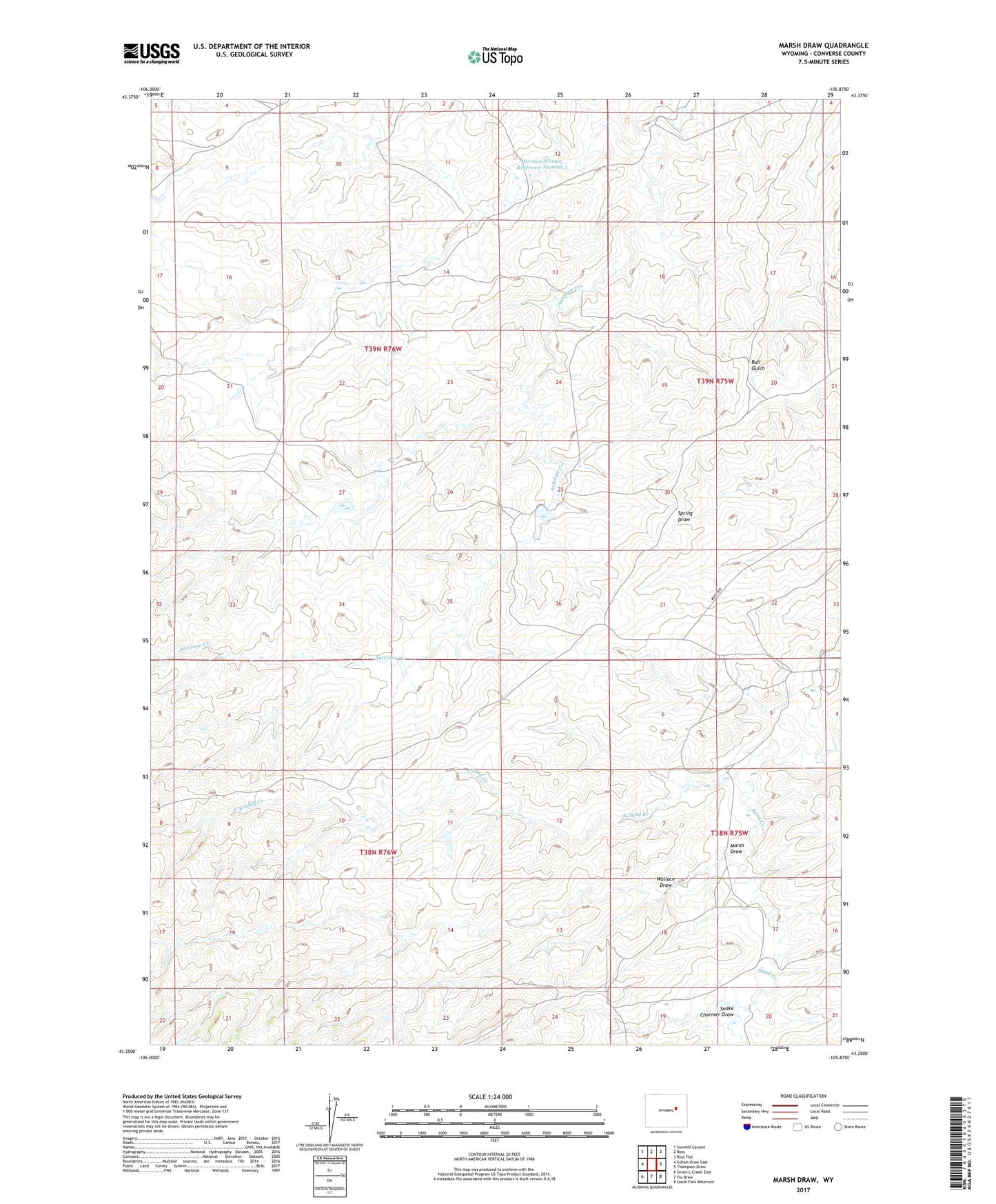
2021 topographic map quadrangle Marsh Draw in the state of Wyoming. Scale: 1:24000. Based on the newly updated USGS 7.5' US Topo map series, this map is in the following counties: Converse. The map contains contour data, water features, and other items you are used to seeing on USGS maps, but also has updated roads and other features. This is the next generation of topographic maps. Printed on high-quality waterproof paper with UV fade-resistant inks.
Quads adjacent to this one:
West: Gillam Draw East
Northwest: Sawmill Canyon
North: Ross
Northeast: Ross Flat
East: Thompson Draw
Southeast: South Fork Reservoir
South: Fly Draw
Southwest: Seven L Creek East
This map covers the same area as the classic USGS quad with code o43105c8.
Contains the following named places: Allemand Ranch, Barton Ranch, Herman Werner Number 1 Dam, Herman Werner Reservoir Number 1, Marsh Draw, North Sand Creek, Snake Charmer Draw, Wallace Draw