MyTopo
South Superior Wyoming US Topo Map
Couldn't load pickup availability
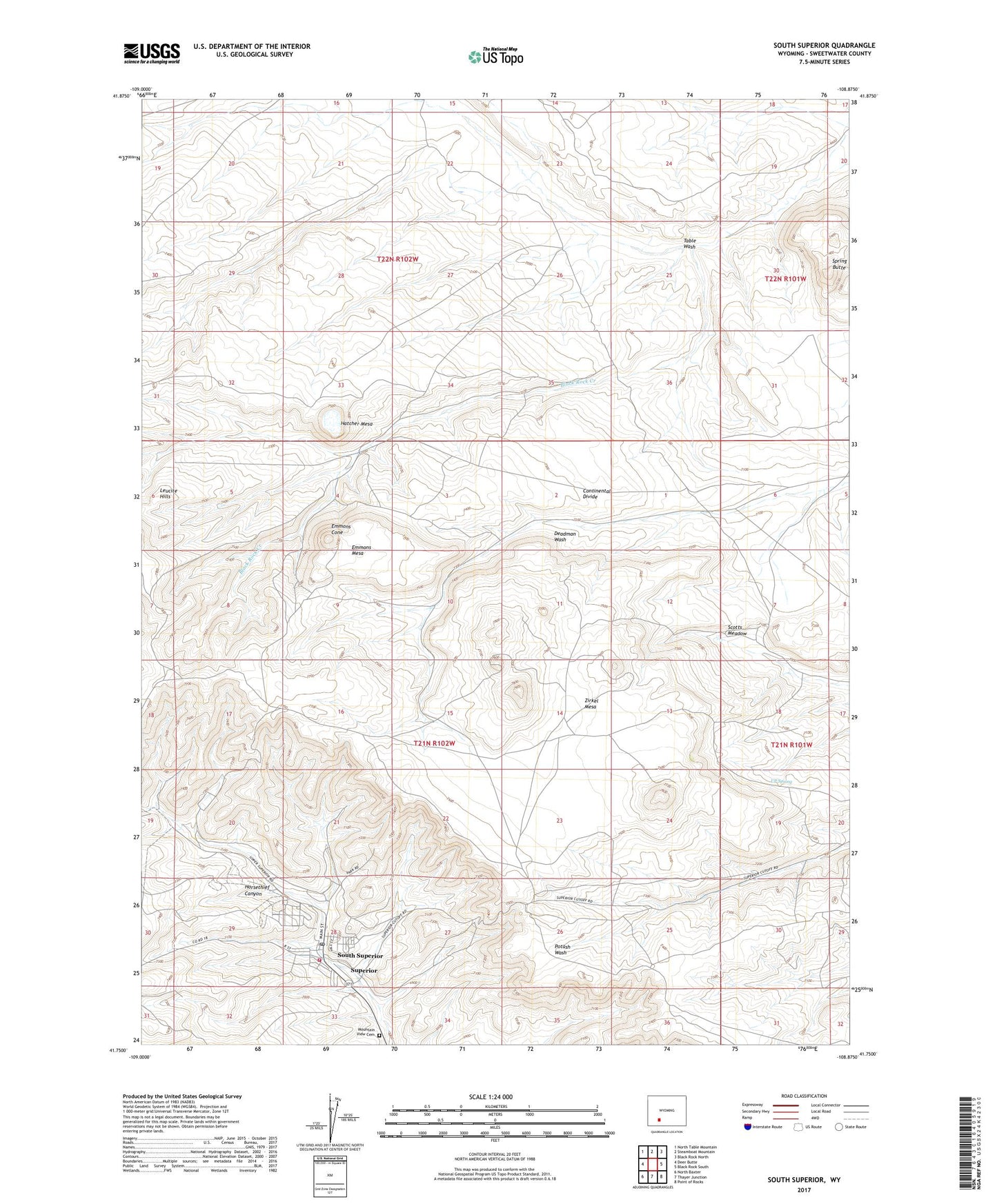
2021 topographic map quadrangle South Superior in the state of Wyoming. Scale: 1:24000. Based on the newly updated USGS 7.5' US Topo map series, this map is in the following counties: Sweetwater. The map contains contour data, water features, and other items you are used to seeing on USGS maps, but also has updated roads and other features. This is the next generation of topographic maps. Printed on high-quality waterproof paper with UV fade-resistant inks.
Quads adjacent to this one:
West: Deer Butte
Northwest: North Table Mountain
North: Steamboat Mountain
Northeast: Black Rock North
East: Black Rock South
Southeast: Point of Rocks
South: Thayer Junction
Southwest: North Baxter
This map covers the same area as the classic USGS quad with code o41108g8.
Contains the following named places: Clark Mine, Copenhagen Mine, D Mine, Emmons Cone, Emmons Mesa, G Mine, Gornik Ranch, Hatcher Mesa, Leucite Hills, Mountain View Cemetery, Premier Mine, Scotts Meadow, South Superior, Spring Butte, Superior, Superior Post Office, Superior School, Superior Volunteer Fire Department, Table Wash, The Natural Corrals, Town of Superior, UP Spring, Zirkel Mesa