MyTopo
Point of Rocks Wyoming US Topo Map
Couldn't load pickup availability
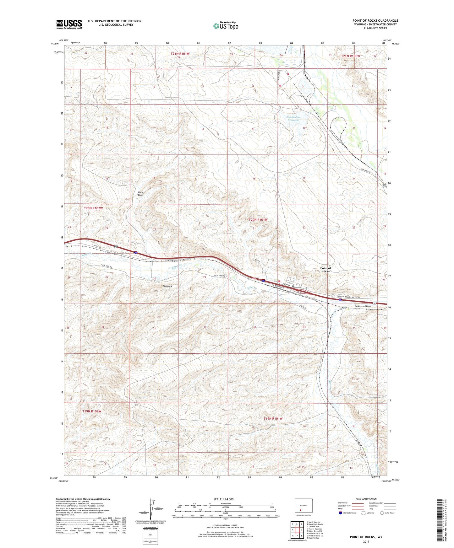
2021 topographic map quadrangle Point of Rocks in the state of Wyoming. Scale: 1:24000. Based on the newly updated USGS 7.5' US Topo map series, this map is in the following counties: Sweetwater. The map contains contour data, water features, and other items you are used to seeing on USGS maps, but also has updated roads and other features. This is the next generation of topographic maps. Printed on high-quality waterproof paper with UV fade-resistant inks.
Quads adjacent to this one:
West: Thayer Junction
Northwest: South Superior
North: Black Rock South
Northeast: Tenmile Rim
East: Bitter Creek NW
Southeast: Black Buttes
South: Point of Rocks SE
Southwest: Point of Rocks SW
This map covers the same area as the classic USGS quad with code o41108f7.
Contains the following named places: Black Butte Coal Company Fire Brigade, Bridger Coal Company Emergency Response Team, Coon Draw, Deadman Wash, Jim Bridger Mine, Jim Bridger Power Plant Fire Brigade, Jim Bridger Power Plant Surge Pond Dam, Jim Bridger Reservoir, Lecite Hills Mine, Point of Rocks, Point of Rocks Census Designated Place, Point of Rocks Mine, Point of Rocks Post Office, Point of Rocks Stagecoach Station, Shiprock, ZIP Code: 82942