MyTopo
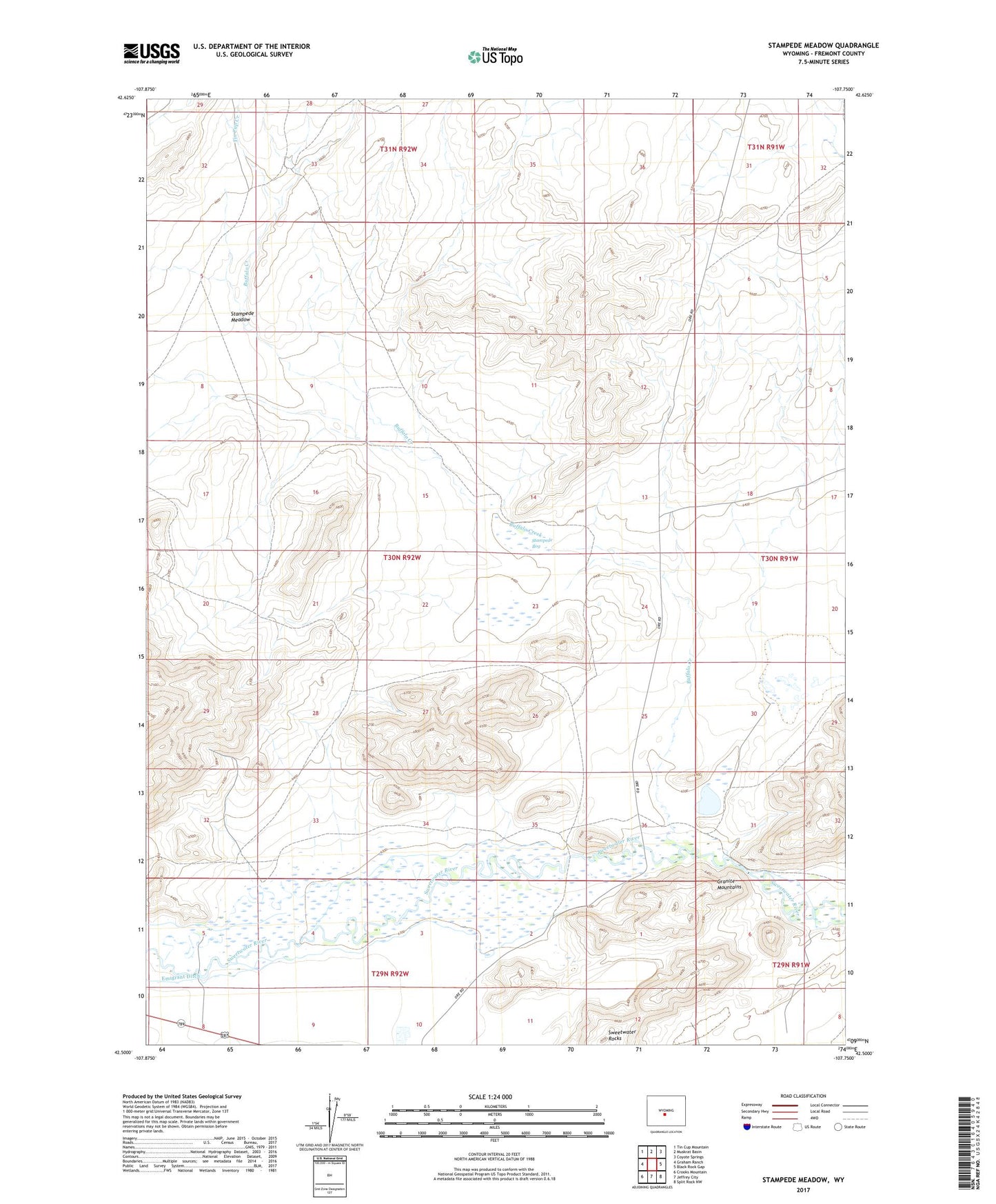
Stampede Meadow Wyoming US Topo Map
Couldn't load pickup availability
2021 topographic map quadrangle Stampede Meadow in the state of Wyoming. Scale: 1:24000. Based on the newly updated USGS 7.5' US Topo map series, this map is in the following counties: Fremont. The map contains contour data, water features, and other items you are used to seeing on USGS maps, but also has updated roads and other features. This is the next generation of topographic maps. Printed on high-quality waterproof paper with UV fade-resistant inks.
Quads adjacent to this one:
West: Graham Ranch
Northwest: Tin Cup Mountain
North: Muskrat Basin
Northeast: Coyote Springs
East: Black Rock Gap
Southeast: Split Rock NW
South: Jeffrey City
Southwest: Crooks Mountain
Contains the following named places: Buffalo Creek, Claytor Ranch, Claytor School, Crooks Gap Mine, Emigrant Ditch, King Solomon Claim, Lucky Strike Claim, McIntosh Ranch, Oregon Trail, Stampede Bog, Stampede Meadow, Tin Cup Creek