MyTopo
Tin Cup Mountain Wyoming US Topo Map
Couldn't load pickup availability
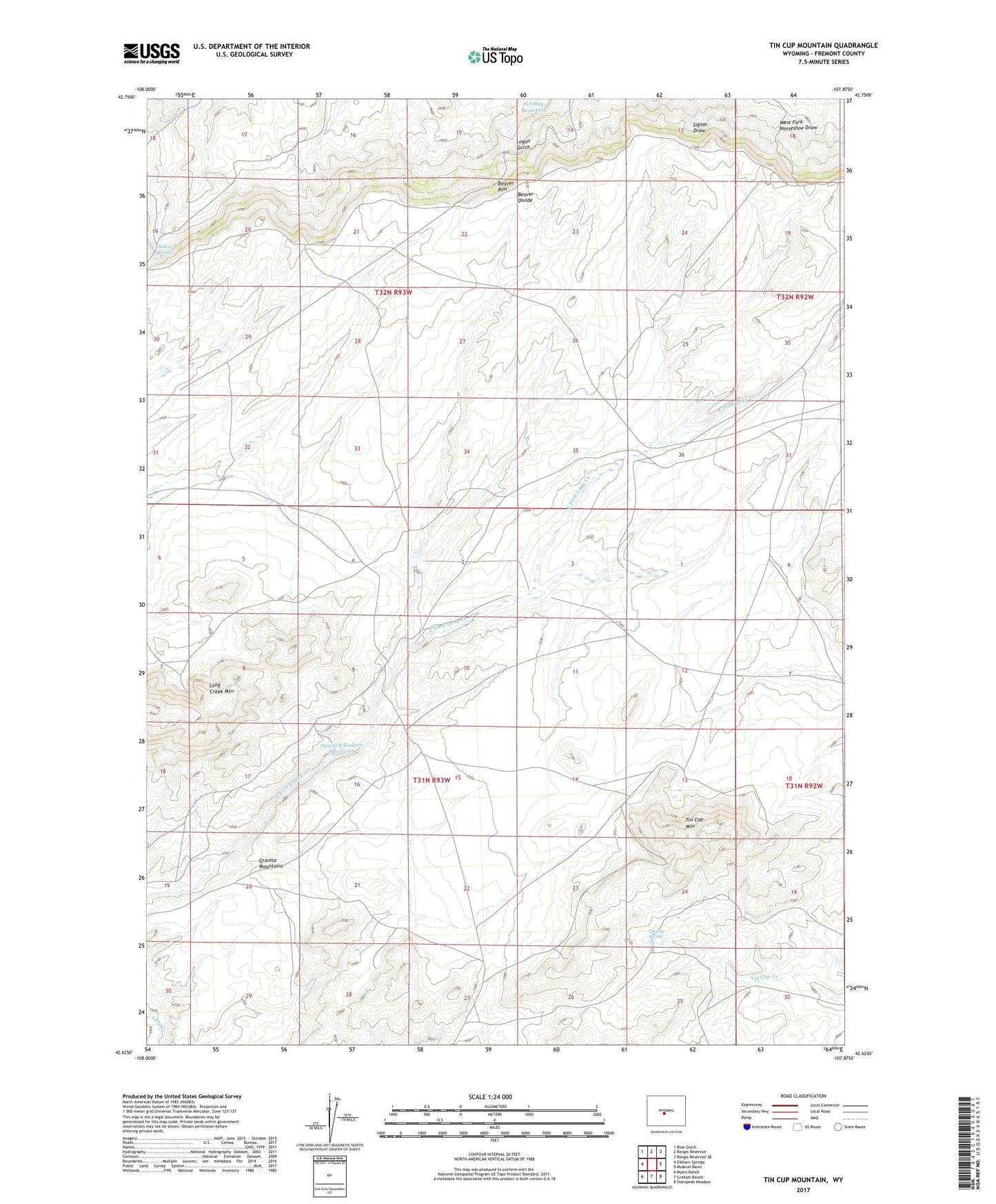
2021 topographic map quadrangle Tin Cup Mountain in the state of Wyoming. Scale: 1:24000. Based on the newly updated USGS 7.5' US Topo map series, this map is in the following counties: Fremont. The map contains contour data, water features, and other items you are used to seeing on USGS maps, but also has updated roads and other features. This is the next generation of topographic maps. Printed on high-quality waterproof paper with UV fade-resistant inks.
Quads adjacent to this one:
West: Elkhorn Springs
Northwest: Blue Gulch
North: Rongis Reservoir
Northeast: Rongis Reservoir SE
East: Muskrat Basin
Southeast: Stampede Meadow
South: Graham Ranch
Southwest: Myers Ranch
This map covers the same area as the classic USGS quad with code o42107f8.
Contains the following named places: Anderson Mine, Beaver Divide, Beaver Rim, Daniel F Hudson Dam, Daniel F Hudson Reservoir, Findlay Reservoir, Findlay Springs, Findlay Springs Mine, Givens Homestead, Hades Number Seventeen Mine, Jeffrey City Division, Long Creek Mountain, Long Creek Ranch, Tin Cup Mine, Tin Cup Mountain, Tin Cup Spring