MyTopo
Stevens Flat Wyoming US Topo Map
Couldn't load pickup availability
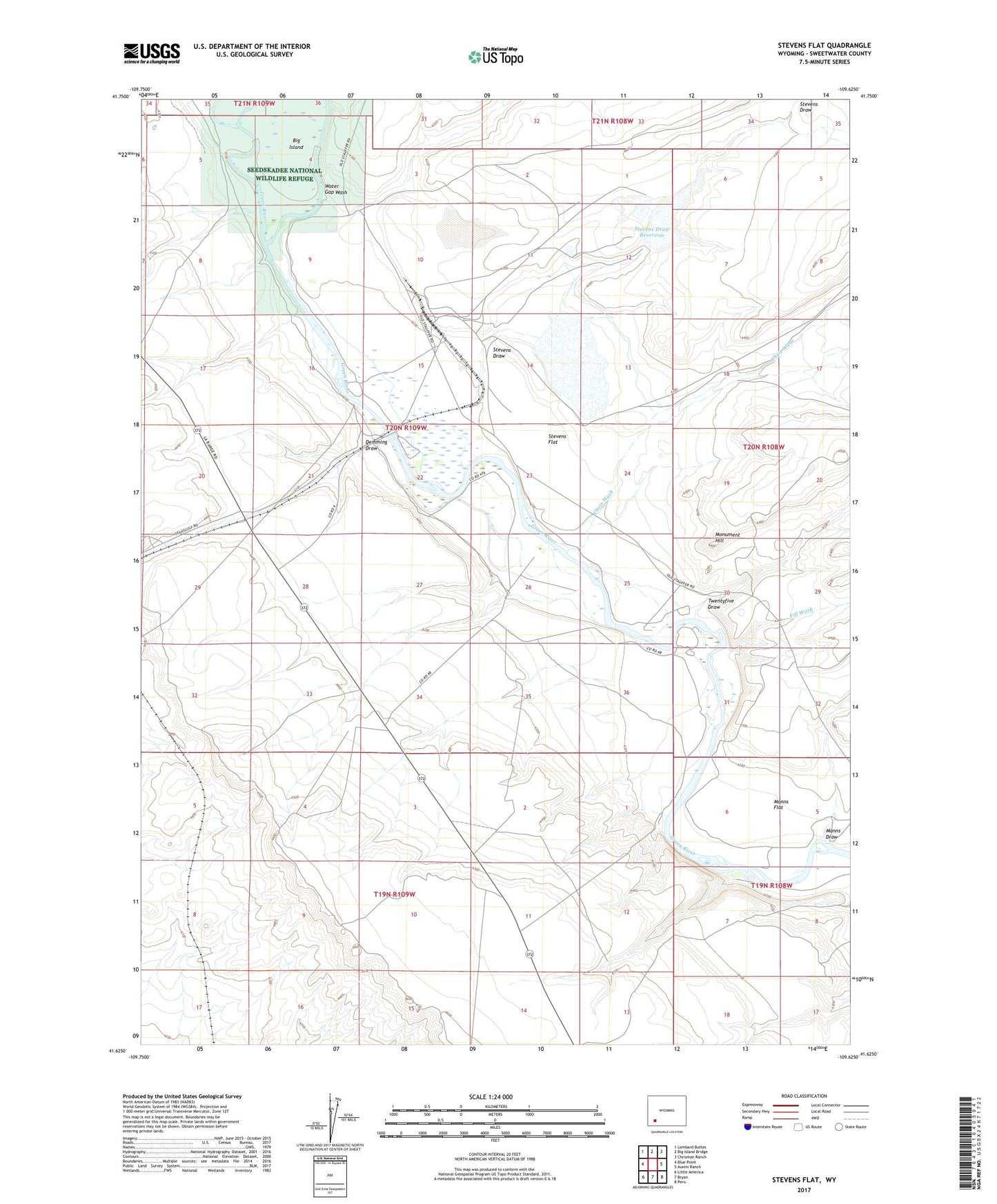
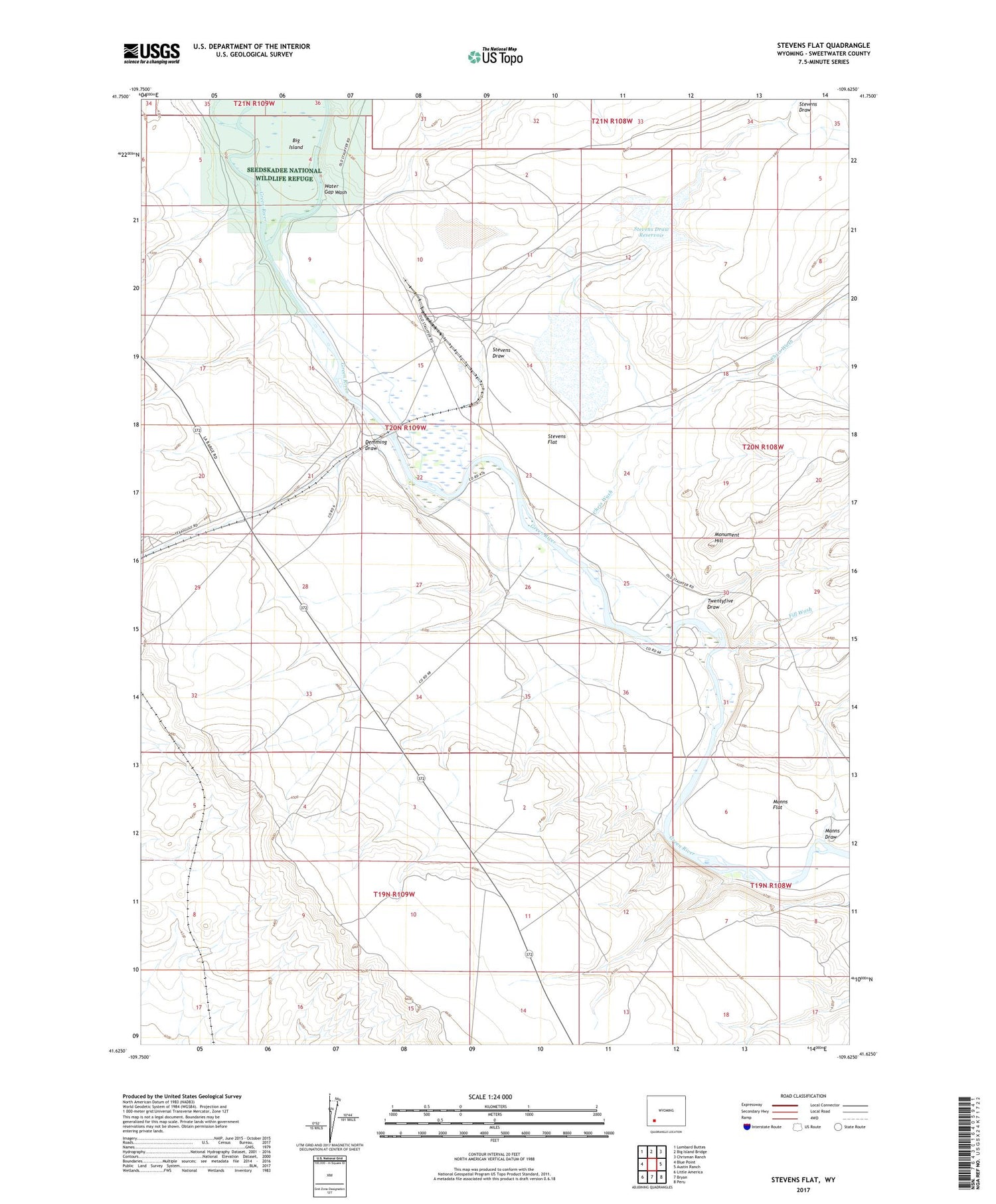
2021 topographic map quadrangle Stevens Flat in the state of Wyoming. Scale: 1:24000. Based on the newly updated USGS 7.5' US Topo map series, this map is in the following counties: Sweetwater. The map contains contour data, water features, and other items you are used to seeing on USGS maps, but also has updated roads and other features. This is the next generation of topographic maps. Printed on high-quality waterproof paper with UV fade-resistant inks.
Quads adjacent to this one:
West: Blue Point
Northwest: Lombard Buttes
North: Big Island Bridge
Northeast: Chrisman Ranch
East: Austin Ranch
Southeast: Peru
South: Bryan
Southwest: Little America
Contains the following named places: Big Island Mine, Chris Wash, Demming Draw, Fill Wash, Hofeldt Ranch, Manns Draw, Manns Flat, Monument Hill, Pal Ranch, Stauffer Trona Mine, Stevens Draw, Stevens Draw Dam, Stevens Draw Reservoir, Stevens Flat, Twentyfive Draw, Water Gap Wash, ZIP Code: 82935