MyTopo
Sublet Wyoming US Topo Map
Couldn't load pickup availability
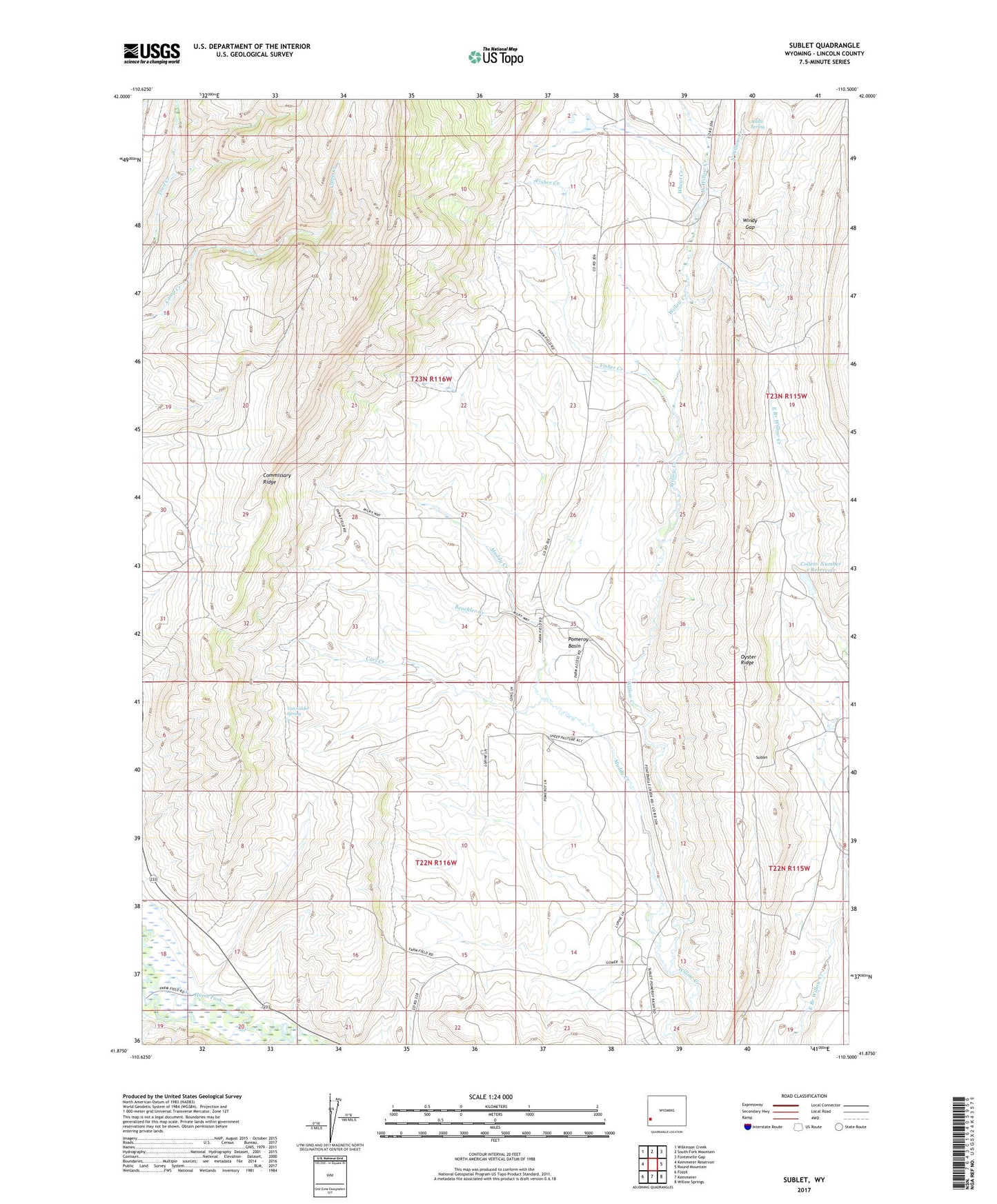
2021 topographic map quadrangle Sublet in the state of Wyoming. Scale: 1:24000. Based on the newly updated USGS 7.5' US Topo map series, this map is in the following counties: Lincoln. The map contains contour data, water features, and other items you are used to seeing on USGS maps, but also has updated roads and other features. This is the next generation of topographic maps. Printed on high-quality waterproof paper with UV fade-resistant inks.
Quads adjacent to this one:
West: Kemmerer Reservoir
Northwest: Wilkinson Creek
North: South Fork Mountain
Northeast: Fontenelle Gap
East: Round Mountain
Southeast: Willow Springs
South: Kemmerer
Southwest: Fossil
This map covers the same area as the classic USGS quad with code o41110h5.
Contains the following named places: Alkali Spring, Beachler Creek, Carl Creek, Colletti Number 2 Dam, Colletti Number 2 Reservoir, Fisher Creek, Kemmerer Number 5 Mine, Muddy Creek, North Willow Creek, Pomeroy Basin, Top of the World Mine, Van Gilder Spring, West Willow Creek, Wheat Creek, Willey Number 1 Dam, Willey Number 1 Reservoir, Windy Gap, ZIP Code: 83101