MyTopo
Kemmerer Reservoir Wyoming US Topo Map
Couldn't load pickup availability
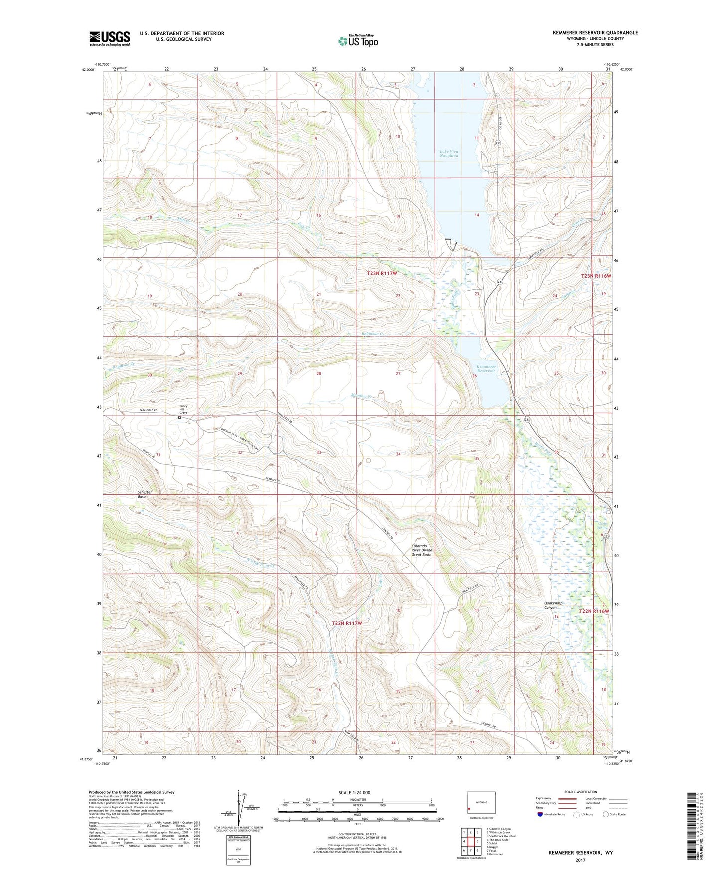
2021 topographic map quadrangle Kemmerer Reservoir in the state of Wyoming. Scale: 1:24000. Based on the newly updated USGS 7.5' US Topo map series, this map is in the following counties: Lincoln. The map contains contour data, water features, and other items you are used to seeing on USGS maps, but also has updated roads and other features. This is the next generation of topographic maps. Printed on high-quality waterproof paper with UV fade-resistant inks.
Quads adjacent to this one:
West: The Rock Slide
Northwest: Sublette Canyon
North: Wilkinson Creek
Northeast: South Fork Mountain
East: Sublet
Southeast: Kemmerer
South: Fossil
Southwest: Nugget
This map covers the same area as the classic USGS quad with code o41110h6.
Contains the following named places: Camp Creek, Curtis Spring, Dempsey Creek, Fish Creek, Hams Fork Plateau, Kemmer Number 1 Reservoir, Kemmerer Number 1 Dam, Kemmerer Reservoir, Lake Creek, Lake Viva Naughton, Lake Viva Naughton Dam, Meadow Creek, Nancy Hill Grave, Quakenasp Canyon, Robinson Creek, Schuster Basin, Trail Creek, Utah Power and Light Company Hams Fork Reservoir