MyTopo
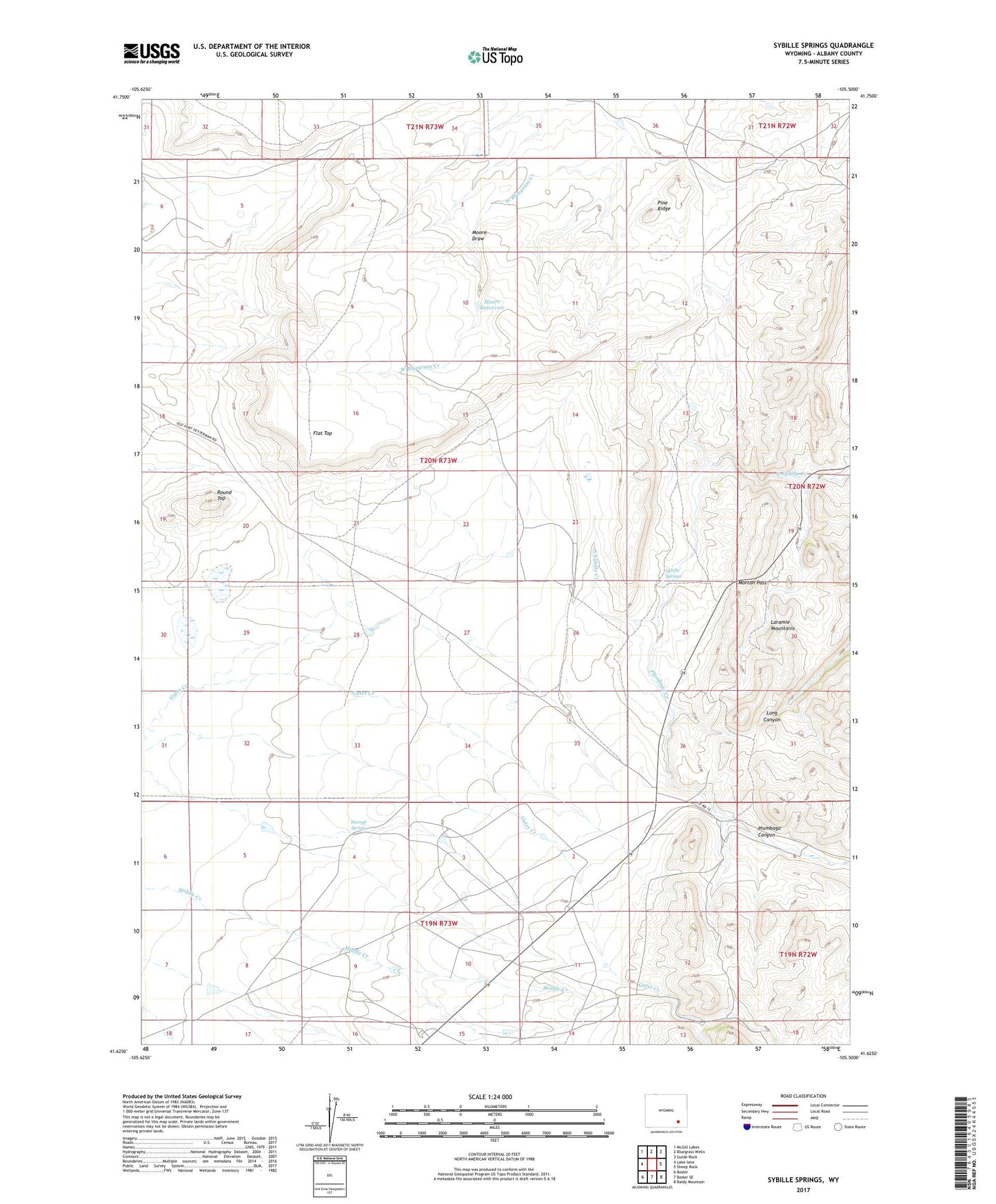
Sybille Springs Wyoming US Topo Map
Couldn't load pickup availability
2021 topographic map quadrangle Sybille Springs in the state of Wyoming. Scale: 1:24000. Based on the newly updated USGS 7.5' US Topo map series, this map is in the following counties: Albany. The map contains contour data, water features, and other items you are used to seeing on USGS maps, but also has updated roads and other features. This is the next generation of topographic maps. Printed on high-quality waterproof paper with UV fade-resistant inks.
Quads adjacent to this one:
West: Lake Ione
Northwest: McGill Lakes
North: Bluegrass Wells
Northeast: Guide Rock
East: Sheep Rock
Southeast: Baldy Mountain
South: Bosler SE
Southwest: Bosler
Contains the following named places: Farley Ranch, Flat Top, Moore Draw, Moore Reservoir, Morton Pass, Pine Ridge, Plumbago Canyon, Plumbago Canyon Mine, Plumbago Creek, Round Top, Stumpf Spring, Sybille Springs, Woods Mine