MyTopo
The Hogsback Wyoming US Topo Map
Couldn't load pickup availability
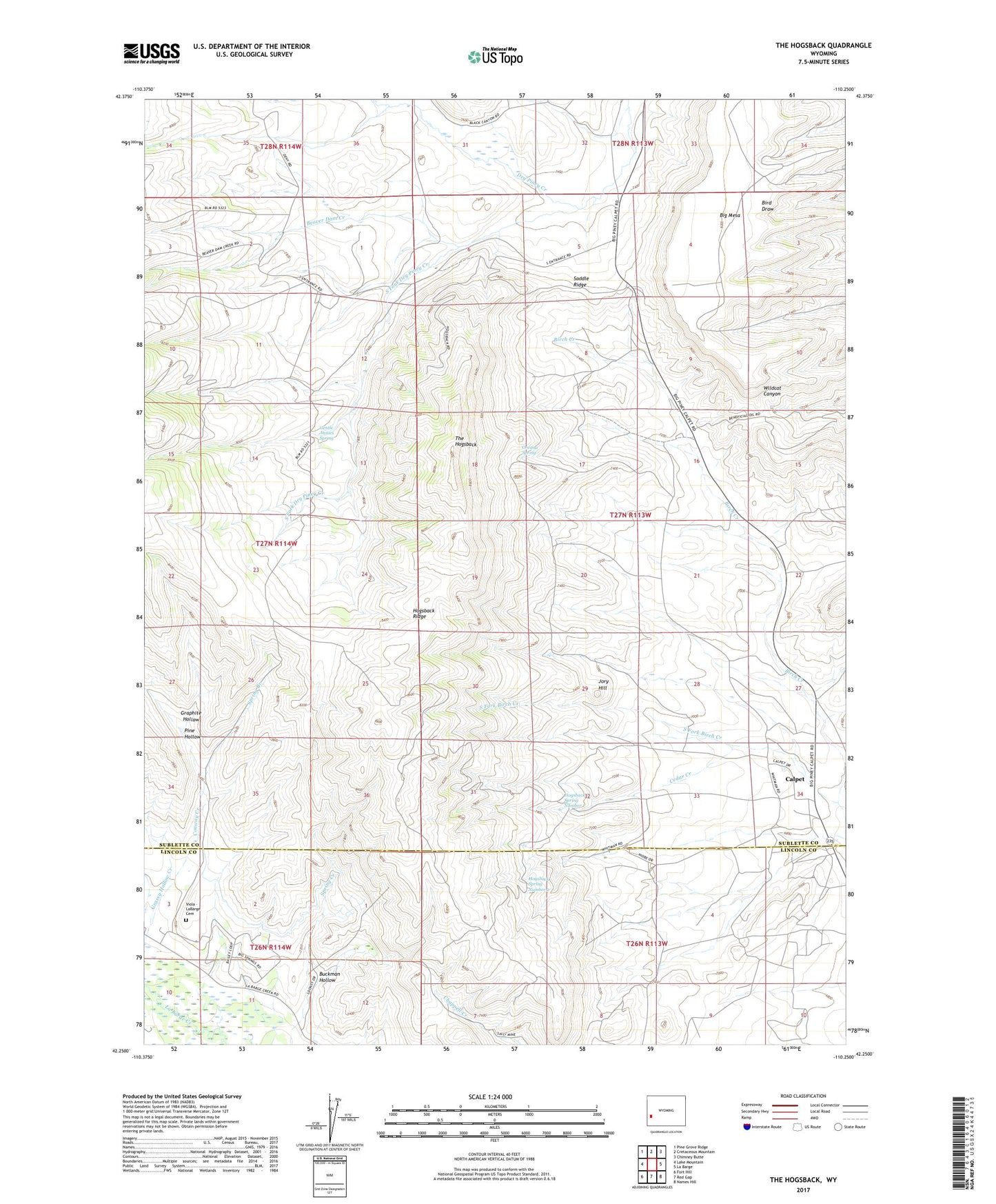
2021 topographic map quadrangle The Hogsback in the state of Wyoming. Scale: 1:24000. Based on the newly updated USGS 7.5' US Topo map series, this map is in the following counties: Sublette, Lincoln. The map contains contour data, water features, and other items you are used to seeing on USGS maps, but also has updated roads and other features. This is the next generation of topographic maps. Printed on high-quality waterproof paper with UV fade-resistant inks.
Quads adjacent to this one:
West: Lake Mountain
Northwest: Pine Grove Ridge
North: Cretaceous Mountain
Northeast: Chimney Butte
East: La Barge
Southeast: Names Hill
South: Red Gap
Southwest: Fort Hill
Contains the following named places: Beaver Dam Creek, Big Mesa, Buckman Hollow, Calpet, Calpet Census Designated Place, Cedar Creek, Conway Creek, Dry Piney Camp, Gentle Annies Spring, Graphite Hollow, Grassy Hollow Creek, Guyette Ditch Number 1, Hogsback Ridge, Hogsback Spring Number 1, Hogsback Spring Number 2, Jory Hill, La Barge Gas and Oil Field, North La Barge Gas and Oil Field, Oreana Spring, Pine Hollow, Rainbow Camp, Saddle Ridge, Sayley Mine, South Fork Birch Creek, South Fork Dry Piney Creek, Spring Branch, The Hogsback, Viola - LaBarge Cemetery, Viola Area Mine, Western Camp