MyTopo
The Rock Slide Wyoming US Topo Map
Couldn't load pickup availability
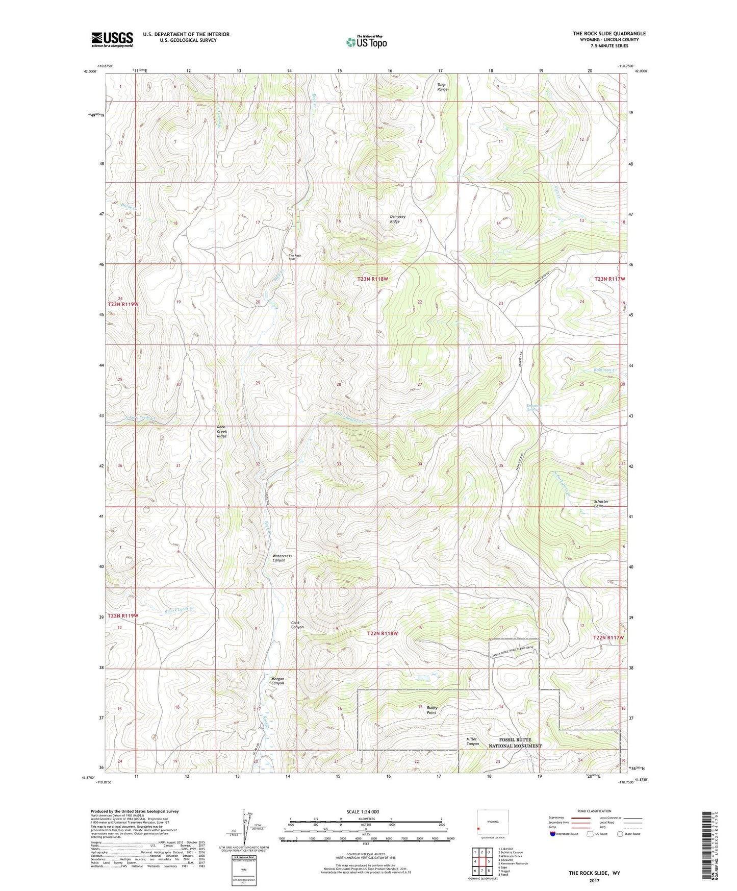
2021 topographic map quadrangle The Rock Slide in the state of Wyoming. Scale: 1:24000. Based on the newly updated USGS 7.5' US Topo map series, this map is in the following counties: Lincoln. The map contains contour data, water features, and other items you are used to seeing on USGS maps, but also has updated roads and other features. This is the next generation of topographic maps. Printed on high-quality waterproof paper with UV fade-resistant inks.
Quads adjacent to this one:
West: Beckwith
Northwest: Cokeville
North: Sublette Canyon
Northeast: Wilkinson Creek
East: Kemmerer Reservoir
Southeast: Fossil
South: Nugget
Southwest: Sage
Contains the following named places: Cook Canyon, Dempsey Ridge, Emigrant Spring, Little Beaver Creek, Morgan Canyon, Rock Creek Ridge, Rubey Point, The Rock Slide, Watercress Canyon