MyTopo
Sublette Canyon Wyoming US Topo Map
Couldn't load pickup availability
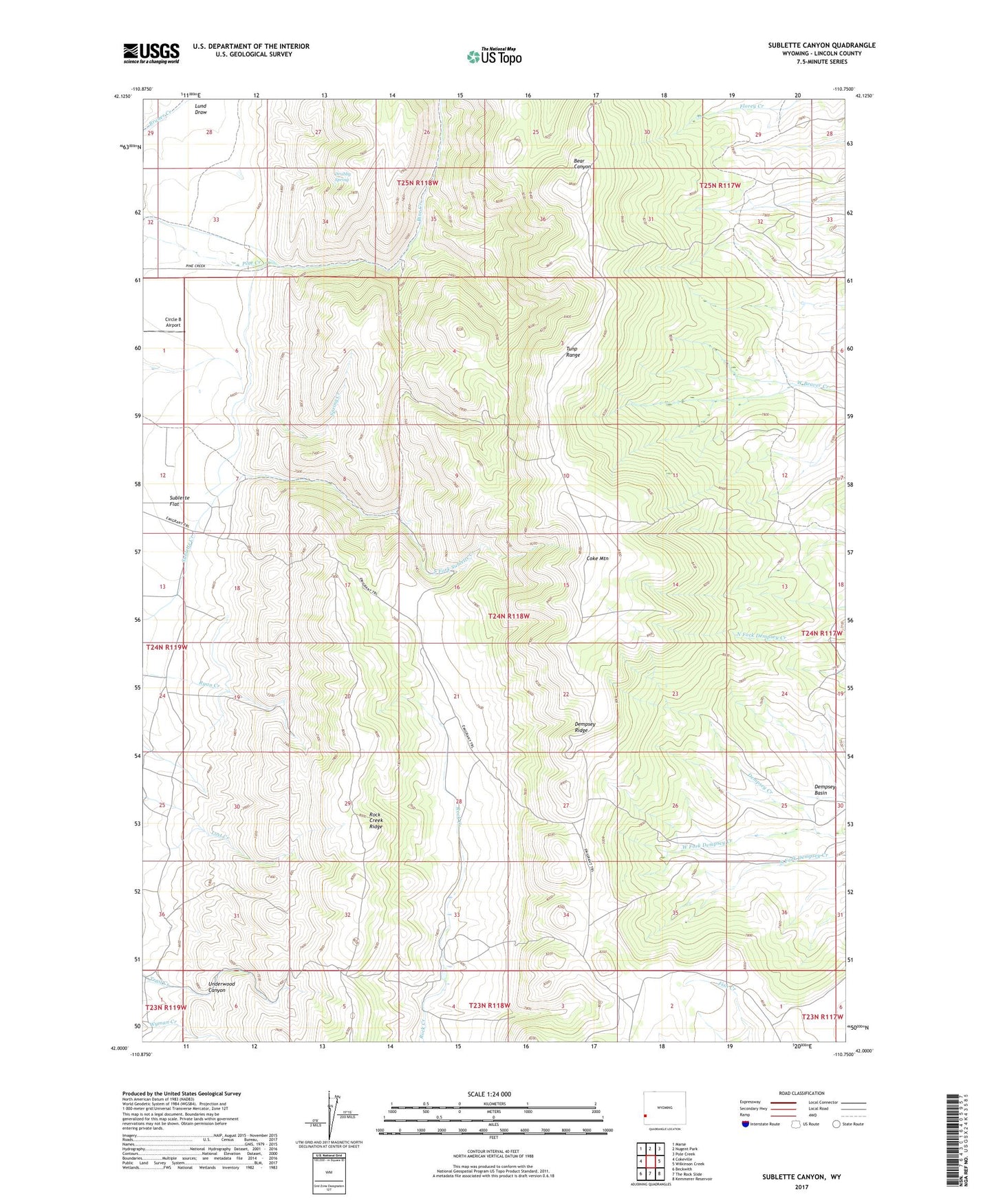
2021 topographic map quadrangle Sublette Canyon in the state of Wyoming. Scale: 1:24000. Based on the newly updated USGS 7.5' US Topo map series, this map is in the following counties: Lincoln. The map contains contour data, water features, and other items you are used to seeing on USGS maps, but also has updated roads and other features. This is the next generation of topographic maps. Printed on high-quality waterproof paper with UV fade-resistant inks.
Quads adjacent to this one:
West: Cokeville
Northwest: Marse
North: Nugent Park
Northeast: Pole Creek
East: Wilkinson Creek
Southeast: Kemmerer Reservoir
South: The Rock Slide
Southwest: Beckwith
This map covers the same area as the classic USGS quad with code o42110a7.
Contains the following named places: Circle B Airport, Coke Mountain, Drubby Spring, Kemmerer West Division, Lund Draw, South Fork Sublette Creek, Tunp Range, Tunp Range Number Three Mine, Underwood Canyon, West Fork Dempsey Creek