
MyTopo
Thermopolis Wyoming US Topo Map
Couldn't load pickup availability
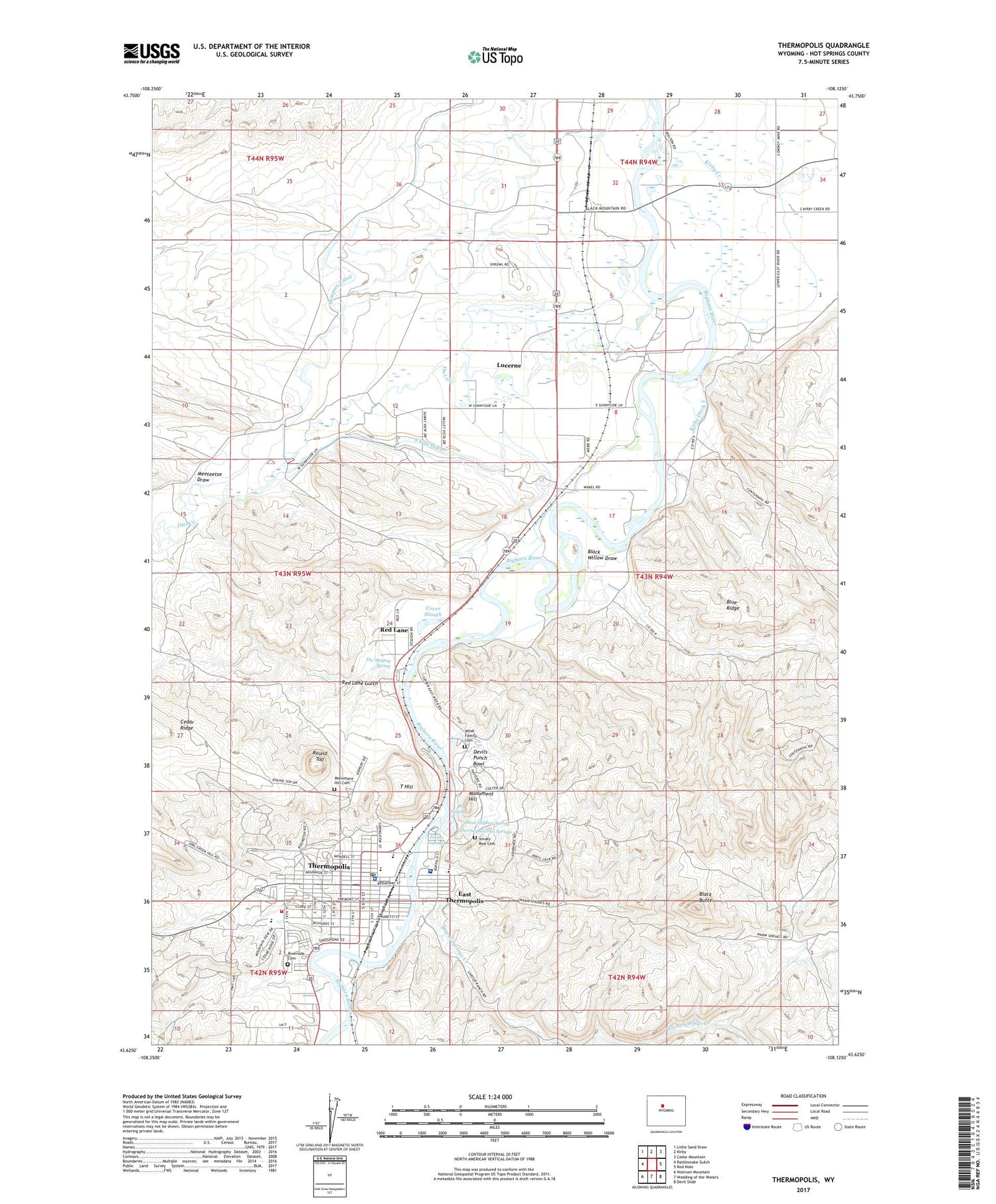
2021 topographic map quadrangle Thermopolis in the state of Wyoming. Scale: 1:24000. Based on the newly updated USGS 7.5' US Topo map series, this map is in the following counties: Hot Springs. The map contains contour data, water features, and other items you are used to seeing on USGS maps, but also has updated roads and other features. This is the next generation of topographic maps. Printed on high-quality waterproof paper with UV fade-resistant inks.
Quads adjacent to this one:
West: Rattlesnake Gulch
Northwest: Little Sand Draw
North: Kirby
Northeast: Cedar Mountain
East: Red Hole
Southeast: Devil Slide
South: Wedding of the Waters
Southwest: Nostrum Mountain
Contains the following named places: Andreen Pit, Big Spring, Black Butte, Black Sulphur Spring, Black Willow Draw, Blue Ridge, Canyon Hills Manor Hospital, Cover Slough, Dempsey Canal, Devils Punch Bowl, East Thermopolis, Harvey Pit, Hill School, Hot Springs County High School, Hot Springs County Memorial Hospital, Hot Springs County-Thermopolis Municipal Airport, Hot Springs State Park, Kirby Creek, Kirby Ditch, KTHE-AM (Thermopolis), Lucerne, Lucerne Census Designated Place, Lucerne Mine, Lucerne School, Meeteetse Draw, Milek Family Cemetery, Monument Hill, Monument Hill Cemetery, Mortimore's Ambulance Service, N-vam Mine, Owl Creek, Park Pit, Pioneer Home, Rainbow Terraces, Ralph Witters Elementary School, Red Lane, Red Lane Gulch, Riverside Cemetery, Round Top, Scotch Plunge, Shafer Pit, Smoky Row Cemetery, South Fork Warm Springs Creek, South Side Ditch, T Hill, Teepee Fountain, The Maytag Spring, Thermopolis, Thermopolis Hot Springs, Thermopolis Middle School, Thermopolis Police Department, Thermopolis Post Office, Thermopolis Volunteer Fire Department, Town of East Thermopolis, Town of Thermopolis, Warm Springs Creek


