MyTopo
Tower Junction Wyoming US Topo Map
Couldn't load pickup availability
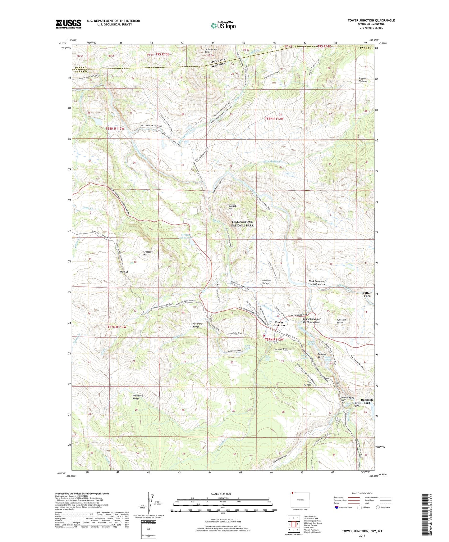
2021 topographic map quadrangle Tower Junction in the states of Wyoming, Montana. Scale: 1:24000. Based on the newly updated USGS 7.5' US Topo map series, this map is in the following counties: Park. The map contains contour data, water features, and other items you are used to seeing on USGS maps, but also has updated roads and other features. This is the next generation of topographic maps. Printed on high-quality waterproof paper with UV fade-resistant inks.
Quads adjacent to this one:
West: Blacktail Deer Creek
Northwest: Ash Mountain
North: Specimen Creek
Northeast: Hummingbird Peak
East: Lamar Canyon
Southeast: Amethyst Mountain
South: Mount Washburn
Southwest: Cook Peak
Contains the following named places: Antelope Creek, Bannock Ford, Barronette Bridge, Buffalo Ford, Buffalo Plateau Trail, Bump-Sullivan Reservoir, Bumpus Butte, Calcite Springs, Coyote Creek, Coyote Creek Trail, Crescent Hill, Devils Den, Elk Creek, Floating Island Lake, Garnet Hill, Geode Creek, Grand Canyon of the Yellowstone, Hellroaring Creek, Hellroaring Ranger Station, Junction Butte, Lamar River, Little Buffalo Creek, Little Cottonwood Creek, Lost Creek, Lost Creek Falls, Lost Lake, Nymph Spring, Overhanging Cliff, Pleasant Valley, Rainy Lake, Roosevelt Lodge, The Cut, The Narrows, The Needle, Tower Creek, Tower Fall, Tower Fall Campground, Tower Junction, Tower Ranger Station, Yanceys, Yancy Creek, Yellowstone National Park Fire Department Tower Junction Station, Yellowstone River Trail