MyTopo
Lamar Canyon Wyoming US Topo Map
Couldn't load pickup availability
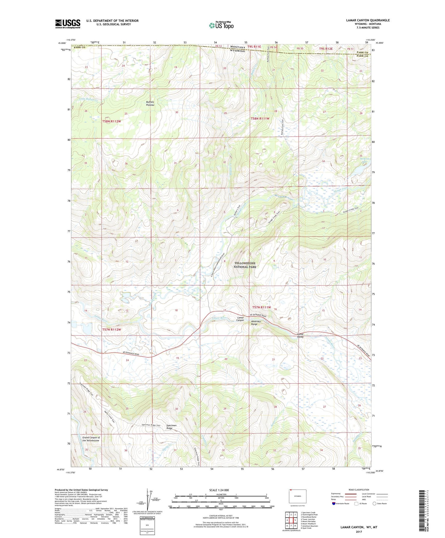
2021 topographic map quadrangle Lamar Canyon in the state of Wyoming. Scale: 1:24000. Based on the newly updated USGS 7.5' US Topo map series, this map is in the following counties: Park. The map contains contour data, water features, and other items you are used to seeing on USGS maps, but also has updated roads and other features. This is the next generation of topographic maps. Printed on high-quality waterproof paper with UV fade-resistant inks.
Quads adjacent to this one:
West: Tower Junction
Northwest: Specimen Creek
North: Hummingbird Peak
Northeast: Roundhead Butte
East: Mount Hornaday
Southeast: Opal Creek
South: Amethyst Mountain
Southwest: Mount Washburn
This map covers the same area as the classic USGS quad with code o44110h3.
Contains the following named places: Buffalo Creek, Buffalo Plateau Trail, Crystal Creek, Jasper Creek, Lamar Canyon, Lamar Valley, McBride Lake, Slough Creek, Slough Creek Patrol Cabins