MyTopo
Verne Wyoming US Topo Map
Couldn't load pickup availability
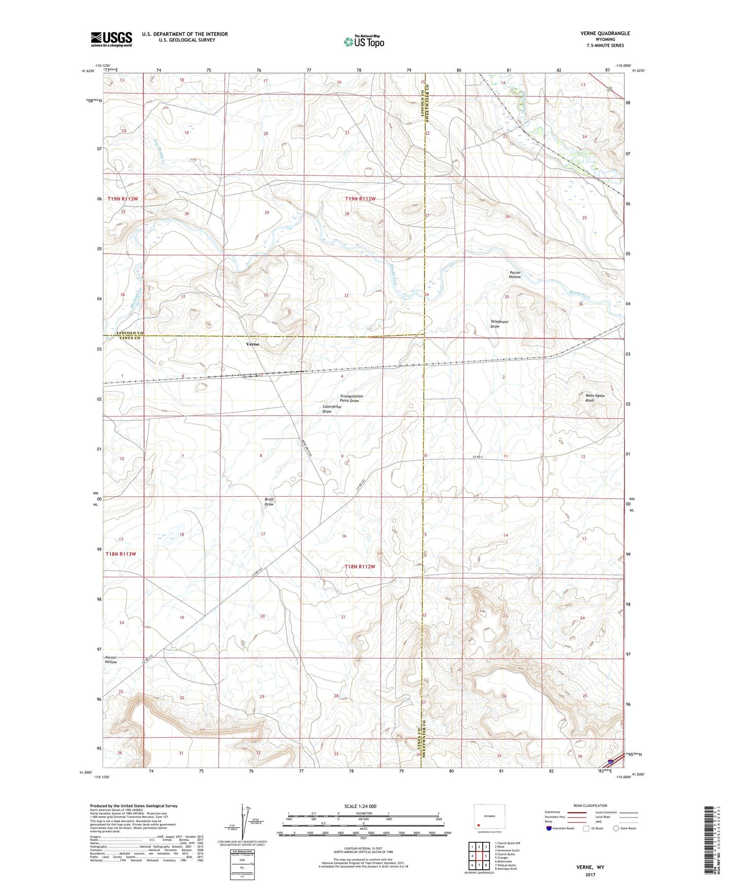
2021 topographic map quadrangle Verne in the state of Wyoming. Scale: 1:24000. Based on the newly updated USGS 7.5' US Topo map series, this map is in the following counties: Sweetwater, Uinta, Lincoln. The map contains contour data, water features, and other items you are used to seeing on USGS maps, but also has updated roads and other features. This is the next generation of topographic maps. Printed on high-quality waterproof paper with UV fade-resistant inks.
Quads adjacent to this one:
West: Church Butte
Northwest: Church Butte NW
North: Moxa
Northeast: Sevenmile Gulch
East: Granger
Southeast: Antelope Knoll
South: Wildcat Butte
Southwest: Millersville
Contains the following named places: Bruff Draw, Caterpillar Draw, Diamond Alkali Company Number One Mine, Dry Muddy Creek, Moore and Bagley Ditch, Moss Agate Knoll, Porter Hollow, Rocky Crossing, Telephone Draw, Triangulation Point Draw, Verne, ZIP Code: 82934