MyTopo
Granger Wyoming US Topo Map
Couldn't load pickup availability
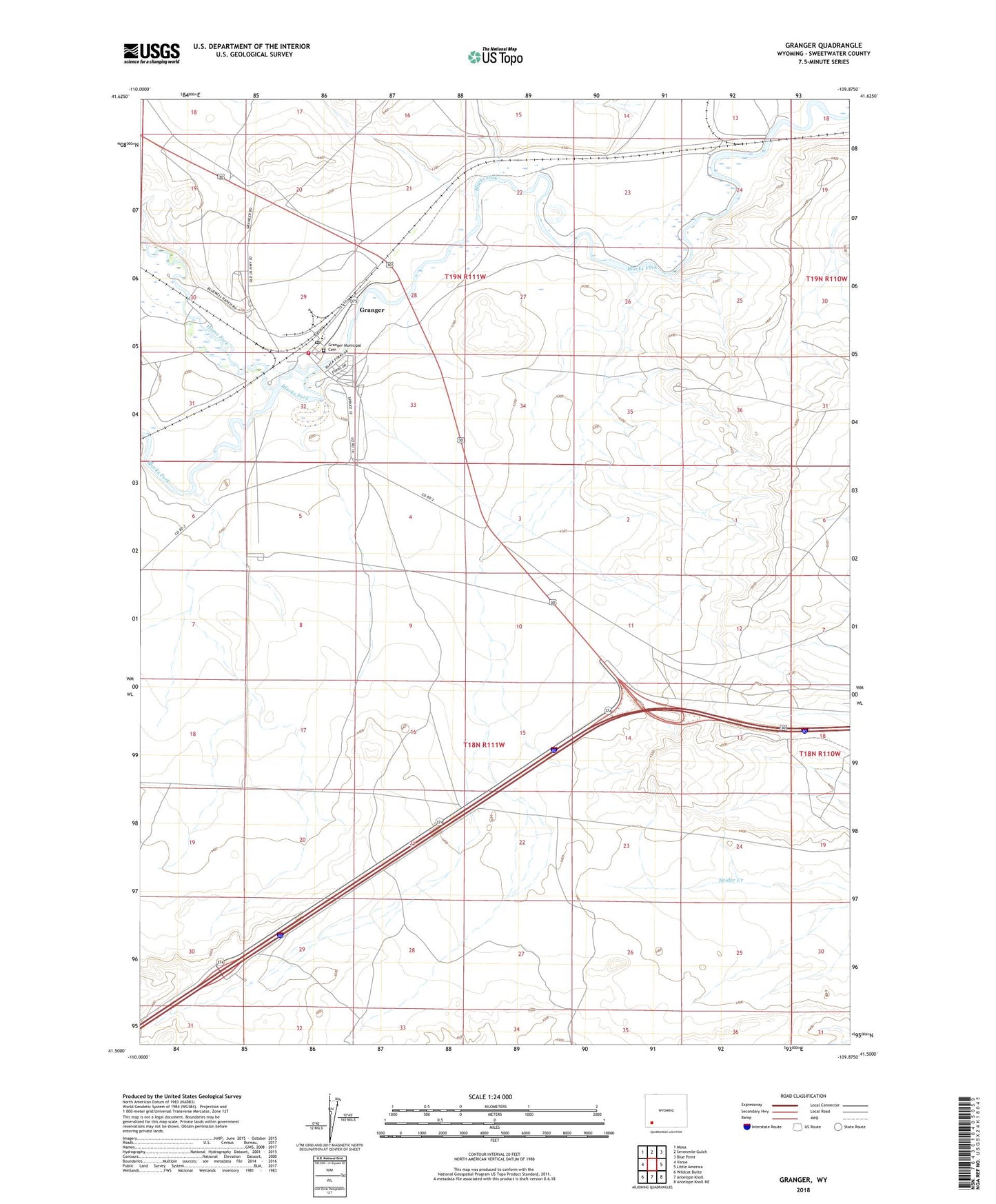
2021 topographic map quadrangle Granger in the state of Wyoming. Scale: 1:24000. Based on the newly updated USGS 7.5' US Topo map series, this map is in the following counties: Sweetwater. The map contains contour data, water features, and other items you are used to seeing on USGS maps, but also has updated roads and other features. This is the next generation of topographic maps. Printed on high-quality waterproof paper with UV fade-resistant inks.
Quads adjacent to this one:
West: Verne
Northwest: Moxa
North: Sevenmile Gulch
Northeast: Blue Point
East: Little America
Southeast: Antelope Knoll NE
South: Antelope Knoll
Southwest: Wildcat Butte
This map covers the same area as the classic USGS quad with code o41109e8.
Contains the following named places: Granger, Granger Junction, Granger Middle School, Granger Municipal Cemetery, Granger Number Two Mine, Granger Post Office, Granger School, Granger Stage Station Historical Marker, Hams Fork, Texasgulf-Trona Mine, Town of Granger