MyTopo
Verona Wyoming US Topo Map
Couldn't load pickup availability
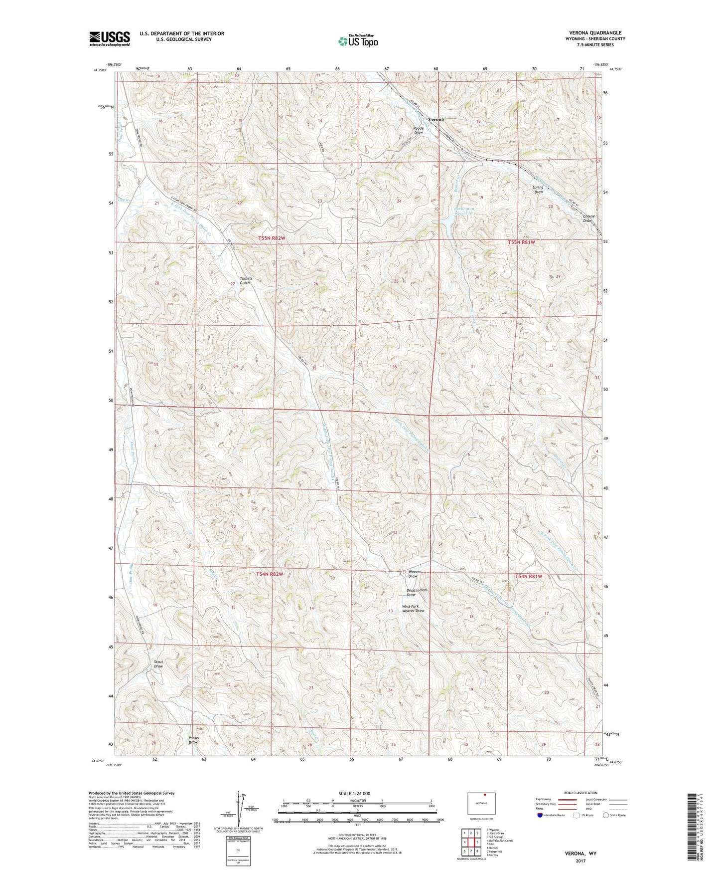
2021 topographic map quadrangle Verona in the state of Wyoming. Scale: 1:24000. Based on the newly updated USGS 7.5' US Topo map series, this map is in the following counties: Sheridan. The map contains contour data, water features, and other items you are used to seeing on USGS maps, but also has updated roads and other features. This is the next generation of topographic maps. Printed on high-quality waterproof paper with UV fade-resistant inks.
Quads adjacent to this one:
West: Buffalo Run Creek
Northwest: Wyarno
North: Jones Draw
Northeast: S R Springs
East: Ulm
Southeast: Ucross
South: Horse Hill
Southwest: Banner
Contains the following named places: Beaver Creek, Bull Creek, Burlington Reservoir, Dead Indian Draw, Dry Creek, Dutch Creek School, East Fork Dow Prong Dutch Creek, Grouse Draw, Middle Fork Dow Prong Dutch Creek, Parker Draw, Roode Draw, Spring Draw, Stout Draw, Tibbets Gulch, Verona, Verona Dam, Verona Reservoir, Weaver Draw, West Fork Weaver Draw