MyTopo
Wyarno Wyoming US Topo Map
Couldn't load pickup availability
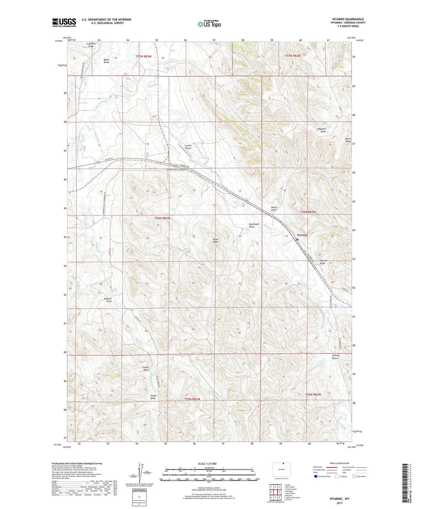
2021 topographic map quadrangle Wyarno in the state of Wyoming. Scale: 1:24000. Based on the newly updated USGS 7.5' US Topo map series, this map is in the following counties: Sheridan. The map contains contour data, water features, and other items you are used to seeing on USGS maps, but also has updated roads and other features. This is the next generation of topographic maps. Printed on high-quality waterproof paper with UV fade-resistant inks.
Quads adjacent to this one:
West: Sheridan
Northwest: Acme
North: Bar N Draw
Northeast: Cedar Canyon
East: Jones Draw
Southeast: Verona
South: Buffalo Run Creek
Southwest: Big Horn
This map covers the same area as the classic USGS quad with code o44106g7.
Contains the following named places: Allens Draw, Arno Quarry Mine, Bates Draw, Burgess Number 1 Dam, Burgess Number 2 Dam, Burgess Reservoir Number 1, Burgess Reservoir Number 2, Clearmont Fire District - Wyarno, Dawson Draw, Dow Prong, Dutch Creek, Eyechaner Draw, Fields Draw, Hape Dam, Hape Reservoir, Hazel Peak, Helvey Draw, Johnston Draw, Kahn and Roberts Dam, Kahn and Roberts Reservoir, Kahn Dam, Kahn Reservoir, McKey Boarding Home, Negro Draw, Paul Number 3 Dam, Paul Number 3 Reservoir, Plum Creek, Prairie Dog Ditch Number 11, Prairie Dog Ditch Number 13, Symons Airport, University of Wyoming Experiment Station, West Fork Wildcat Creek, Wildcat Creek, Wyarno, Wyarno Draw, Wyarno Post Office, ZIP Code: 82801