MyTopo
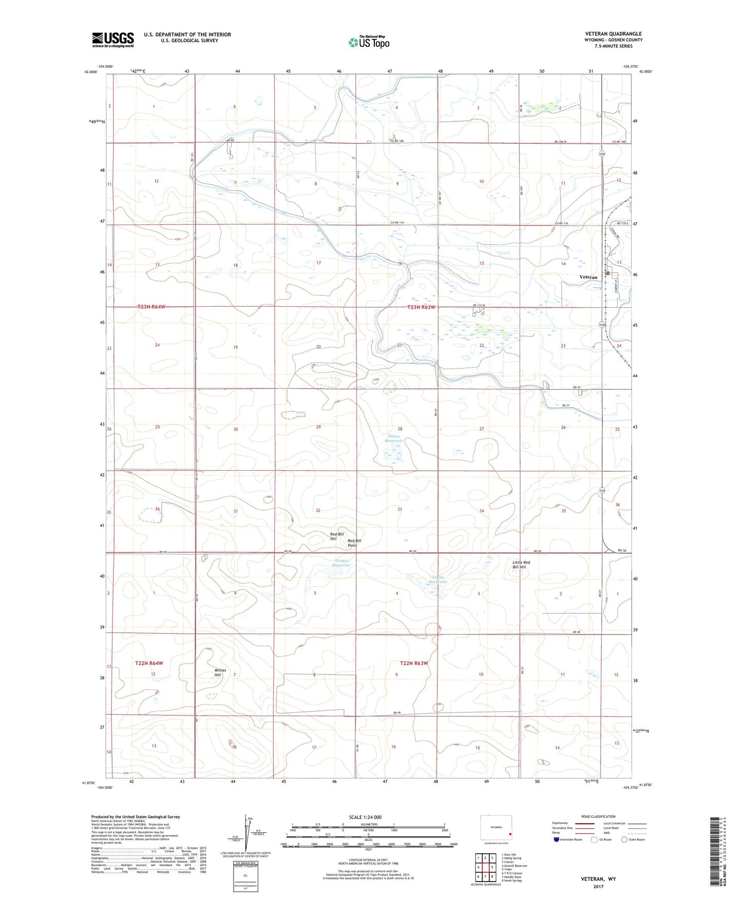
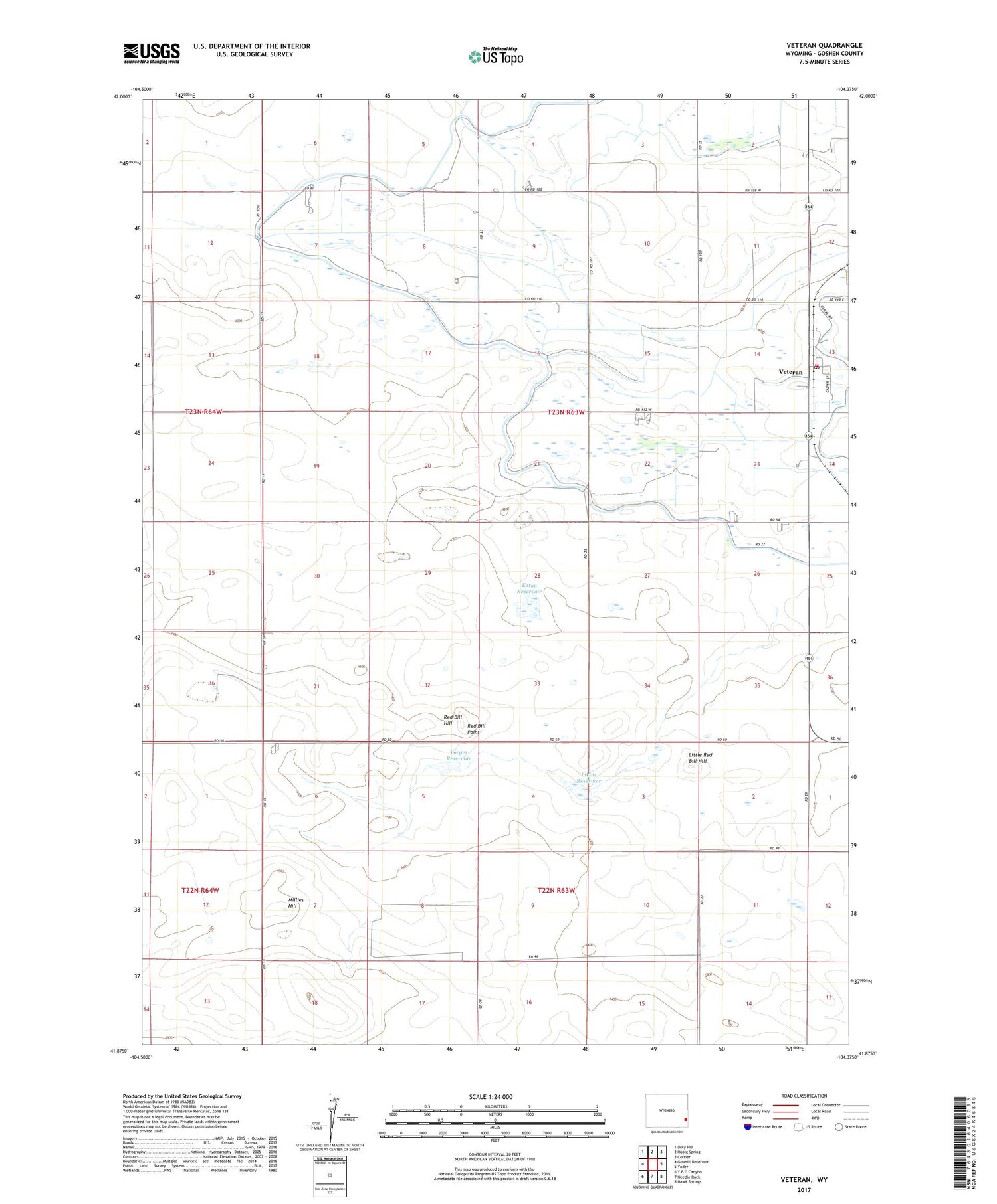
Veteran Wyoming US Topo Map
Couldn't load pickup availability
2021 topographic map quadrangle Veteran in the state of Wyoming. Scale: 1:24000. Based on the newly updated USGS 7.5' US Topo map series, this map is in the following counties: Goshen. The map contains contour data, water features, and other items you are used to seeing on USGS maps, but also has updated roads and other features. This is the next generation of topographic maps. Printed on high-quality waterproof paper with UV fade-resistant inks.
Quads adjacent to this one:
West: Glomill Reservoir
Northwest: Doty Hill
North: Habig Spring
Northeast: Cottier
East: Yoder
Southeast: Hawk Springs
South: Needle Rock
Southwest: Y B O Canyon
Contains the following named places: Box Elder Drain, Carlson Ranch, Day Ranch, E G House Ranch, Eaton Reservoir, Goshen County Fire District 5B - Veteran Fire Department, House Ranch, K Yorges Ranch, Likins Reservoir, Little Red Bill Hill, Millies Hill, Myers Drain, Red Bill Hill, Red Bill Point, Veteran, Veteran Census Designated Place, Veteran Post Office, Yorges Ranch, Yorges Reservoir, ZIP Codes: 82243, 82244