MyTopo
Habig Spring Wyoming US Topo Map
Couldn't load pickup availability
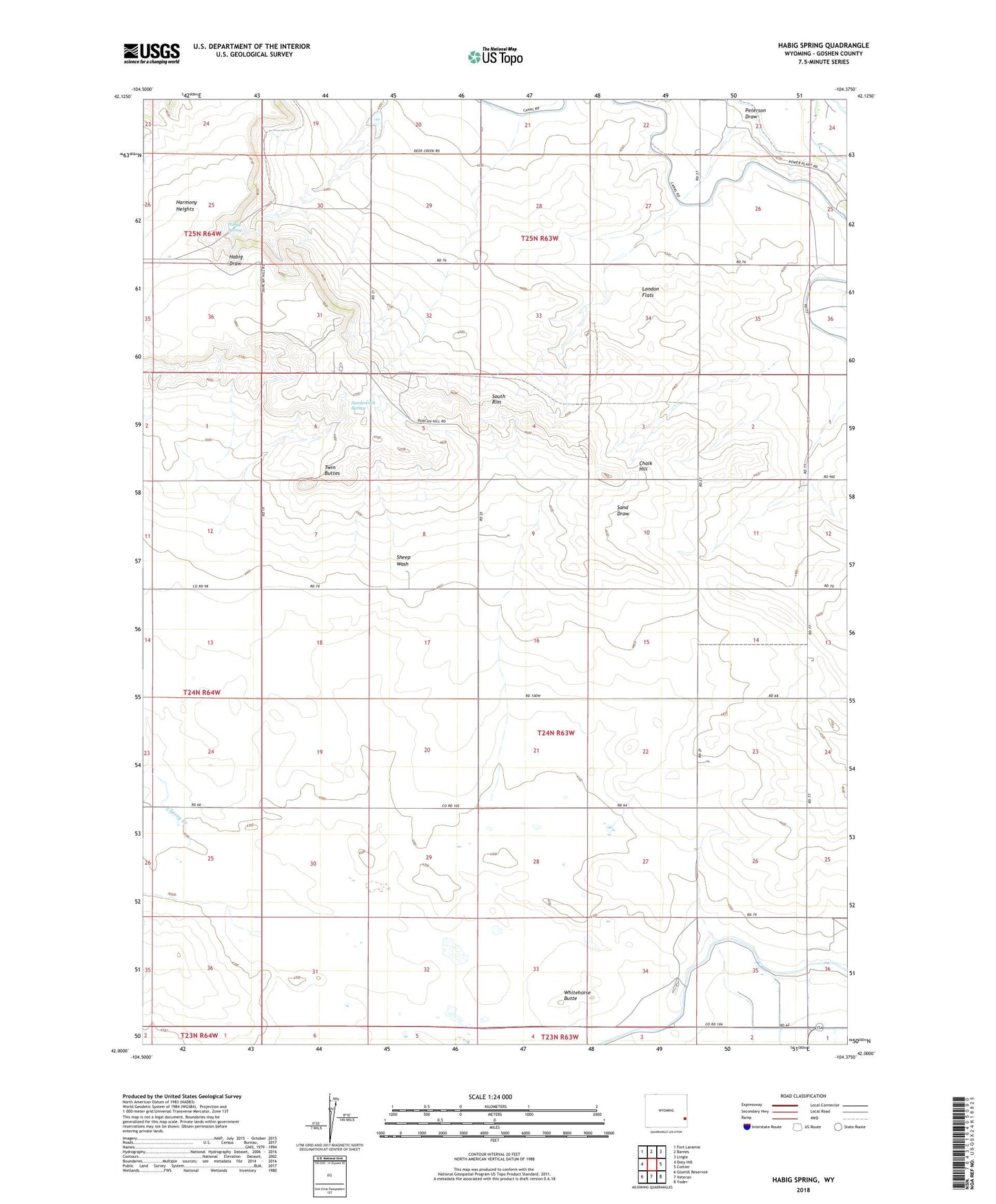
2021 topographic map quadrangle Habig Spring in the state of Wyoming. Scale: 1:24000. Based on the newly updated USGS 7.5' US Topo map series, this map is in the following counties: Goshen. The map contains contour data, water features, and other items you are used to seeing on USGS maps, but also has updated roads and other features. This is the next generation of topographic maps. Printed on high-quality waterproof paper with UV fade-resistant inks.
Quads adjacent to this one:
West: Doty Hill
Northwest: Fort Laramie
North: Barnes
Northeast: Lingle
East: Cottier
Southeast: Yoder
South: Veteran
Southwest: Glomill Reservoir
This map covers the same area as the classic USGS quad with code o42104a4.
Contains the following named places: Chalk Hill, Cherry Creek, H 2 Detention Dam, H 2 Detention Reservoir, H I Detention Dam, H I Detention Reservoir, Habig Spring, Peterson Draw, Sandercock Spring, Sheep Wash, South Rim, Twin Buttes, Whitehorse Butte