MyTopo
Wild Horse Flats Wyoming US Topo Map
Couldn't load pickup availability
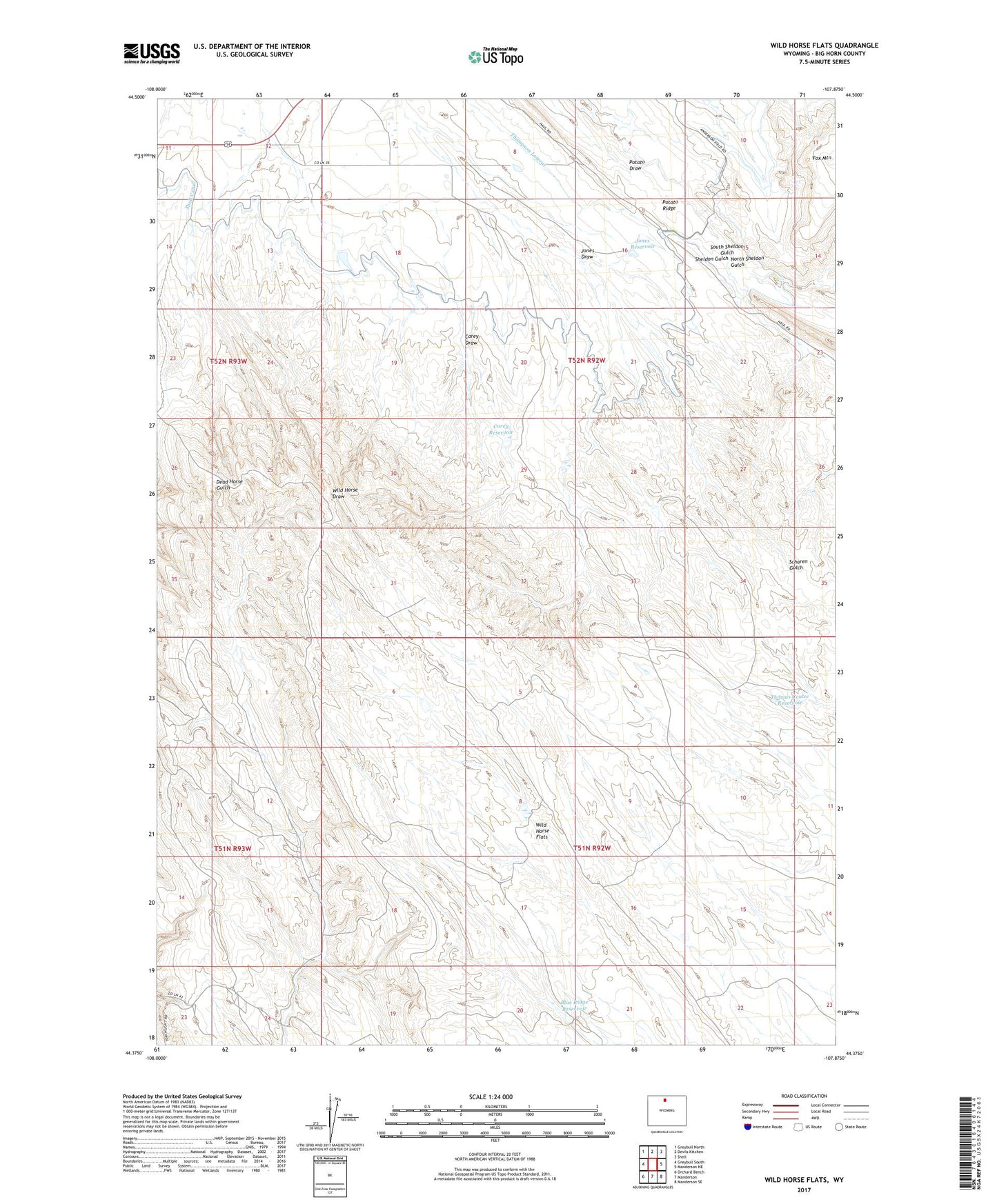
2021 topographic map quadrangle Wild Horse Flats in the state of Wyoming. Scale: 1:24000. Based on the newly updated USGS 7.5' US Topo map series, this map is in the following counties: Big Horn. The map contains contour data, water features, and other items you are used to seeing on USGS maps, but also has updated roads and other features. This is the next generation of topographic maps. Printed on high-quality waterproof paper with UV fade-resistant inks.
Quads adjacent to this one:
West: Greybull South
Northwest: Greybull North
North: Devils Kitchen
Northeast: Shell
East: Manderson NE
Southeast: Manderson SE
South: Manderson
Southwest: Orchard Bench
Contains the following named places: Blue Ridge Detention Dam, Blue Ridge Reservoir, Carey Draw, Carey Reservoir, Fox Mountain, Jones Draw, Jones Reservoir, L. E. Collinwood Bentonite Mine, Lamb Oil Field, North Sheldon Gulch, Perkins Dam, Perkins Reservoir, Shell Canal, South Sheldon Gulch, Thomas Coulee Reservoir, Wild Horse Flats